Blacks Harbour, New Brunswick
Place in New Brunswick, Canada
45°03′32″N 66°47′05″W / 45.05889°N 66.78472°W / 45.05889; -66.78472[1]
(2021)[1]
 1.5
1.5 Route 176
 Route 778
Blacks Harbour is a community in the rural community of Eastern Charlotte, New Brunswick, Canada. It held village status prior to 2023. It is on a harbour of the same name opening onto the Bay of Fundy. It is 15 kilometres southeast of the town of St. George, 3 kilometres west of Beaver Harbour and 56 kilometres east from the town of St. Stephen on Route 176.
History
Blacks Harbour's exact origin is unknown, possibly an early family name. Post office dates from 1889.[2]
On 1 January 2023, Blacks Harbour amalgamated with St. George and all or part of five local service districts to form the new incorporated rural community of Eastern Charlotte.[3][4] The name Blacks Harbour remains in official use.[5]
Geography
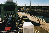
Blacks Harbour is the northern terminus for the year-round Blacks Harbour to Grand Manan Island Ferry operated by Coastal Transport
Fishing has been a vital part of its existence for over 200 years. Connors Brothers Limited was founded in 1885 at Blacks Harbour, now a major international processor of all types of seafood. The company is also a major New Brunswick employer.
Demographics
| Year | Pop. | ±% |
|---|---|---|
| 1991 | 1,139 | — |
| 1996 | 1,148 | +0.8% |
| 2001 | 1,082 | −5.7% |
| 2006 | 952 | −12.0% |
| 2011 | 982 | +3.2% |
| 2016 | 894 | −9.0% |
| 2021 | 907 | +1.5% |
| Source: [1] | ||
In the 2021 Census of Population conducted by Statistics Canada, Blacks Harbour had a population of 907 living in 385 of its 421 total private dwellings, a change of 1.5% from its 2016 population of 894. With a land area of 9.02 km2 (3.48 sq mi), it had a population density of 100.6/km2 (260.4/sq mi) in 2021.[1]
Canada census – Blacks Harbour community profile
| 2021 | 2011 | |
|---|---|---|
| Population | 907 (+1.5% from 2016) | 982 (+3.2% from 2006) |
| Land area | 9.02 km2 (3.48 sq mi) | 8.90 km2 (3.44 sq mi) |
| Population density | 100.6/km2 (261/sq mi) | 110.3/km2 (286/sq mi) |
| Median age | 45.6 (M: 44.4, F: 46.8) | 42.5 (M: 40.2, F: 45.0) |
| Private dwellings | 421 (total) 385 (occupied) | 417 (total) |
| Median household income | $60,000 | $43,367 |
References: 2021[7] 2011[8] earlier[9][10]
Language
| Canada Census Mother Tongue - Blacks Harbour, New Brunswick[6] | ||||||||||||||||||
|---|---|---|---|---|---|---|---|---|---|---|---|---|---|---|---|---|---|---|
| Census | Total | English | French | English & French | Other | |||||||||||||
| Year | Responses | Count | Trend | Pop % | Count | Trend | Pop % | Count | Trend | Pop % | Count | Trend | Pop % | |||||
2011 | 950 | 850 | 1.8% | 89.47% | 65 |  18.7% 18.7% | 6.84% | 5 | n/a% | 0.53% | 30 | 100.0% | 3.16% | |||||
2006 | 930 | 835 | 13.5% | 89.79% | 80 | 20.0% | 8.60% | 0 |  0.0% 0.0% | 0.00% | 15 | n/a% | 1.61% | |||||
2001 | 1,065 | 965 | 1.0% | 90.61% | 100 | 4.8% | 9.39% | 0 | 100.0% | 0.00% | 0 | 100.0% | 0.00% | |||||
1996 | 1,135 | 975 | n/a | 85.90% | 105 | n/a | 9.25% | 10 | n/a | 0.88% | 45 | n/a | 3.96% | |||||
References
- ^ a b c d "Population and dwelling counts: Canada, provinces and territories, census divisions and census subdivisions (municipalities), New Brunswick". Statistics Canada. 9 February 2022. Retrieved 21 February 2022.
- ^ Hamilton, William (1978). The Macmillan Book of Canadian Place Names. Toronto: Macmillan. p. 71. ISBN 0-7715-9754-1.
- ^ "Local Governments Establishment Regulation – Local Governance Act". Government of New Brunswick. 12 October 2022. Retrieved 20 January 2023.
- ^ "RSC 10 Southwest Regional Service Commission". Government of New Brunswick. Retrieved 20 January 2023.
- ^ "Proposed entity names reflect strong ties to nature and history" (Press release). Irishtown, New Brunswick: Government of New Brunswick. 25 May 2022. Retrieved 20 January 2023.
- ^ a b Statistics Canada: 1996, 2001, 2006, 2011 census
- ^ "2021 Community Profiles". 2021 Canadian Census. Statistics Canada. 4 February 2022. Retrieved 19 October 2023.
- ^ "2011 Community Profiles". 2011 Canadian Census. Statistics Canada. 21 March 2019. Retrieved 19 May 2014.
- ^ "2006 Community Profiles". 2006 Canadian Census. Statistics Canada. 20 August 2019.
- ^ "2001 Community Profiles". 2001 Canadian Census. Statistics Canada. 18 July 2021.
Places adjacent to Blacks Harbour, New Brunswick | ||||||||||||||||
|---|---|---|---|---|---|---|---|---|---|---|---|---|---|---|---|---|
| ||||||||||||||||


- v
- t
- e
Subdivisions of New Brunswick
- Beaurivage
- Belle-Baie
- Cap-Acadie
- Caraquet
- Carleton North
- Champdoré
- Grand Bay–Westfield
- Grand Falls
- Grand-Bouctouche
- Hampton
- Hartland
- Hautes-Terres
- Heron Bay
- Île-de-Lamèque
- Oromocto
- Quispamsis
- Riverview
- Rivière-du-Nord
- Rothesay
- Saint-Quentin
- Salisbury
- Shediac
- Shippagan
- St. Andrews
- St. Stephen
- Sussex
- Tantramar
- Vallée-des-Rivières
- Woodstock
- Acadian Peninsula
- Capital Region
- Chaleur
- Fundy
- Greater Miramichi
- Kent
- Kings
- Northwest
- Restigouche
- Southeast
- Southwest
- Western Valley
- Big Hole Tract 8 (North Half)
- Big Hole Tract 8 (South Half)
- Buctouche 16
- Buctouche Micmac Band Extension
- Devon 30
- Eel Ground 2
- Eel River 3
- Esgenoôpetitj
- Fort Folly 1
- Indian Island 28
- Indian Point 1
- Indian Ranch
- Kingsclear 6
- Metepenagiag Urban Reserve 3
- Metepenagiag Urban Reserve 8
- Metepenagiag Uta'nk
- Moose Meadows 4
- Oinpegitjoig
- Oromocto 26
- Pabineau 11
- Pokemouche 13
- Red Bank 4
- Red Bank 7
- Renous 12
- Richibucto 15
- Soegao No. 35
- St Basile 10
- St. Mary's 24
- Tabusintac 9
- The Brothers 18
- Tobique 20
- Woodstock 23
 Category:New Brunswick
 Portal:Canada
 WikiProject:New Brunswick


Authority control databases | |
|---|---|
| International |
|
| National |
|
 | This New Brunswick location article is a stub. You can help Wikipedia by expanding it. |
- v
- t
- e


