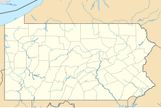
Bridge in West Earl Township
Sergeant Melvin R. Wink Memorial Bridge


The Bridge in West Earl Township, as it is designated on the National Register of Historic Places, is also known by its historic name, Big Conestoga Creek Bridge No. 12. It carries Farmersville Road (unsigned SR 1010) across the Conestoga River at Brownstown, West Earl Township, Pennsylvania, in the United States. The bridge is notable for its form, a three-span, continuous, arched concrete girder that does not touch the abutments. Designer Frank H. Shaw was a consulting engineer to Lancaster County when the bridge was constructed in 1917, but appointed county engineer that same year.[2] The bridge was replaced with a new three-span structure in 2019.[3] It is now known as the Sergeant Melvin R. Wink Memorial Bridge.

See also
- List of bridges documented by the Historic American Engineering Record in Pennsylvania
- List of bridges on the National Register of Historic Places in Pennsylvania
- List of crossings of the Conestoga River
- National Register of Historic Places listings in Lancaster County, Pennsylvania
References
- ^ "National Register Information System". National Register of Historic Places. National Park Service. July 9, 2010.
- ^ Spivey, Justin M. (August 1998). "Big Conestoga Creek Bridge No. 12" (PDF). Historic American Engineering Record. Washington, D.C.: Library of Congress. p. 2. Retrieved March 3, 2018.
- ^ "Work to replace West Farmersville Road bridge in West Earl Township to begin next week". LancasterOnline. LNP. Retrieved 7 May 2020.
External links
 Media related to Bridge in West Earl Township at Wikimedia Commons
- Historic American Engineering Record (HAER) No. PA-500, "Big Conestoga Creek Bridge No. 12, Spanning Conestoga River at Farmersville Road (State Route 1010), Brownstown, Lancaster County, PA", 11 photos, 1 color transparency, 3 measured drawings, 19 data pages, 2 photo caption pages
- Frank Harold Shaw at Structurae
- Big Conestoga Creek Bridge No. 12 at Structurae
- v
- t
- e


- Adams
- Allegheny
- Armstrong
- Beaver
- Bedford
- Berks
- Blair
- Bradford
- Bucks
- Butler
- Cambria
- Cameron
- Carbon
- Centre
- Chester
- Clarion
- Clearfield
- Clinton
- Columbia
- Crawford
- Cumberland
- Dauphin
- Delaware
- Elk
- Erie
- Fayette
- Forest
- Franklin
- Fulton
- Greene
- Huntingdon
- Indiana
- Jefferson
- Juniata
- Lackawanna
- Lancaster
- Lawrence
- Lebanon
- Lehigh
- Luzerne
- Lycoming
- McKean
- Mercer
- Mifflin
- Monroe
- Montgomery
- Montour
- Northampton
- Northumberland
- Perry
- Philadelphia
- Pike
- Potter
- Schuylkill
- Snyder
- Somerset
- Sullivan
- Susquehanna
- Tioga
- Union
- Venango
- Warren
- Washington
- Wayne
- Westmoreland
- Wyoming
- York
 Category
 NRHP portal


