British Columbia Highway 95A
Highway in British Columbia
Highway 95A | ||||
|---|---|---|---|---|
| Kimberley Highway | ||||
| Route information | ||||
| Maintained by British Columbia Ministry of Transportation and Infrastructure | ||||
| Length | 55 km[1] (34 mi) | |||
| Existed | 1968–present | |||
| Major junctions | ||||
| South end |   Hwy 3 / Hwy 95 in Cranbrook Hwy 3 / Hwy 95 in Cranbrook | |||
| North end |  Hwy 93 / Hwy 95 at Wasa Junction Hwy 93 / Hwy 95 at Wasa Junction | |||
| Location | ||||
| Country | Canada | |||
| Province | British Columbia | |||
| Major cities | Cranbrook, Kimberley | |||
| Highway system | ||||
| | ||||
| ||||


Highway 95A, the Kimberley Highway, is a 55 km (34 mi) long alternate route to Highway 95 that passes through the city of Kimberley and the community of Ta Ta Creek. The highway was created in 1968, when Highway 95 was re-routed from Highway 95A's current route to a path through the Fort Steele area.
The section of 95A running from downtown Kimberley to Ta Ta Creek is also known as the "Sullivan highway" as that section of highway combined with Ross Street (straight through the traffic light if going southbound) used to lead directly to the entrance of the Sullivan mine. Now fairly deserted except for tourist season the "Sully" section of 95A is a popular location for those teaching new drivers how to handle curvy BC highways as it features many intimidating looking but well engineered curves. Every curve in the 100km/h speed limit zone on the Sullivan is properly "banked" and can safely be taken by regular cars, SUVs, and pickups at a full 100km/h in dry weather as the highway was designed for top heavy heavy truck traffic serving the Sullivan mine.
Major intersections
For south to north. The entire route is in the Regional District of East Kootenay.
| Location | km[1] | mi | Destinations | Notes | |
|---|---|---|---|---|---|
| Cranbrook | 0.00 | 0.00 | Hwy 3 / Hwy 95 – Fernie, Cranbrook, USA Border | Cranbrook Interchange | |
| | 8.39 | 5.21 |  Airport Access Road – Airport Airport Access Road – Airport | ||
| Kimberley | 27.70 | 17.21 | Wallinger Avenue, Ross Street – Kimberley Alpine Resort | Hwy 95A branches east | |
| | 55.48 | 34.47 | Hwy 93 / Hwy 95 – Invermere, Radium Hot Springs, Wasa, Fort Steele | Through traffic follows Hwy 93 north / Hwy 95 north | |
| 1.000 mi = 1.609 km; 1.000 km = 0.621 mi | |||||
McPhee Bridge
49°34′56″N 115°47′53″W / 49.582344°N 115.798033°W / 49.582344; -115.798033
The McPhee Bridge, also known as the St. Mary's Bridge, rises high above the St. Mary River and is near the Canadian Rockies International Airport and the Shadow Mountain Golf Community. The bridge is used by over 12,000[2] people each day to travel between Cranbrook and Kimberley. It is right on the city boundary of northwest Cranbrook. The present Bridge was opened on September 26, 1981.[3]
Photo gallery
-
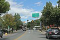 Hwy 95A in downtown Kimberley.
 -
 Curve on Hwy 95A.


References
- ^ a b Landmark Kilometre Inventory (PDF). British Columbia Ministry of Transportation and Infrastructure (Report). Cypher Consulting. July 2016. pp. 469–472. Archived from the original (PDF) on 2017-03-11. Retrieved 2017-12-08.
- ^ "Traffic Volumes". Archived from the original on 2018-06-22. Retrieved 2018-06-21.
- ^ Government of British Columbia (1982). Ministry of Transportation and Highways Report for the Fiscal Year 1981/82 (Report). p. 286. ISSN 0706-1897.
External links
- Official Numbered Routes in British Columbia by British Columbia Driving & Transportation
Wikimedia Commons has media related to British Columbia Highway 95A.
- v
- t
- e
Roads of British Columbia
- Atlin Road
- Bridge River Road
- Cecil Lake Road
- Chilliwack Lake Road
- Coalmont Road
- Columbia Valley Highway
- Deltaport Way
- Head Bay Road
- Hemlock Valley Road
- Highway 91 Connector
- Horsefly Road
- Jesmond Road
- Likely Road
- Mission Mountain Road
- Nazko Road
- Omineca Resource Road
- Pavilion Mountain Road
- Port Mellon Highway
- Queen Charlotte City–Skidegate Road
- Strathcona Parkway
- Telegraph Creek Road
- Westside Road
- Alaska Highway
- Banff–Windermere Highway
- Caribou Highway1
- Coquihalla Highway2
- Crowsnest Highway2
- Don Phillips Way
- Heritage Highway
- Inland Island Highway2
- International Selkirk Loop1
- John Hart Highway1
- Liard Highway
- Lougheed Highway1
- Mary Hill Bypass1
- Nisga'a Highway
- Northern Woods and Water Route
- Okanagan Connector2
- Okanagan Highway2
- Pacific Highway1
- Patricia Bay Highway2
- Sea to Sky Highway2
- South Fraser Perimeter Road2
- Southern Yellowhead Highway2
- Stewart–Cassiar Highway
- Sunshine Coast Highway
- Trans-Canada Highway2
- Yellowhead Highway1
- Atlin Road
- Big Bend Highway
- Cariboo Road
- Chilkoot Trail
- Dewdney Trail
- Dewdney Trunk Road
- Douglas Road
- Hudson's Bay Brigade Trail
- Lillooet Cattle Trail
- Okanagan Trail
- Old Cariboo Road
- Old Yale Road (Grand Trunk Road)
- Pacific Highway
- River Trail
- Whatcom Trail
- 1 highways with expressway sections
- 2 highways with expressway and freeway sections
- 3 highways under construction
- 4 designation reassigned to new route


