Chavar District
Former district in Ilam province, Iran
Former District in Ilam, Iran
Chavar District Persian: بخش چوار | |
|---|---|
Former District | |
33°45′N 46°05′E / 33.750°N 46.083°E / 33.750; 46.083[1] | |
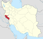
| Country | Iran |
| Province | Ilam |
| County | Ilam |
| Capital | Chavar |
| Population (2016)[2] | |
| • Total | 10,554 |
| Time zone | UTC+3:30 (IRST) |
Chavar District (Persian: بخش چوار) is a former administrative division in Ilam County, Ilam province, Iran. Its capital was the city of Chavar.[3]
History
In November 2019, the district was separated from the county in the establishment of Chavar County.[4]
Demographics
Population
At the time of the 2006 National Census, the district's population was 11,860 in 2,378 households.[5] The following census in 2011 counted 11,710 people in 2,692 households.[6] The 2016 census measured the population of the district as 10,554 inhabitants in 2,752 households.[2]
Administrative divisions
| Administrative Divisions | 2006[5] | 2011[6] | 2016[2] |
|---|---|---|---|
| Arkavazi RD | 4,640 | 4,384 | 3,702 |
| Boli RD | 1,646 | 1,551 | 1,021 |
| Chavar (city) | 5,574 | 5,775 | 5,831 |
| Total | 11,860 | 11,710 | 10,554 |
| RD = Rural District | |||
See also
 Iran portal
References
- ^ OpenStreetMap contributors (4 June 2023). "Chavar District (Ilam County)" (Map). OpenStreetMap (in Persian). Retrieved 4 June 2023.
- ^ a b c "Census of the Islamic Republic of Iran, 1395 (2016)". AMAR (in Persian). The Statistical Center of Iran. p. 16. Archived from the original (Excel) on 1 November 2020. Retrieved 19 December 2022.
- ^ Habibi, Hassan (21 June 1369). "Approval of the organization and chain of citizenship of the elements and units of the national divisions of Ilam province, centered in the city of Ilam". Lamtakam (in Persian). Ministry of Interior, Defense Political Commission of the Government Council. Archived from the original on 8 February 2024. Retrieved 8 February 2024.
- ^ Jahangiri, Ishaq (8 November 2019). "Letter of approval regarding country divisions in Ilam County, Ilam province". Laws and Regulations Portal of the Islamic Republic of Iran (in Persian). Ministry of Interior, Council of Ministers. Archived from the original on 17 November 2022. Retrieved 4 June 2023.
- ^ a b "Census of the Islamic Republic of Iran, 1385 (2006)". AMAR (in Persian). The Statistical Center of Iran. p. 16. Archived from the original (Excel) on 20 September 2011. Retrieved 25 September 2022.
- ^ a b "Census of the Islamic Republic of Iran, 1390 (2011)". Syracuse University (in Persian). The Statistical Center of Iran. p. 16. Archived from the original (Excel) on 17 January 2023. Retrieved 19 December 2022.
- v
- t
- e
Ilam province, Iran
Capital: Ilam
and cities
| Abdanan County | |
|---|---|
| Darreh Shahr County | |
| Dehloran County | |
| Eyvan County | |
| Holeylan County | |
| Ilam County | |
| Malekshahi County | |
| Mehran County | |
| Chardavol County | |
| Sirvan County | |
| Badreh County |
- Siyahgol fire Temple
- Imamzadeh Seyd Salaheddin Muhammad
- Posht Ghal'eh Chowar castle
- Shirin and Farhad Iwan, Mehran
- Tangeh Bahram chubin
- Takht-e khan relief
- Golki relief,Malekshahi
- Sirvan ancient city
- Telesmkhan cave
- Ghal'eh Ghiran castle
- Ghal'eh Vali castle
- Falahati Palace
- Mountain of Ghalaghiran
- Kabir Kouh
- Ilam Museum of Natural History
| |||||||||||||||||||||||||
|---|---|---|---|---|---|---|---|---|---|---|---|---|---|---|---|---|---|---|---|---|---|---|---|---|---|
| Capital | |||||||||||||||||||||||||
| Districts |
| ||||||||||||||||||||||||

 | This Ilam province location article is a stub. You can help Wikipedia by expanding it. |
- v
- t
- e


