Idaux-Mendy
Commune in Nouvelle-Aquitaine, France
Idaux-Mendy Idauze-Mendi | ||
|---|---|---|
Commune | ||
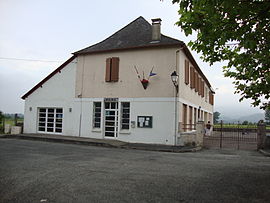 The town hall and school of Idaux-Mendy | ||
Location of Idaux-Mendy  | ||
(2020–2026) Renée Carrique[1] | | |
| Area 1 | 9.67 km2 (3.73 sq mi) | |
| Population (2021)[2] | 276 | |
| • Density | 29/km2 (74/sq mi) | |
| Time zone | UTC+01:00 (CET) | |
| • Summer (DST) | UTC+02:00 (CEST) | |
| INSEE/Postal code | 64268 /64130 | |
| Elevation | 152–331 m (499–1,086 ft) (avg. 173 m or 568 ft) | |
| 1 French Land Register data, which excludes lakes, ponds, glaciers > 1 km2 (0.386 sq mi or 247 acres) and river estuaries. | ||
Idaux-Mendy (Basque: Idauze-Mendi)[3] is a commune in the Pyrénées-Atlantiques department in south-western France.
It is located in the former province of Soule.[3]
Population
| Year | Pop. | ±% p.a. |
|---|---|---|
| 1968 | 229 | — |
| 1975 | 237 | +0.49% |
| 1982 | 227 | −0.61% |
| 1990 | 242 | +0.80% |
| 1999 | 262 | +0.89% |
| 2007 | 260 | −0.10% |
| 2012 | 262 | +0.15% |
| 2017 | 270 | +0.60% |
| Source: INSEE[4] | ||

See also
References
- ^ "Répertoire national des élus: les maires". data.gouv.fr, Plateforme ouverte des données publiques françaises (in French). 2 December 2020.
- ^ "Populations légales 2021" (in French). The National Institute of Statistics and Economic Studies. 28 December 2023.
- ^ a b IDAUZE-MENDI, Auñamendi Eusko Entziklopedia (in Spanish)
- ^ Population en historique depuis 1968, INSEE
Wikimedia Commons has media related to Idaux-Mendy.
- v
- t
- e
Municipalities in Soule
- Ainharbe
- Aloze-Ziboze-Onizegaine
- Altzai-Altzabeheti-Zunharreta
- Altzürukü
- Arrokiaga
- Arüe-Ithorrotze-Olhaibi
- Atharratze-Sorholüze
- Barkoxe
- Berrogaine-Lahüntze
- Bildoze-Onizepea
- Domintxaine-Berroeta
- Eskiula
- Espeize-Ündüreine
- Etxarri
- Etxebarre
- Gamere-Zihiga
- Garindaine
- Gotaine-Irabarne
- Hauze
- Idauze-Mendi
- Iruri
- Jestaze
- Lakarri-Arhane-Sarrikotagaine
- Larraine
- Lexantzü-Zünharre
- Ligi-Atherei
- Liginaga-Astüe
- Lohitzüne-Oihergi
- Maule-Lextarre
- Mendikota
- Mitikile-Larrori-Mendibile
- Montori
- Muskildi
- Ospitalepea
- Ozaraine-Erribareita
- Ozaze-Zühara
- Pagola
- Sarrikotape
- Sohüta
- Urdatx-Santa-Grazi
- Urdiñarbe
- Ürrustoi-Larrebille
- Zalgize-Doneztebe


Authority control databases | |
|---|---|
| International |
|
| National |
|
| Other |
|
 | This Pyrénées-Atlantiques geographical article is a stub. You can help Wikipedia by expanding it. |
- v
- t
- e


