Kébir Airport
Airport

Kébir
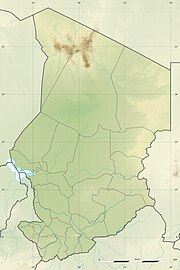
Location of airport in Chad
| Direction | Length | Surface | |
|---|---|---|---|
| m | ft | ||
| 04/22 | 1,320 | 4,331 | Sand |
Source: AIS ASECNA[1]
Kébir Airport (Arabic: مطار كبير) is an airstrip serving Ounianga,[1] a town in the Ennedi-Ouest Region of northern Chad.
Facilities
The airport resides at an elevation of 418 metres (1,371 ft) above mean sea level. It has one runway designated 04/22 with a sand surface measuring 1,320 by 20 metres (4,331 ft × 66 ft).[1]
References
- ^ a b c "CHAD: AD 2-7-01 Index to aerodromes" (PDF). AIS ASECNA. 28 July 2011. Archived from the original (PDF) on 5 March 2016. Retrieved 30 August 2012.
- v
- t
- e
- Abéché
- Abou-Deia
- Ade
- Adré
- Am-Dam
- Am Timan
- Ati
- Biltine
- Bokoro
- Bol
- Bongor
- Bousso
- Daguessa
- Djedaa
- Doba
- Fada
- Faya-Largeau
- Goz Beïda
- Guéréda
- Haraze
- Iriba
- Kébir
- Koro-Toro
- Koukou Angarana
- Kyabé
- Laï
- Mao
- Massenya
- Melfi
- Mongo
- Moundou
- Moussoro
- Moyto
- N'Djamena International
- Oum Hadjer
- Pala
- Sarh
- Zakouma
- Zouar
- Zougra


