Khani Chahar Bagh District
District in Faryab, Afghanistan
Khani Chahar Bagh خان چارباغ | |
|---|---|
District | |
| 37°07′N 65°14′E / 37.11°N 65.23°E / 37.11; 65.23 | |
| Country |  Afghanistan Afghanistan |
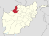
| Province | Faryab |
| Area | |
| • Total | 1,056 km2 (408 sq mi) |
| Elevation | 278 m (912 ft) |
| Population (2013)[3] | |
| • Total | 70,000 |
Khani Chahar Bagh (Persian: خان چارباغ) is the most northerly district in Faryab province. The main village, Chahar Bagh 37°02′40″N 65°13′51″E / 37.0444°N 65.2308°E / 37.0444; 65.2308, is in the southern part of the district. In the north the district's border is with Turkmenistan. The population in 2013 was estimated at 70,000. Ethnic composition includes 25% Turkmen and 75% Uzbek.[4]
References
- ^ "District Names". National Democratic Institute. Archived from the original on 29 January 2016. Retrieved 30 September 2015.
- ^ Afghanistan Geographic & Thematic Layers
- ^ "Faryab Province". Government of Afghanistan and United Nations Development Programme (UNDP). Ministry of Rural Rehabilitation and Development. Archived from the original on 14 April 2013. Retrieved 22 October 2012.
- ^ Khan Charbagh District (Re-elected)
External links
- District Profile UNHCR, July 2002
- Map of Settlements IMMAP, 2011
- v
- t
- e
Districts of Afghanistan by province
| ||
|---|---|---|
| Districts |
|  |
| Populated places | ||
| Other | ||
 | This Faryab Province, Afghanistan location article is a stub. You can help Wikipedia by expanding it. |
- v
- t
- e


