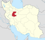
Khurheh, Markazi
Khurheh Persian: خورهه | |
|---|---|
Village | |
 Street in Khurheh | |
| 34°04′30″N 50°29′31″E / 34.07500°N 50.49194°E / 34.07500; 50.49194[1] | |
| Country | Iran |
| Province | Markazi |
| County | Mahallat |
| District | Central |
| Rural District | Khurheh |
| Population (2016)[2] | |
| • Total | 425 |
| Time zone | UTC+3:30 (IRST) |
Khurheh (Persian: خورهه)[a] is a village in, and the capital of, Khurheh Rural District of the Central District of Mahallat County, Markazi province, Iran.[4]
Khurheh is 12 miles (19 km) north of Mahallat, Markazi Province of Iran, with historical buildings believed to be of Parthian period.[5] This site was first excavated by Naser al-Din Shah Qajar, on a treasure hunt. It also has an inscription on a rock that date to Seljuq Empire.[6]
Demographics
Population
At the time of the 2006 National Census, the village's population was 627 in 224 households.[7] The following census in 2011 counted 429 people in 170 households.[8] The 2016 census measured the population of the village as 425 people in 188 households. It was the most populous village in its rural district.[2]
See also
 Iran portal
Notes
References
- ^ OpenStreetMap contributors (23 March 2024). "Khurheh, Mahallat County" (Map). OpenStreetMap (in Persian). Retrieved 23 March 2024.
- ^ a b "Census of the Islamic Republic of Iran, 1395 (2016)". AMAR (in Persian). The Statistical Center of Iran. p. 00. Archived from the original (Excel) on 17 October 2020. Retrieved 19 December 2022.
- ^ Khurheh can be found at GEOnet Names Server, at this link, by opening the Advanced Search box, entering "-3071449" in the "Unique Feature Id" form, and clicking on "Search Database".
- ^ Mousavi, Mirhossein (18 May 1365). "Creation and establishment of two rural districts including villages, places and fields in Mahallat County under Markazi province". Lamtakam (in Persian). Ministry of Interior, Board of Ministers. Archived from the original on 18 January 2024. Retrieved 18 January 2024.
- ^ Kleiss, Wolfram. "COLUMNS". Encyclopedia Iranica. Archived from the original on 29 April 2011. Retrieved 1 October 2009.
- ^ "Cultural Heritage Organization of Iran website(In Persian)". Archived from the original on 22 July 2011. Retrieved 1 October 2009.
- ^ "Census of the Islamic Republic of Iran, 1385 (2006)". AMAR (in Persian). The Statistical Center of Iran. p. 00. Archived from the original (Excel) on 20 September 2011. Retrieved 25 September 2022.
- ^ "Census of the Islamic Republic of Iran, 1390 (2011)". Syracuse University (in Persian). The Statistical Center of Iran. p. 00. Archived from the original (Excel) on 19 January 2023. Retrieved 19 December 2022.
 | This Mahallat County location article is a stub. You can help Wikipedia by expanding it. |
- v
- t
- e


