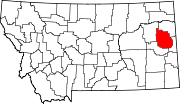
List of mountains in Dawson County, Montana
Map all coordinates using OpenStreetMap
Download coordinates as:
- KML
- GPX (all coordinates)
- GPX (primary coordinates)
- GPX (secondary coordinates)
There are 13 named mountain summits in Dawson County, Montana.[1]
- Blue Mountain, 46°57′29″N 104°35′34″W / 46.95806°N 104.59278°W / 46.95806; -104.59278 (Blue Mountain), el. 2,946 feet (898 m)[2]
- Bryants Buttes, 47°08′22″N 104°38′07″W / 47.13944°N 104.63528°W / 47.13944; -104.63528 (Bryants Buttes), el. 2,434 feet (742 m)[3]
- Clay Butte, 47°34′22″N 104°56′43″W / 47.57278°N 104.94528°W / 47.57278; -104.94528 (Clay Butte), el. 3,113 feet (949 m)[4]
- Cluster Buttes, 47°09′39″N 104°21′20″W / 47.16083°N 104.35556°W / 47.16083; -104.35556 (Cluster Buttes), el. 2,602 feet (793 m)[5]
- Crazy Butte, 47°21′45″N 105°21′05″W / 47.36250°N 105.35139°W / 47.36250; -105.35139 (Crazy Butte), el. 2,854 feet (870 m)[6]
- Custers Lookout, 47°10′10″N 104°43′22″W / 47.16944°N 104.72278°W / 47.16944; -104.72278 (Custers Lookout), el. 2,362 feet (720 m)[7]
- Diamond G Butte, 47°00′51″N 105°19′15″W / 47.01417°N 105.32083°W / 47.01417; -105.32083 (Diamond G Butte), el. 3,205 feet (977 m)[8]
- Glendive Butte, 47°12′30″N 104°46′12″W / 47.20833°N 104.77000°W / 47.20833; -104.77000 (Glendive Butte), el. 2,631 feet (802 m)[9]
- High Point, 47°18′00″N 105°17′36″W / 47.30000°N 105.29333°W / 47.30000; -105.29333 (High Point), el. 3,300 feet (1,000 m)[10]
- Mount Antelope, 47°16′06″N 105°23′55″W / 47.26833°N 105.39861°W / 47.26833; -105.39861 (Mount Antelope), el. 3,461 feet (1,055 m)[11]
- Rattlesnake Butte, 46°52′24″N 104°35′48″W / 46.87333°N 104.59667°W / 46.87333; -104.59667 (Rattlesnake Butte), el. 2,680 feet (820 m)[12]
- Twin Buttes, 47°19′23″N 104°57′19″W / 47.32306°N 104.95528°W / 47.32306; -104.95528 (Twin Buttes), el. 2,769 feet (844 m)[13]
- Woodworth Hill, 47°26′52″N 105°22′47″W / 47.44778°N 105.37972°W / 47.44778; -105.37972 (Woodworth Hill), el. 2,664 feet (812 m)[14]
See also
Notes
- ^ "Dawson Archives". MountainZone. Retrieved 2020-10-10.
- ^ "Blue Mountain". Geographic Names Information System. United States Geological Survey, United States Department of the Interior.
- ^ "Bryants Buttes". Geographic Names Information System. United States Geological Survey, United States Department of the Interior.
- ^ "Clay Butte". Geographic Names Information System. United States Geological Survey, United States Department of the Interior.
- ^ "Cluster Buttes". Geographic Names Information System. United States Geological Survey, United States Department of the Interior.
- ^ "Crazy Butte". Geographic Names Information System. United States Geological Survey, United States Department of the Interior.
- ^ "Custers Lookout". Geographic Names Information System. United States Geological Survey, United States Department of the Interior.
- ^ "Diamond G Butte". Geographic Names Information System. United States Geological Survey, United States Department of the Interior.
- ^ "Glendive Butte". Geographic Names Information System. United States Geological Survey, United States Department of the Interior.
- ^ "High Point". Geographic Names Information System. United States Geological Survey, United States Department of the Interior.
- ^ "Mount Antelope". Geographic Names Information System. United States Geological Survey, United States Department of the Interior.
- ^ "Rattlesnake Butte". Geographic Names Information System. United States Geological Survey, United States Department of the Interior.
- ^ "Twin Buttes". Geographic Names Information System. United States Geological Survey, United States Department of the Interior.
- ^ "Woodworth Hill". Geographic Names Information System. United States Geological Survey, United States Department of the Interior.