List of the most isolated major summits of the United States

The following sortable table comprises the 209 most topographically isolated mountain peaks of the United States of America (including its territories) with at least 500 meters (1640 feet) of topographic prominence.[1][a]
The summit of a mountain or hill may be measured in three principal ways:
- The topographic elevation of a summit measures the height of the summit above a geodetic sea level.[2][3]
- The topographic prominence of a summit is a measure of how high the summit rises above its surroundings.[4][3]
- The topographic isolation (or radius of dominance) of a summit measures how far the summit lies from its nearest point of equal elevation.[5]
In the United States, only Denali exceeds 4000 kilometers (2485 miles) of topographic isolation. 3 summits exceed 2000 kilometers (1243 miles), 8 exceed 1000 kilometers (621.4 miles), 13 exceed 500 kilometers (310.7 miles), 47 exceed 200 kilometers (124.3 miles), 113 exceed 100 kilometers (62.14 miles), and 214 major summits exceed 50 kilometers (31.07 miles) of topographic isolation.
Most isolated major summits
Map this section's coordinates using OpenStreetMap
Download coordinates as:
- KML
- GPX (all coordinates)
- GPX (primary coordinates)
- GPX (secondary coordinates)
The list below contains the 200 most isolated major summits in the 50 states and District of Columbia, plus an additional 9 major isolated summits in the U.S. territories, for a total of 209 summits.
Of these 209 most isolated major summits of the United States, 63 are located in Alaska, 19 in Montana, 16 in California, 14 in Utah, 13 in Nevada, 12 in Colorado, 12 in Arizona, 10 in Wyoming, 7 in Washington, 7 in Oregon, 6 in New Mexico, 5 in the Northern Mariana Islands, 4 in Hawaiʻi, 3 in Idaho, 3 in Texas, 2 in North Carolina, 2 in Maine, 2 in New York, 2 in American Samoa, 2 in Puerto Rico, and one each in New Hampshire, Arkansas, South Dakota, Tennessee, Vermont, Virginia, and West Virginia. Two of these summits lie on the international border between Alaska and British Columbia and one lies on the state border between Tennessee and North Carolina.
| Rank | Mountain Peak | State or territory | Mountain Range | Elevation | Prominence | Isolation | Location |
|---|---|---|---|---|---|---|---|
| 1 | Denali[7][8][b] | Alaska Range | 20,310 ft 6190.5 m | 20,146 ft 6141 m | 4,629.37 mi 7,450.24 km | 63°04′08″N 151°00′23″W / 63.0690°N 151.0063°W / 63.0690; -151.0063 (Denali) | |
| 2 | Mauna Kea[9][10][11][c][d] |  Hawaii Hawaii | Island of Hawaiʻi | 13,803 ft 4207.3 m | 13,803 ft 4207 m | 2,452.5 mi 3,946.92 km | 19°49′15″N 155°28′05″W / 19.8207°N 155.4681°W / 19.8207; -155.4681 (Mauna Kea) |
| 3 | Mount Whitney[12][13][14][e][f] |  California California | Sierra Nevada | 14,505 ft 4421 m | 10,080 ft 3072 m | 1,646.3 mi 2,649.47 km | 36°34′43″N 118°17′31″W / 36.5786°N 118.2920°W / 36.5786; -118.2920 (Mount Whitney) |
| 4 | Mount Mitchell[15][16][g][h][i] |  North Carolina North Carolina | Blue Ridge Mountains | 6,684 ft 2037 m | 6,092 ft 1857 m | 1,188.99 mi 1,913.49 km | 35°45′54″N 82°15′54″W / 35.7649°N 82.2651°W / 35.7649; -82.2651 (Mount Mitchell) |
| 5 | Agrihan Island high point[17][18] |  Northern Mariana Islands Northern Mariana Islands | Mariana Islands (Agrihan island) | 3,204 ft 977 m | 3,204 ft 977 m | 1,179.34 mi 1,897.96 km | 18°46′21″N 145°40′04″E / 18.7725°N 145.6678°E / 18.7725; 145.6678 (Agrihan (unnamed summit)) |
| 6 | Mount Washington[19][20][21][j][k][l] |  New Hampshire New Hampshire | White Mountains | 6,288 ft 1917 m | 6,158 ft 1877 m | 819.56 mi 1,318.95 km | 44°16′14″N 71°18′12″W / 44.2705°N 71.3032°W / 44.2705; -71.3032 (Mount Washington) |
| 7 | Mount Rainier[22][23][m][n] |  Washington Washington | Cascade Range | 14,417 ft 4394 m | 13,210 ft 4026 m | 731.18 mi 1,176.72 km | 46°51′10″N 121°45′37″W / 46.8529°N 121.7604°W / 46.8529; -121.7604 (Mount Rainier) |
| 8 | Mount Elbert[24][25][26][o] |  Colorado Colorado | Sawatch Range | 14,440 ft 4401.2 m | 9,093 ft 2772 m | 670.55 mi 1,079.15 km | 39°07′04″N 106°26′43″W / 39.1178°N 106.4454°W / 39.1178; -106.4454 (Mount Elbert) |
| 9 | Shishaldin Volcano[27][28][p][q] | Unimak Island | 9,414 ft 2869 m | 9,414 ft 2869 m | 545 mi 877 km | 54°45′19″N 163°58′15″W / 54.7554°N 163.9709°W / 54.7554; -163.9709 (Shishaldin Volcano) | |
| 10 | Tanaga Volcano[29][30][r][s] | Tanaga Island | 5,925 ft 1806 m | 5,925 ft 1806 m | 407 mi 656 km | 51°53′02″N 178°08′34″W / 51.8838°N 178.1429°W / 51.8838; -178.1429 (Tanaga Volcano) | |
| 11 | Mount Isto[31][32][t][u] | Brooks Range | 8,976 ft 2736 m | 7,901 ft 2408 m | 394 mi 634 km | 69°12′09″N 143°48′07″W / 69.2025°N 143.8020°W / 69.2025; -143.8020 (Mount Isto) | |
| 12 | Signal Hill[33][34][v][w] (Mount Magazine) |  Arkansas Arkansas | Ouachita Mountains | 2,753 ft 839 m | 2,143 ft 653 m | 381 mi 613 km | 35°10′02″N 93°38′41″W / 35.1671°N 93.6447°W / 35.1671; -93.6447 (Signal Hill) |
| 13 | Mount Shasta[35][36][37][x] | California | Cascade Range | 14,179 ft 4321.8 m | 9,772 ft 2979 m | 335 mi 539 km | 41°24′33″N 122°11′42″W / 41.4092°N 122.1949°W / 41.4092; -122.1949 (Mount Shasta) |
| 14 | Gannett Peak[38][39][40][y][z] |  Wyoming Wyoming | Wind River Range | 13,809 ft 4209.1 m | 7,076 ft 2157 m | 290 mi 467 km | 43°11′03″N 109°39′15″W / 43.1842°N 109.6542°W / 43.1842; -109.6542 (Gannett Peak) |
| 15 | Mount Osborn[41][42][aa] | Seward Peninsula | 4,714 ft 1437 m | 4,377 ft 1334 m | 282 mi 453 km | 64°59′32″N 165°19′46″W / 64.9922°N 165.3294°W / 64.9922; -165.3294 (Mount Osborn) | |
| 16 | Mount Igikpak[43][44][ab] | Brooks Range | 8,276 ft 2523 m | 6,126 ft 1867 m | 282 mi 453 km | 67°24′46″N 154°57′56″W / 67.4129°N 154.9656°W / 67.4129; -154.9656 (Mount Igikpak) | |
| 17 | Humphreys Peak[45][46][ac][ad] |  Arizona Arizona | San Francisco Peaks | 12,637 ft 3852 m | 6,039 ft 1841 m | 246 mi 396 km | 35°20′47″N 111°40′41″W / 35.3464°N 111.6780°W / 35.3464; -111.6780 (Humphreys Peak) |
| 18 | Cerro de Punta[47][48] |  Puerto Rico Puerto Rico | Cordillera Central | 4,390 ft 1,338 m | 4,390 ft 1,338 m | 244.57 mi 393.59 km | 18°10′21″N 66°35′30″W / 18.1724°N 66.5918°W / 18.1724; -66.5918 (Cerro de Punta) |
| 19 | Wheeler Peak[49][50][51][ae] |  Nevada Nevada | Snake Range | 13,065 ft 3982.3 m | 7,568 ft 2307 m | 232 mi 373 km | 38°59′09″N 114°18′50″W / 38.9858°N 114.3139°W / 38.9858; -114.3139 (Wheeler Peak) |
| 20 | Mount Vsevidof[52][53][af][ag] | Umnak Island | 7,051 ft 2149 m | 7,051 ft 2149 m | 223 mi 358 km | 53°07′32″N 168°41′38″W / 53.1256°N 168.6938°W / 53.1256; -168.6938 (Mount Vsevidof) | |
| 21 | Mount Veniaminof[54][55][ah] | Alaska Peninsula | 8,225 ft 2507 m | 8,200 ft 2499 m | 209 mi 337 km | 56°13′10″N 159°17′51″W / 56.2194°N 159.2975°W / 56.2194; -159.2975 (Mount Veniaminof) | |
| 22 | Kawaikini[56][57][ai] | Hawaii | Island of Kauaʻi | 5,243 ft 1598 m | 5,243 ft 1598 m | 204 mi 328 km | 22°03′31″N 159°29′50″W / 22.0586°N 159.4973°W / 22.0586; -159.4973 (Kawaikini) |
| 23 | Hall Island high point[58] | Hall Island | 1,665 ft 507 m | 1,665 ft 507 m | 192.9 mi 310 km | 60°39′53″N 173°05′19″W / 60.6647°N 173.0887°W / 60.6647; -173.0887 (Hall Island high point) | |
| 24 | Kuskokwim high point[59][aj] | Kuskokwim Mountains | 5,250 ft 1600 m | 4,475 ft 1364 m | 191.6 mi 308 km | 60°06′57″N 159°19′27″W / 60.1159°N 159.3241°W / 60.1159; -159.3241 (Kuskokwim high point) | |
| 25 | Spruce Knob[60][61][ak] |  West Virginia West Virginia | Allegheny Mountains | 4,863 ft 1482.1 m | 2,791 ft 851 m | 175.4 mi 282 km | 38°42′00″N 79°31′58″W / 38.6999°N 79.5328°W / 38.6999; -79.5328 (Spruce Knob) |
| 26 | Kings Peak[62][63][al][am] |  Utah Utah | Uinta Mountains | 13,534 ft 4125 m | 6,358 ft 1938 m | 166.6 mi 268 km | 40°46′35″N 110°22′22″W / 40.7763°N 110.3729°W / 40.7763; -110.3729 (Kings Peak) |
| 27 | Sierra Blanca Peak[64][65][66][an] |  New Mexico New Mexico | Sacramento Mountains | 11,981 ft 3651.8 m | 5,553 ft 1693 m | 165.7 mi 267 km | 33°22′27″N 105°48′31″W / 33.3743°N 105.8087°W / 33.3743; -105.8087 (Sierra Blanca Peak) |
| 28 | Anatahan Island high point | Northern Mariana Islands | Mariana Islands (Anatahan Island) | 2,592 ft 790 m[67] | 2,592 ft 790 m | 165.65 mi 266.58 km | 16°21′14″N 145°39′26″E / 16.3540°N 145.6572°E / 16.3540; 145.6572 (Anatahan Island) |
| 29 | San Gorgonio Mountain[68][69][ao][ap] | California | San Bernardino Mountains | 11,503 ft 3506 m | 8,294 ft 2528 m | 162.5 mi 262 km | 34°05′57″N 116°49′30″W / 34.0992°N 116.8249°W / 34.0992; -116.8249 (San Gorgonio Mountain) |
| 30 | Katahdin[70][71][aq][ar] |  Maine Maine | Longfellow Mountains | 5,270 ft 1606.4 m | 4,293 ft 1309 m | 158.3 mi 255 km | 45°54′16″N 68°55′17″W / 45.9044°N 68.9213°W / 45.9044; -68.9213 (Katahdin) |
| 31 | Peak 4030[72][as] | Nulato Hills | 4,030 ft 1228 m | 1,640 ft 500 m | 158.2 mi 255 km | 64°27′13″N 159°24′55″W / 64.4535°N 159.4152°W / 64.4535; -159.4152 (Peak 4030) | |
| 32 | Mount Baldy[73][74][75][at] | Arizona | White Mountains | 11,409 ft 3477.4 m | 4,728 ft 1441 m | 154 mi 248 km | 33°54′21″N 109°33′45″W / 33.9059°N 109.5626°W / 33.9059; -109.5626 (Mount Baldy) |
| 33 | Borah Peak[76][77][78][au] |  Idaho Idaho | Lost River Range | 12,668 ft 3861.2 m | 6,002 ft 1829 m | 150.8 mi 243 km | 44°08′15″N 113°46′52″W / 44.1374°N 113.7811°W / 44.1374; -113.7811 (Borah Peak) |
| 34 | Lata Mountain[79] |  American Samoa American Samoa | Samoan Islands (Ta‘ū Island) | 3,169 ft 966 m[79] | 3,169 ft 966 m | 149.44 mi 240.5 km | 14°13′59″S 169°27′15″W / 14.2330°S 169.4541°W / -14.2330; -169.4541 (Lata Mountain) |
| 35 | Cloud Peak[80][81][82][av][aw] | Wyoming | Bighorn Mountains | 13,167 ft 4013.3 m | 7,077 ft 2157 m | 145 mi 233 km | 44°22′56″N 107°10′26″W / 44.3821°N 107.1739°W / 44.3821; -107.1739 (Cloud Peak) |
| 36 | Black Elk Peak[83][84][85][ax] |  South Dakota South Dakota | Black Hills | 7,244 ft 2208 m | 2,932 ft 894 m | 140.2 mi 226 km | 43°51′57″N 103°31′57″W / 43.8658°N 103.5324°W / 43.8658; -103.5324 (Black Elk Peak) |
| 37 | Slide Mountain[86][87][ay] |  New York New York | Catskill Mountains | 4,180 ft 1274 m | 3,295 ft 1004 m | 136.4 mi 220 km | 41°59′57″N 74°23′09″W / 41.9992°N 74.3859°W / 41.9992; -74.3859 (Slide Mountain) |
| 38 | Mount Griggs[88][89] | Alaska Peninsula | 7,650 ft 2332 m | 7,300 ft 2225 m | 135.4 mi 218 km | 58°21′12″N 155°05′45″W / 58.3534°N 155.0958°W / 58.3534; -155.0958 (Mount Griggs) | |
| 39 | Charleston Peak[90][91][92][az] (Mount Charleston) | Nevada | Spring Mountains | 11,916 ft 3632 m | 8,258 ft 2517 m | 135.1 mi 218 km | 36°16′18″N 115°41′44″W / 36.2716°N 115.6956°W / 36.2716; -115.6956 (Charleston Peak) |
| 40 | Junipero Serra Peak[93][94][ba][bb] | California | Santa Lucia Range | 5,865 ft 1788 m | 4,447 ft 1355 m | 131.8 mi 212 km | 36°08′45″N 121°25′09″W / 36.1457°N 121.4191°W / 36.1457; -121.4191 (Junipero Serra Peak) |
| 41 | Mount Baker[95][96][bc][bd] | Washington | Skagit Range | 10,786 ft 3287 m | 8,845 ft 2696 m | 131.5 mi 212 km | 48°46′36″N 121°48′52″W / 48.7768°N 121.8145°W / 48.7768; -121.8145 (Mount Baker) |
| 42 | Mount Marcy[97][98][be] | New York | Adirondack Mountains | 5,343 ft 1628.57 m | 4,919 ft 1499 m | 129.6 mi 209 km | 44°06′46″N 73°55′25″W / 44.1127°N 73.9237°W / 44.1127; -73.9237 (Mount Marcy) |
| 43 | Mount Marcus Baker[99][100][bf] | Chugach Mountains | 13,176 ft 4016 m | 10,751 ft 3277 m | 126.3 mi 203 km | 61°26′15″N 147°45′09″W / 61.4374°N 147.7525°W / 61.4374; -147.7525 (Mount Marcus Baker) | |
| 44 | Mount Hayes[101][102][bg][bh] | Alaska Range | 13,832 ft 4216 m | 11,507 ft 3507 m | 125.5 mi 202 km | 63°37′13″N 146°43′04″W / 63.6203°N 146.7178°W / 63.6203; -146.7178 (Mount Hayes) | |
| 45 | Sacajawea Peak[103][104][bi][bj] |  Oregon Oregon | Wallowa Mountains | 9,843 ft 3000 m | 6,393 ft 1949 m | 125.5 mi 202 km | 45°14′42″N 117°17′34″W / 45.2450°N 117.2929°W / 45.2450; -117.2929 (Sacajawea Peak) |
| 46 | Steens Mountain[105][106][bk] | Oregon | Steens Mountain | 9,738 ft 2968 m | 4,383 ft 1336 m | 124.7 mi 201 km | 42°38′11″N 118°34′36″W / 42.6364°N 118.5767°W / 42.6364; -118.5767 (Steens Mountain) |
| 47 | Mount Fairweather[107][108][bl] (Fairweather Mountain) |  British Columbia British Columbia | Saint Elias Mountains | 15,325 ft 4671 m | 12,995 ft 3961 m | 124.4 mi 200 km | 58°54′23″N 137°31′35″W / 58.9064°N 137.5265°W / 58.9064; -137.5265 (Mount Fairweather) |
| 48 | Tooth Benchmark[109][110][bm] | Saint Lawrence Island | 2,207 ft 673 m | 2,207 ft 673 m | 112.5 mi 181.1 km | 63°35′31″N 170°22′49″W / 63.5920°N 170.3804°W / 63.5920; -170.3804 (Tooth Benchmark) | |
| 49 | Delano Peak[111][112][113][bn] | Utah | Tushar Mountains | 12,174 ft 3710.7 m | 4,709 ft 1435 m | 112.1 mi 180.5 km | 38°22′09″N 112°22′17″W / 38.3692°N 112.3714°W / 38.3692; -112.3714 (Delano Peak) |
| 50 | Mount Olympus[114][115][116][bo] | Washington | Olympic Mountains | 7,980 ft 2432.3 m | 7,838 ft 2389 m | 108 mi 173.7 km | 47°48′05″N 123°42′39″W / 47.8013°N 123.7108°W / 47.8013; -123.7108 (Mount Olympus) |
| 51 | Black Mountain[117][bp] | Brooks Range | 5,020 ft 1530 m | 3,346 ft 1020 m | 103.5 mi 166.6 km | 68°33′35″N 160°19′41″W / 68.5598°N 160.3281°W / 68.5598; -160.3281 (Black Mountain) | |
| 52 | Blanca Peak[118][119][bq][br][bs] | Colorado | Sangre de Cristo Mountains | 14,351 ft 4374 m | 5,326 ft 1623 m | 103.4 mi 166.4 km | 37°34′39″N 105°29′08″W / 37.5775°N 105.4856°W / 37.5775; -105.4856 (Blanca Peak) |
| 53 | Mount Tozi[120][bt] | Ray Mountains | 5,519 ft 1682 m | 4,169 ft 1271 m | 99.5 mi 160.1 km | 65°41′11″N 150°56′59″W / 65.6865°N 150.9498°W / 65.6865; -150.9498 (Mount Tozi) | |
| 54 | Mount Cleveland[121][122][123][bu] |  Montana Montana | Lewis Range | 10,479 ft 3194 m | 5,246 ft 1599 m | 99.4 mi 159.9 km | 48°55′30″N 113°50′54″W / 48.9249°N 113.8482°W / 48.9249; -113.8482 (Mount Cleveland) |
| 55 | Mount Jefferson[124][125][bv][bw] | Nevada | Toquima Range | 11,946 ft 3641 m | 5,871 ft 1789 m | 98.6 mi 158.7 km | 38°45′07″N 116°55′36″W / 38.7519°N 116.9267°W / 38.7519; -116.9267 (Mount Jefferson) |
| 56 | Mount Torbert[126][127][bx][by] | Alaska Range | 11,413 ft 3479 m | 8,688 ft 2648 m | 97.7 mi 157.3 km | 61°24′31″N 152°24′45″W / 61.4086°N 152.4125°W / 61.4086; -152.4125 (Mount Torbert) | |
| 57 | Mount Chiginagak[128][129] | Aleutian Range | 6,925 ft 2111 m | 6,675 ft 2035 m | 97.6 mi 157 km | 57°08′00″N 156°59′28″W / 57.1334°N 156.9912°W / 57.1334; -156.9912 (Mount Chiginagak) | |
| 58 | Baldy Peak[130][131][bz][ca] |  Texas Texas | Davis Mountains | 8,381 ft 2554.5 m | 3,923 ft 1196 m | 95.4 mi 153.6 km | 30°38′08″N 104°10′25″W / 30.6356°N 104.1737°W / 30.6356; -104.1737 (Baldy Peak) |
| 59 | Hualapai Peak[132][133][134][cb] | Arizona | Hualapai Mountains | 8,426 ft 2568.2 m | 4,439 ft 1353 m | 95.2 mi 153.2 km | 35°04′30″N 113°53′52″W / 35.0751°N 113.8979°W / 35.0751; -113.8979 (Hualapai Peak) |
| 60 | Ruby Dome[135][136][137][cc][cd] | Nevada | Ruby Mountains | 11,392 ft 3472 m | 4,810 ft 1466 m | 94.7 mi 152.5 km | 40°37′18″N 115°28′31″W / 40.6217°N 115.4754°W / 40.6217; -115.4754 (Ruby Dome) |
| 61 | Mount Pavlof[138][139][ce] | Alaska Peninsula | 8,250 ft 2515 m | 8,200 ft 2499 m | 94.3 mi 151.8 km | 55°25′02″N 161°53′36″W / 55.4173°N 161.8932°W / 55.4173; -161.8932 (Pavlof Volcano) | |
| 62 | South Baldy[140][141][142][cf] | New Mexico | Magdalena Mountains | 10,787 ft 3288 m | 3,813 ft 1162 m | 88.1 mi 141.7 km | 33°59′28″N 107°11′16″W / 33.9910°N 107.1879°W / 33.9910; -107.1879 (South Baldy) |
| 63 | Truuli Peak[143][144][cg] | Kenai Mountains | 6,612 ft 2015 m | 6,062 ft 1848 m | 87.8 mi 141.3 km | 59°54′46″N 150°26′05″W / 59.9129°N 150.4348°W / 59.9129; -150.4348 (Truuli Peak) | |
| 64 | Great Sitkin Volcano[145][146][ch] | Great Sitkin Island | 5,710 ft 1740 m | 5,710 ft 1740 m | 87.8 mi 141.3 km | 52°04′35″N 176°06′39″W / 52.0763°N 176.1108°W / 52.0763; -176.1108 (Great Sitkin Volcano) | |
| 65 | Eagle Peak[147][148][149][ci] | California | Warner Mountains | 9,895 ft 3016 m | 4,362 ft 1330 m | 87.4 mi 140.6 km | 41°17′01″N 120°12′03″W / 41.2835°N 120.2007°W / 41.2835; -120.2007 (Eagle Peak) |
| 66 | Mount Taylor[150][151][152][cj] | New Mexico | San Mateo Mountains | 11,305 ft 3445.9 m | 4,094 ft 1248 m | 86.8 mi 139.6 km | 35°14′19″N 107°36′31″W / 35.2387°N 107.6085°W / 35.2387; -107.6085 (Mount Taylor) |
| 67 | Accomplishment Peak[153][154][ck] | Brooks Range | 8,045 ft 2452 m | 4,195 ft 1279 m | 86.5 mi 139.2 km | 68°26′36″N 148°05′41″W / 68.4433°N 148.0947°W / 68.4433; -148.0947 (Accomplishment Peak) | |
| 68 | Granite Peak[155][156][157][cl] | Montana | Beartooth Mountains | 12,807 ft 3903.5 m | 4,779 ft 1457 m | 86 mi 138.5 km | 45°09′48″N 109°48′27″W / 45.1634°N 109.8075°W / 45.1634; -109.8075 (Granite Peak) |
| 69 | Kiska Volcano[158][159][cm][cn] | Kiska Island | 4,004 ft 1220 m | 4,004 ft 1220 m | 85.6 mi 137.7 km | 52°06′10″N 177°36′11″E / 52.1027°N 177.6030°E / 52.1027; 177.6030 (Kiska Volcano) | |
| 70 | Korovin Volcano[160][161][co] | Atka Island | 5,030 ft 1533 m | 5,030 ft 1533 m | 85.2 mi 137.2 km | 52°22′54″N 174°09′55″W / 52.3816°N 174.1653°W / 52.3816; -174.1653 (Korovin Volcano) | |
| 71 | Uncompahgre Peak[162][163][164][cp][cq] | Colorado | San Juan Mountains | 14,321 ft 4365 m | 4,277 ft 1304 m | 85 mi 136.8 km | 38°04′18″N 107°27′44″W / 38.0717°N 107.4621°W / 38.0717; -107.4621 (Uncompahgre Peak) |
| 72 | Devils Paw[165][166][cr] | British Columbia | Coast Mountains | 8,507 ft 2593 m | 5,587 ft 1703 m | 84.7 mi 136.3 km | 58°43′44″N 133°50′25″W / 58.7289°N 133.8402°W / 58.7289; -133.8402 (Devils Paw) |
| 73 | Kaʻala[167][cs] | Hawaii | Island of Oʻahu | 4,060 ft 1237 m | 4,060 ft 1237 m | 84.4 mi 135.8 km | 21°30′28″N 158°08′33″W / 21.5079°N 158.1426°W / 21.5079; -158.1426 (Ka'ala) |
| 74 | Koniag Peak[168][169][ct] | Kodiak Island | 4,520 ft 1378 m | 4,520 ft 1378 m | 84.2 mi 135.5 km | 57°21′17″N 153°19′25″W / 57.3548°N 153.3235°W / 57.3548; -153.3235 (Koniag Peak) | |
| 75 | Makushin Volcano[170][171][cu] | Unalaska Island | 5,905 ft 1800 m | 5,905 ft 1800 m | 83.1 mi 133.8 km | 53°52′42″N 166°55′48″W / 53.8782°N 166.9299°W / 53.8782; -166.9299 (Makushin Volcano) | |
| 76 | Mount Pinos[172][173][174][cv] | California | San Emigdio Mountains | 8,847 ft 2696.5 m | 4,800 ft 1463 m | 82.9 mi 133.5 km | 34°48′46″N 119°08′43″W / 34.8128°N 119.1454°W / 34.8128; -119.1454 (Mount Pinos) |
| 77 | Snowshoe Peak[175][176][cw][cx] | Montana | Cabinet Mountains | 8,743 ft 2665 m | 5,438 ft 1658 m | 82.9 mi 133.5 km | 48°13′23″N 115°41′20″W / 48.2231°N 115.6890°W / 48.2231; -115.6890 (Snowshoe Peak) |
| 78 | Mount Graham[177][178][179][cy] | Arizona | Pinaleño Mountains | 10,724 ft 3268.6 m | 6,340 ft 1932 m | 82.4 mi 132.6 km | 32°42′06″N 109°52′17″W / 32.7017°N 109.8714°W / 32.7017; -109.8714 (Mount Graham) |
| 79 | Granite Peak[180][181][182][cz] | Nevada | Santa Rosa Range | 9,732 ft 2966.3 m | 4,400 ft 1341 m | 82.4 mi 132.6 km | 41°40′05″N 117°35′20″W / 41.6681°N 117.5889°W / 41.6681; -117.5889 (Granite Peak) |
| 80 | Cache Peak[183][184][185][da] | Idaho | Albion Range | 10,343 ft 3152.5 m | 4,479 ft 1365 m | 81.8 mi 131.6 km | 42°11′08″N 113°39′40″W / 42.1856°N 113.6611°W / 42.1856; -113.6611 (Cache Peak) |
| 81 | West Butte[186][187][db][dc] | Montana | Sweetgrass Hills | 6,986 ft 2129 m | 3,638 ft 1109 m | 80.9 mi 130.2 km | 48°55′54″N 111°31′57″W / 48.9316°N 111.5324°W / 48.9316; -111.5324 (West Butte) |
| 82 | Alamagan Island high point | Northern Mariana Islands | Mariana Islands (Alamagan Island) | 2,441 ft 744 m[188] | 2,441 ft 744 m | 80.56 mi 129.66 km | 17°36′09″N 145°49′48″E / 17.6025°N 145.8301°E / 17.6025; 145.8301 (Alamagan Island) |
| 83 | Veniaminof Peak[189][190][dd] | Baranof Island | 5,390 ft 1643 m | 5,390 ft 1643 m | 79.7 mi 128.3 km | 57°00′54″N 134°59′18″W / 57.0151°N 134.9882°W / 57.0151; -134.9882 (Veniaminof Peak) | |
| 84 | McDonald Peak[191][192][de][df] | Montana | Mission Range | 9,824 ft 2994 m | 5,650 ft 1722 m | 79.4 mi 127.8 km | 47°22′57″N 113°55′09″W / 47.3826°N 113.9191°W / 47.3826; -113.9191 (McDonald Peak) |
| 85 | Hilgard Peak[193][194][dg][dh] | Montana | Madison Range | 11,321 ft 3451 m | 4,063 ft 1238 m | 76.4 mi 123 km | 44°55′00″N 111°27′33″W / 44.9166°N 111.4593°W / 44.9166; -111.4593 (Hilgard Peak) |
| 86 | Haleakalā[195][196][di] | Hawaii | Island of Maui | 10,023 ft 3055 m | 10,023 ft 3055 m | 76.3 mi 122.9 km | 20°42′35″N 156°15′12″W / 20.7097°N 156.2533°W / 20.7097; -156.2533 (Haleakalā) |
| 87 | Mount Nebo[197][198][dj][dk] | Utah | Wasatch Range | 11,933 ft 3637 m | 5,508 ft 1679 m | 75.6 mi 121.6 km | 39°49′19″N 111°45′37″W / 39.8219°N 111.7603°W / 39.8219; -111.7603 (Mount Nebo) |
| 88 | Tweedy Mountain[199][200][201][dl][dm] | Montana | Pioneer Mountains | 11,159 ft 3401 m | 3,814 ft 1163 m | 75 mi 120.7 km | 45°28′50″N 112°57′56″W / 45.4805°N 112.9655°W / 45.4805; -112.9655 (Tweedy Mountain) |
| 89 | Blackburn Hills[202][203] | Nulato Hills | 3,295 ft 1004 m | 1,640 ft 500 m | 73.9 mi 118.9 km | 63°24′39″N 159°39′21″W / 63.4107°N 159.6559°W / 63.4107; -159.6559 (Blackburn Hills) | |
| 90 | Buldir Volcano[204][205][206][dn][do] | Buldir Island | 2,152 ft 656 m | 2,152 ft 656 m | 73.8 mi 118.7 km | 52°20′54″N 175°54′38″E / 52.3482°N 175.9105°E / 52.3482; 175.9105 (Buldir Volcano) | |
| 91 | Mount Tom White[207][208] | Chugach Mountains | 11,191 ft 3411 m | 7,641 ft 2329 m | 73 mi 117.6 km | 60°39′06″N 143°41′50″W / 60.6518°N 143.6972°W / 60.6518; -143.6972 (Mount Tom White) | |
| 92 | Mount Peale[209][210][211][dp] | Utah | La Sal Mountains | 12,726 ft 3879 m | 6,181 ft 1884 m | 72.8 mi 117.1 km | 38°26′19″N 109°13′45″W / 38.4385°N 109.2292°W / 38.4385; -109.2292 (Mount Peale) |
| 93 | Guadalupe Peak[212][213][214][dq][dr] | Texas | Guadalupe Mountains | 8,751 ft 2667 m | 3,039 ft 926 m | 72.6 mi 116.9 km | 31°53′30″N 104°51′38″W / 31.8916°N 104.8606°W / 31.8916; -104.8606 (Guadalupe Peak) |
| 94 | Cinnabar Mountain[215][216][ds] | Idaho | Owyhee Mountains | 8,409 ft 2563.2 m | 3,133 ft 955 m | 71.5 mi 115.1 km | 42°58′50″N 116°39′27″W / 42.9805°N 116.6575°W / 42.9805; -116.6575 (Cinnabar Mountain) |
| 95 | Lassen Peak[217][218][219] | California | Cascade Range | 10,462 ft 3188.7 m | 5,229 ft 1594 m | 71.4 mi 114.9 km | 40°29′18″N 121°30′18″W / 40.4882°N 121.5050°W / 40.4882; -121.5050 (Lassen Peak) |
| 96 | Clingmans Dome[220][dt][du] |  Tennessee North Carolina Tennessee North Carolina | Great Smoky Mountains | 6,643 ft 2025 m | 4,513 ft 1376 m | 70.7 mi 113.9 km | 35°33′46″N 83°29′55″W / 35.5629°N 83.4986°W / 35.5629; -83.4986 (Clingmans Dome) |
| 97 | Anvil Peak[221][222][dv][dw] | Semisopochnoi Island | 4,007 ft 1221 m | 4,007 ft 1221 m | 70 mi 112.6 km | 51°59′09″N 179°36′08″E / 51.9859°N 179.6021°E / 51.9859; 179.6021 (Anvil Peak) | |
| 98 | Mount McLoughlin[223][224][225][dx][dy] | Oregon | Cascade Range | 9,499 ft 2895 m | 4,475 ft 1364 m | 69.5 mi 111.8 km | 42°26′40″N 122°18′56″W / 42.4445°N 122.3156°W / 42.4445; -122.3156 (Mount McLoughlin) |
| 99 | Grand Teton[226][227][228][dz][ea] | Wyoming | Teton Range | 13,775 ft 4198.7 m | 6,545 ft 1995 m | 69.4 mi 111.6 km | 43°44′28″N 110°48′09″W / 43.7412°N 110.8024°W / 43.7412; -110.8024 (Grand Teton) |
| 100 | Kaibab Plateau high point[229][230][eb] | Arizona | Kaibab Plateau | 9,224 ft 2812 m | 3,610 ft 1100 m | 69.1 mi 111.2 km | 36°23′45″N 112°09′03″W / 36.3958°N 112.1509°W / 36.3958; -112.1509 (Kaibab Plateau high point) |
| 101 | Star Peak[231][232][233][ec] | Nevada | Humboldt Range | 9,840 ft 2999.1 m | 5,400 ft 1646 m | 69 mi 111.1 km | 40°31′21″N 118°10′15″W / 40.5224°N 118.1708°W / 40.5224; -118.1708 (Star Peak) |
| 102 | White Mountain Peak[234][235][236][ed] | California | White Mountains | 14,252 ft 4344 m | 7,196 ft 2193 m | 67.4 mi 108.6 km | 37°38′03″N 118°15′21″W / 37.6341°N 118.2557°W / 37.6341; -118.2557 (White Mountain Peak) |
| 103 | Laramie Peak[237][238][239] | Wyoming | Laramie Mountains | 10,276 ft 3132 m | 3,317 ft 1011 m | 67.4 mi 108.4 km | 42°16′05″N 105°26′33″W / 42.2681°N 105.4425°W / 42.2681; -105.4425 (Laramie Peak) |
| 104 | Miller Peak[240][241][ee][ef] | Arizona | Huachuca Mountains | 9,470 ft 2886 m | 5,011 ft 1527 m | 66.5 mi 107 km | 31°23′34″N 110°17′35″W / 31.3928°N 110.2930°W / 31.3928; -110.2930 (Miller Peak) |
| 105 | Kusilvak high point[242] | Nulato Hills | 2,905 ft 885 m | 1,830 ft 558 m | 65.7 mi 105.8 km | 62°55′43″N 161°44′46″W / 62.9285°N 161.7461°W / 62.9285; -161.7461 (Kusilvak high point) | |
| 106 | Copernicus Peak[243][244][245][eg] | California | Diablo Range | 4,383 ft 1336 m | 3,120 ft 951 m | 65.2 mi 104.9 km | 37°20′48″N 121°37′48″W / 37.3468°N 121.6300°W / 37.3468; -121.6300 (Copernicus Peak) |
| 107 | Sugarloaf Mountain[246][247][eh] | Maine | Longfellow Mountains | 4,250 ft 1295 m | 3,178 ft 969 m | 64.8 mi 104.3 km | 45°01′54″N 70°18′48″W / 45.0318°N 70.3132°W / 45.0318; -70.3132 (Sugarloaf Mountain) |
| 108 | Asuncion Island high point[248] | Northern Mariana Islands | Mariana Islands (Asuncion Island) | 2,812 ft 857 m | 2,812 ft 857 m | 64.3 mi 103.48 km | 19°41′34″N 145°24′08″E / 19.6927°N 145.4023°E / 19.6927; 145.4023 (Asuncion Island) |
| 109 | Chiricahua Peak[249][250][ei][ej] | Arizona | Chiricahua Mountains | 9,763 ft 2976 m | 5,149 ft 1569 m | 64.2 mi 103.3 km | 31°50′44″N 109°17′28″W / 31.8456°N 109.2910°W / 31.8456; -109.2910 (Chiricahua Peak) |
| 110 | Mount Harper[251] | Yukon–Tanana Uplands | 6,543 ft 1994 m | 1,640 ft 500 m | 63.8 mi 102.7 km | 64°14′13″N 143°50′39″W / 64.2370°N 143.8442°W / 64.2370; -143.8442 (Mount Harper) | |
| 111 | Mount Angayukaqsraq[252][253][ek] | Brooks Range | 4,750 ft 1448 m | 3,500 ft 1067 m | 63.6 mi 102.4 km | 67°42′30″N 159°24′19″W / 67.7083°N 159.4053°W / 67.7083; -159.4053 (Mount Angayukaqsraq) | |
| 112 | Mount Prindle[254] | Yukon–Tanana Uplands | 5,286 ft 1611 m | 2,836 ft 864 m | 62.9 mi 101.2 km | 65°27′40″N 146°28′33″W / 65.4610°N 146.4758°W / 65.4610; -146.4758 (Mount Prindle) | |
| 113 | Bearpaw Baldy[255][256][el] | Montana | Bearpaw Mountains | 6,921 ft 2109.4 m | 4,229 ft 1289 m | 62.8 mi 101 km | 48°08′55″N 109°39′03″W / 48.1487°N 109.6509°W / 48.1487; -109.6509 (Bearpaw Baldy) |
| 114 | Naomi Peak[257][258][259][em] | Utah | Wasatch Range | 9,984 ft 3043 m | 3,169 ft 966 m | 61.5 mi 98.9 km | 41°54′41″N 111°40′31″W / 41.9114°N 111.6754°W / 41.9114; -111.6754 (Naomi Peak) |
| 115 | Mount Linn[260][261][en][eo] | California | Northern California Coast Range | 8,098 ft 2468 m | 4,854 ft 1480 m | 61.5 mi 98.9 km | 40°02′11″N 122°51′15″W / 40.0365°N 122.8542°W / 40.0365; -122.8542 (Mount Linn) |
| 116 | Mount Ajo[262][ep] | Arizona | Ajo Range | 4,811 ft 1466 m | 2,703 ft 824 m | 61.2 mi 98.5 km | 32°01′36″N 112°41′26″W / 32.0268°N 112.6906°W / 32.0268; -112.6906 (Mount Ajo) |
| 117 | Ibapah Peak[263][264][eq][er] | Utah | Deep Creek Range | 12,092 ft 3686 m | 5,267 ft 1605 m | 61.2 mi 98.5 km | 39°49′42″N 113°55′12″W / 39.8282°N 113.9200°W / 39.8282; -113.9200 (Ibapah Peak) |
| 118 | Rogers Peak[265][es][et] | Oregon | Oregon Coast Range | 3,710 ft 1131 m | 3,034 ft 925 m | 60.8 mi 97.9 km | 45°39′54″N 123°32′53″W / 45.6649°N 123.5481°W / 45.6649; -123.5481 (Rogers Peak) |
| 119 | Pyre Peak[266][267][268][eu] | Seguam Island | 3,458 ft 1054 m | 3,458 ft 1054 m | 60.7 mi 97.7 km | 52°18′57″N 172°30′38″W / 52.3159°N 172.5106°W / 52.3159; -172.5106 (Pyre Peak) | |
| 120 | Mount Blackburn[269][270][271][ev] | Wrangell Mountains | 16,390 ft 4996 m | 11,640 ft 3548 m | 60.7 mi 97.6 km | 61°43′50″N 143°24′11″W / 61.7305°N 143.4031°W / 61.7305; -143.4031 (Mount Blackburn) | |
| 121 | Pikes Peak[272][273][274][ew] | Colorado | Front Range | 14,115 ft 4302.31 m | 5,530 ft 1686 m | 60.6 mi 97.6 km | 38°50′26″N 105°02′39″W / 38.8405°N 105.0442°W / 38.8405; -105.0442 (Pikes Peak) |
| 122 | Matafao Peak[275] | American Samoa | Samoan Islands (Tutuila Island) | 2,142 ft 653 m | 2,142 ft 653 m | 60.58 mi 97.5 km | 14°17′56″S 170°42′11″W / 14.2990°S 170.7030°W / -14.2990; -170.7030 (Matafao Peak) |
| 123 | Matterhorn[276][277][ex][ey] | Nevada | Jarbidge Mountains | 10,843 ft 3305 m | 4,688 ft 1429 m | 60.4 mi 97.2 km | 41°48′39″N 115°22′28″W / 41.8107°N 115.3745°W / 41.8107; -115.3745 (Matterhorn) |
| 124 | Roof Butte[278][279][280][ez] | Arizona | Chuska Mountains | 9,787 ft 2983.1 m | 3,170 ft 966 m | 59.3 mi 95.5 km | 36°27′37″N 109°05′35″W / 36.4602°N 109.0931°W / 36.4602; -109.0931 (Roof Butte) |
| 125 | Redoubt Volcano[281][282][fa][fb] | Chigmit Mountains | 10,197 ft 3108 m | 9,147 ft 2788 m | 58.7 mi 94.5 km | 60°29′07″N 152°44′39″W / 60.4854°N 152.7442°W / 60.4854; -152.7442 (Redoubt Volcano) | |
| 126 | Navajo Mountain[283][284][285] | Utah | Colorado Plateau | 10,348 ft 3154.2 m | 4,236 ft 1291 m | 58.6 mi 94.3 km | 37°02′03″N 110°52′11″W / 37.0343°N 110.8697°W / 37.0343; -110.8697 (Navajo Mountain) |
| 127 | Mooseheart Mountain[286][287] | Kuskokwim Mountains | 2,136 ft 651 m | 1,640 ft 500 m | 58.5 mi 94.1 km | 64°44′43″N 151°03′05″W / 64.7452°N 151.0514°W / 64.7452; -151.0514 (Mooseheart Mountain) | |
| 128 | Mount Hesperus[288][289][fc][fd] | Alaska Range | 9,828 ft 2996 m | 6,978 ft 2127 m | 58.1 mi 93.5 km | 61°48′13″N 154°08′49″W / 61.8036°N 154.1469°W / 61.8036; -154.1469 (Mount Hesperus) | |
| 129 | Mount Hood[290][291][292][fe] | Oregon | Cascade Range | 11,249 ft 3428.8 m | 7,706 ft 2349 m | 57.3 mi 92.2 km | 45°22′25″N 121°41′45″W / 45.3735°N 121.6959°W / 45.3735; -121.6959 (Mount Hood) |
| 130 | Telescope Peak[293][294][295][ff] | California | Panamint Range | 11,043 ft 3366 m | 6,188 ft 1886 m | 57.2 mi 92 km | 36°10′11″N 117°05′21″W / 36.1698°N 117.0892°W / 36.1698; -117.0892 (Telescope Peak) |
| 131 | Virgin Peak[296][297][fg][fh] | Nevada | Virgin Mountains | 8,090 ft 2466 m | 3,215 ft 980 m | 56.8 mi 91.5 km | 36°36′10″N 114°06′44″W / 36.6027°N 114.1123°W / 36.6027; -114.1123 (Virgin Peak) |
| 132 | Mount Cleveland[298][299][300][fi] | Chuginadak Island | 5,675 ft 1730 m | 5,675 ft 1730 m | 56.3 mi 90.6 km | 52°49′23″N 169°56′47″W / 52.8230°N 169.9465°W / 52.8230; -169.9465 (Mount Cleveland) | |
| Prince of Wales Island high point[301] | Prince of Wales Island | 3,996 ft 1218 m | 3,996 ft 1218 m | 56.3 mi 90.6 km | 55°32′14″N 132°52′38″W / 55.5373°N 132.8773°W / 55.5373; -132.8773 (Prince of Wales Island high point) | ||
| 134 | Glacier Peak[302][303][304][fj] | Washington | Cascade Range | 10,545 ft 3214 m | 7,518 ft 2291 m | 56 mi 90.2 km | 48°06′45″N 121°06′50″W / 48.1125°N 121.1138°W / 48.1125; -121.1138 (Glacier Peak) |
| 135 | Mount Ellen[305][306][fk][fl] | Utah | Henry Mountains | 11,527 ft 3513 m | 5,862 ft 1787 m | 56 mi 90.2 km | 38°06′32″N 110°48′49″W / 38.1089°N 110.8136°W / 38.1089; -110.8136 (Mount Ellen) |
| 136 | Mount Kimball[307][308][fm] | Alaska Range | 10,350 ft 3155 m | 7,425 ft 2263 m | 55.8 mi 89.8 km | 63°14′20″N 144°38′31″W / 63.2390°N 144.6419°W / 63.2390; -144.6419 (Mount Kimball) | |
| 137 | Ferris Mountain[309][310][311][fn] | Wyoming | Ferris Mountains | 10,071 ft 3069.6 m | 3,282 ft 1000 m | 55.3 mi 89 km | 42°15′24″N 107°14′22″W / 42.2566°N 107.2394°W / 42.2566; -107.2394 (Ferris Mountain) |
| 138 | Pilot Peak[312][313][314][fo] | Nevada | Pilot Range | 10,720 ft 3267.6 m | 5,731 ft 1747 m | 53.7 mi 86.4 km | 41°01′16″N 114°04′39″W / 41.0211°N 114.0774°W / 41.0211; -114.0774 (Pilot Peak) |
| 139 | Currant Mountain[315][316][317][fp] | Nevada | White Pine Range | 11,518 ft 3510.7 m | 4,575 ft 1394 m | 52.8 mi 85 km | 38°54′35″N 115°25′29″W / 38.9097°N 115.4246°W / 38.9097; -115.4246 (Currant Mountain) |
| 140 | Red Mountain[318][319][320][fq] | Montana | Flathead Range | 9,413 ft 2869.1 m | 3,801 ft 1159 m | 52.4 mi 84.3 km | 47°07′00″N 112°44′20″W / 47.1166°N 112.7388°W / 47.1166; -112.7388 (Red Mountain) |
| 141 | Mount Mansfield[321][fr][fs] |  Vermont Vermont | Green Mountains | 4,393 ft 1339 m | 3,643 ft 1110 m | 51.9 mi 83.6 km | 44°32′38″N 72°48′52″W / 44.5438°N 72.8144°W / 44.5438; -72.8144 (Mount Mansfield) |
| 142 | Mount Lemmon[322][323][ft][fu] | Arizona | Santa Catalina Mountains | 9,160 ft 2792 m | 5,177 ft 1578 m | 51.5 mi 82.9 km | 32°26′35″N 110°47′19″W / 32.4430°N 110.7885°W / 32.4430; -110.7885 (Mount Lemmon) |
| 143 | Wyoming Peak[324][325][326][fv] | Wyoming | Wyoming Range | 11,423 ft 3481.6 m | 3,558 ft 1084 m | 50.8 mi 81.8 km | 42°36′15″N 110°37′26″W / 42.6043°N 110.6238°W / 42.6043; -110.6238 (Wyoming Peak) |
| 144 | Mount Bona[327][328][fw] | Saint Elias Mountains | 16,550 ft 5044 m | 6,900 ft 2103 m | 49.7 mi 80 km | 61°23′08″N 141°44′58″W / 61.3856°N 141.7495°W / 61.3856; -141.7495 (Mount Bona) | |
| 145 | Peak 4085[329] | Kobuk-Koyukuk Ranges | 4,085 ft 1245 m | 1,640 ft 500 m | 49.4 mi 79.5 km | 66°14′23″N 156°00′26″W / 66.2398°N 156.0071°W / 66.2398; -156.0071 (Peak 4085) | |
| 146 | Mount Jefferson[330][331][332][fx] | Oregon | Cascade Range | 10,502 ft 3201 m | 5,797 ft 1767 m | 48.1 mi 77.5 km | 44°40′27″N 121°47′59″W / 44.6743°N 121.7996°W / 44.6743; -121.7996 (Mount Jefferson) |
| 147 | Rocky Mountain[333][334][335][fy] | Montana | Rocky Mountain Front | 9,398 ft 2864.4 m | 3,252 ft 991 m | 48.1 mi 77.4 km | 47°48′44″N 112°48′01″W / 47.8123°N 112.8003°W / 47.8123; -112.8003 (Rocky Mountain) |
| 148 | Francs Peak[336][337][338][fz] | Wyoming | Absaroka Range | 13,164 ft 4012.3 m | 4,056 ft 1236 m | 47.2 mi 76 km | 43°57′41″N 109°20′21″W / 43.9613°N 109.3392°W / 43.9613; -109.3392 (Francs Peak) |
| 149 | Oregon Butte[339][340][341][ga][gb] | Washington | Blue Mountains | 6,391 ft 1947.9 m | 2,417 ft 737 m | 46.5 mi 74.8 km | 46°06′37″N 117°40′47″W / 46.1104°N 117.6797°W / 46.1104; -117.6797 (Oregon Butte) |
| 150 | Emory Peak[342][343][344][gc][gd] | Texas | Chisos Mountains | 7,812 ft 2381 m | 4,495 ft 1370 m | 46.2 mi 74.3 km | 29°14′46″N 103°18′19″W / 29.2460°N 103.3053°W / 29.2460; -103.3053 (Emory Peak) |
| 151 | Deseret Peak[345][346][ge] | Utah | Stansbury Mountains | 11,035 ft 3364 m | 5,812 ft 1772 m | 46 mi 74 km | 40°27′34″N 112°37′35″W / 40.4595°N 112.6264°W / 40.4595; -112.6264 (Deseret Peak) |
| 152 | Big Baldy Mountain[347][348][gf][gg] | Montana | Little Belt Mountains | 9,181 ft 2798 m | 3,567 ft 1087 m | 45.8 mi 73.6 km | 46°58′07″N 110°36′23″W / 46.9685°N 110.6064°W / 46.9685; -110.6064 (Big Baldy Mountain) |
| 153 | Mount Adams[349][350][351] | Washington | Cascade Range | 12,281 ft 3743.4 m | 8,136 ft 2480 m | 45.8 mi 73.6 km | 46°12′09″N 121°29′27″W / 46.2024°N 121.4909°W / 46.2024; -121.4909 (Mount Adams) |
| 154 | Sovereign Mountain[352][353][gh] | Talkeetna Mountains | 8,849 ft 2697 m | 5,874 ft 1790 m | 45.6 mi 73.5 km | 62°07′52″N 148°36′16″W / 62.1311°N 148.6044°W / 62.1311; -148.6044 (Sovereign Mountain) | |
| 155 | Chagulak Volcano[354][355][gi] | Chagulak Island | 1143 m 3,750 ft | 1143 m 3,750 ft | 71.9 km 44.6 mi | 52°34′16″N 171°08′20″W / 52.5711°N 171.1388°W / 52.5711; -171.1388 (Chagulak Volcano) | |
| 156 | Crazy Peak[356][357][gj][gk] | Montana | Crazy Mountains | 11,214 ft 3418 m | 5,719 ft 1743 m | 44.6 mi 71.8 km | 46°01′05″N 110°16′36″W / 46.0181°N 110.2768°W / 46.0181; -110.2768 (Crazy Peak) |
| 157 | Mount Stuart[358][359][360][gl][gm] | Washington | Wenatchee Mountains | 9,420 ft 2871 m | 5,354 ft 1632 m | 44.5 mi 71.6 km | 47°28′30″N 120°54′09″W / 47.4751°N 120.9024°W / 47.4751; -120.9024 (Mount Stuart) |
| 158 | Longs Peak[361][362][363][gn][go] | Colorado | Front Range | 14,259 ft 4346 m | 2,940 ft 896 m | 43.6 mi 70.2 km | 40°15′18″N 105°36′54″W / 40.2550°N 105.6151°W / 40.2550; -105.6151 (Longs Peak) |
| 159 | El Toro (Southwest Peak)[364][365] | Puerto Rico | Sierra de Luquillo | 3,524 ft 1,074 m | 3,525 ft 1,074 m | 43.37 mi 69.8 km | 18°16′20″N 65°49′45″W / 18.2721°N 65.8292°W / 18.2721; -65.8292 (El Toro, Puerto Rico) |
| 160 | De Long Peak[366] (Peak 8084) | Chugach Mountains | 8,084 ft 2464 m | 6,234 ft 1900 m | 43.1 mi 69.3 km | 60°49′48″N 145°08′01″W / 60.8299°N 145.1335°W / 60.8299; -145.1335 (De Long Peak) | |
| 161 | Mount Douglas[367][368] | Alaska Peninsula | 7,050 ft 2149 m | 6,300 ft 1920 m | 42.9 mi 69 km | 58°51′35″N 153°32′07″W / 58.8598°N 153.5353°W / 58.8598; -153.5353 (Mount Douglas) | |
| 162 | Brian Head[369][370][gp][gq] | Utah | Markagunt Plateau | 11,312 ft 3448 m | 3,767 ft 1148 m | 42.5 mi 68.5 km | 37°40′52″N 112°49′52″W / 37.6812°N 112.8312°W / 37.6812; -112.8312 (Brian Head) |
| 163 | Mount San Antonio[371][372][gr][gs] | California | San Gabriel Mountains | 10,068 ft 3069 m | 6,244 ft 1903 m | 42.5 mi 68.4 km | 34°17′21″N 117°38′47″W / 34.2891°N 117.6463°W / 34.2891; -117.6463 (Mount San Antonio) |
| 164 | Truchas Peak[373][374][375][gt][gu] | New Mexico | Santa Fe Mountains | 13,108 ft 3995.2 m | 4,001 ft 1220 m | 42.3 mi 68.2 km | 35°57′45″N 105°38′42″W / 35.9625°N 105.6450°W / 35.9625; -105.6450 (Truchas Peak) |
| 165 | Mount Akutan[376][377][gv] | Akutan Island | 1296 m 4,251 ft | 1296 m 4,251 ft | 68.1 km 42.3 mi | 54°07′59″N 165°59′07″W / 54.1330°N 165.9854°W / 54.1330; -165.9854 (Mount Akutan) | |
| 166 | Mount Kanaga[378][379][gw] | Kanaga Island | 1307 m 4,287 ft | 1307 m 4,287 ft | 67.6 km 42 mi | 51°55′26″N 177°09′44″W / 51.9238°N 177.1623°W / 51.9238; -177.1623 (Mount Kanaga) | |
| 167 | Flat Top Mountain[380][381][382][gx] | Colorado | Flat Tops | 12,361 ft 3767.7 m | 4,054 ft 1236 m | 40.8 mi 65.6 km | 40°00′53″N 107°05′00″W / 40.0147°N 107.0833°W / 40.0147; -107.0833 (Flat Top Mountain) |
| 168 | Trapper Peak[383][384][gy][gz] | Montana | Bitterroot Range | 10,162 ft 3097 m | 3,570 ft 1088 m | 40.8 mi 65.6 km | 45°53′23″N 114°17′52″W / 45.8898°N 114.2978°W / 45.8898; -114.2978 (Trapper Peak) |
| 169 | Mount Rogers[385][386][ha] |  Virginia Virginia | Blue Ridge Mountains | 5,711 ft 1740.6 m | 2,469 ft 753 m | 40.6 mi 65.4 km | 36°39′36″N 81°32′42″W / 36.6601°N 81.5449°W / 36.6601; -81.5449 (Mount Rogers) |
| 170 | Medicine Bow Peak[387][388][389][hb] | Wyoming | Medicine Bow Mountains | 12,016 ft 3662.4 m | 3,243 ft 988 m | 40.6 mi 65.4 km | 41°21′37″N 106°19′03″W / 41.3603°N 106.3176°W / 41.3603; -106.3176 (Medicine Bow Peak) |
| 171 | Mount Miller[390][391][hc] | Chugach Mountains | 10,750 ft 3277 m | 5,300 ft 1615 m | 40.3 mi 64.9 km | 60°27′38″N 142°18′04″W / 60.4605°N 142.3012°W / 60.4605; -142.3012 (Mount Miller) | |
| 172 | Mount Sanford[392][393] | Wrangell Mountains | 16,237 ft 4949 m | 7,687 ft 2343 m | 40.3 mi 64.8 km | 62°12′48″N 144°07′45″W / 62.2132°N 144.1292°W / 62.2132; -144.1292 (Mount Sanford) | |
| 173 | Troy Peak[394][395][396][hd] | Nevada | Grant Range | 11,302 ft 3445 m | 4,790 ft 1460 m | 40 mi 64.3 km | 38°19′10″N 115°30′07″W / 38.3194°N 115.5019°W / 38.3194; -115.5019 (Troy Peak) |
| 174 | Abajo Peak[397][398][399][he] | Utah | Abajo Mountains | 11,362 ft 3463 m | 4,555 ft 1388 m | 39.9 mi 64.2 km | 37°50′22″N 109°27′45″W / 37.8395°N 109.4624°W / 37.8395; -109.4624 (Abajo Peak) |
| 175 | Mount Timpanogos[400][401][402][hf] | Utah | Wasatch Range | 11,752 ft 3582 m | 5,279 ft 1609 m | 39.6 mi 63.8 km | 40°23′27″N 111°38′45″W / 40.3908°N 111.6459°W / 40.3908; -111.6459 (Mount Timpanogos) |
| 176 | Summit Peak[403][404][405][hg] | Colorado | San Juan Mountains | 13,308 ft 4056.2 m | 2,760 ft 841 m | 39.6 mi 63.7 km | 37°21′02″N 106°41′48″W / 37.3506°N 106.6968°W / 37.3506; -106.6968 (Summit Peak) |
| 177 | Willard Peak[406][407][408][hh] | Utah | Wasatch Range | 9,771 ft 2978.1 m | 3,263 ft 995 m | 39.4 mi 63.5 km | 41°22′58″N 111°58′29″W / 41.3828°N 111.9746°W / 41.3828; -111.9746 (Willard Peak) |
| 178 | South Sister[409][410][411] | Oregon | Cascade Range | 10,363 ft 3158.5 m | 5,593 ft 1705 m | 39.4 mi 63.4 km | 44°06′13″N 121°46′09″W / 44.1035°N 121.7693°W / 44.1035; -121.7693 (South Sister) |
| 179 | West Goat Peak[412][413][hi][hj] | Montana | Anaconda Range | 10,798 ft 3291 m | 3,973 ft 1211 m | 39.1 mi 62.9 km | 45°57′45″N 113°23′42″W / 45.9625°N 113.3949°W / 45.9625; -113.3949 (West Goat Peak) |
| 180 | Mount Wrightson[414][415][hk][hl] | Arizona | Santa Rita Mountains | 2882 m 9,457 ft | 1399 m 4,591 ft | 62.5 km 38.8 mi | 31°41′45″N 110°50′54″W / 31.6959°N 110.8482°W / 31.6959; -110.8482 (Mount Wrightson) |
| 181 | Mount Zirkel[416][417][hm][hn] | Colorado | Park Range | 12,185 ft 3714 m | 3,470 ft 1058 m | 37.7 mi 60.6 km | 40°49′53″N 106°39′47″W / 40.8313°N 106.6631°W / 40.8313; -106.6631 (Mount Zirkel) |
| 182 | Kichatna Spire[418][419] | Alaska Range | 8,985 ft 2739 m | 6,235 ft 1900 m | 37.3 mi 60 km | 62°25′23″N 152°43′23″W / 62.4231°N 152.7231°W / 62.4231; -152.7231 (Kichatna Spire) | |
| 183 | Wheeler Peak[420][421][422][ho][hp] | New Mexico | Taos Mountains | 13,167 ft 4013.3 m | 3,409 ft 1039 m | 37 mi 59.6 km | 36°33′25″N 105°25′01″W / 36.5569°N 105.4169°W / 36.5569; -105.4169 (Wheeler Peak) |
| 184 | Mount Edith[423][424][hq][hr] | Montana | Big Belt Mountains | 9,504 ft 2897 m | 4,110 ft 1253 m | 37 mi 59.5 km | 46°25′54″N 111°11′10″W / 46.4318°N 111.1862°W / 46.4318; -111.1862 (Mount Edith) |
| 185 | Thompson Peak[425][426][427][hs] | California | Klamath Mountains | 8,999 ft 2743 m | 3,934 ft 1199 m | 37 mi 59.5 km | 41°00′02″N 123°02′54″W / 41.0006°N 123.0484°W / 41.0006; -123.0484 (Thompson Peak) |
| 186 | Pagan Island high point[428] | Northern Mariana Islands | Mariana Islands (Pagan Island) | 1,870 ft 570 m | 1,870 ft 570 m | 36.89 mi 59.37 km | 18°08′20″N 145°47′13″E / 18.1390°N 145.7869°E / 18.1390; 145.7869 (Pagan Island) |
| 187 | South Tent Mountain[429][430][431][ht] | Utah | Wasatch Plateau | 11,288 ft 3440.5 m | 3,385 ft 1032 m | 35.8 mi 57.5 km | 39°23′32″N 111°21′27″W / 39.3922°N 111.3576°W / 39.3922; -111.3576 (South Tent Mountain) |
| 188 | Kootznoowoo Peak[432][hu] | Admiralty Island | 1478 m 4,850 ft | 1478 m 4,850 ft | 57.5 km 35.7 mi | 57°47′21″N 134°27′17″W / 57.7891°N 134.4546°W / 57.7891; -134.4546 (Kootznoowoo Peak) | |
| 189 | Homer Youngs Peak[433][434][hv][hw] | Montana | Bitterroot Range | 10,626 ft 3239 m | 3,201 ft 976 m | 35.5 mi 57.2 km | 45°18′40″N 113°40′38″W / 45.3111°N 113.6773°W / 45.3111; -113.6773 (Homer Youngs Peak) |
| 190 | Mount Tobin[435][436][437][hx] | Nevada | Tobin Range | 9,778 ft 2980.4 m | 4,851 ft 1479 m | 35.4 mi 57 km | 40°22′35″N 117°31′34″W / 40.3765°N 117.5261°W / 40.3765; -117.5261 (Mount Tobin) |
| 191 | Culebra Peak[438][439][hy][hz][ia] | Colorado | Culebra Range | 14,053 ft 4283 m | 4,827 ft 1471 m | 35.4 mi 56.9 km | 37°07′21″N 105°11′09″W / 37.1224°N 105.1858°W / 37.1224; -105.1858 (Culebra Peak) |
| 192 | Frosty Peak[440][441] | Aleutian Range | 5,803 ft 1769 m | 5,753 ft 1754 m | 35.4 mi 56.9 km | 55°04′02″N 162°50′06″W / 55.0672°N 162.8351°W / 55.0672; -162.8351 (Frosty Peak) | |
| 193 | Chicoma Mountain[442][443][444][ib] | New Mexico | Jemez Mountains | 11,561 ft 3523.8 m | 4,291 ft 1308 m | 35.3 mi 56.8 km | 36°00′26″N 106°23′05″W / 36.0073°N 106.3846°W / 36.0073; -106.3846 (Chicoma Mountain) |
| 194 | Wind River Peak[445][446][447][ic] | Wyoming | Wind River Range | 13,197 ft 4022.4 m | 2,572 ft 784 m | 35.1 mi 56.6 km | 42°42′31″N 109°07′42″W / 42.7085°N 109.1284°W / 42.7085; -109.1284 (Wind River Peak) |
| 195 | Augustine Volcano[448][449][id] | Augustine Island | 1227 m 4,025 ft | 1227 m 4,025 ft | 56.3 km 35 mi | 59°21′44″N 153°25′59″W / 59.3622°N 153.4330°W / 59.3622; -153.4330 (Augustine Volcano) | |
| 196 | Ute Peak[450][451][452][ie] | Colorado | Ute Mountain | 9,984 ft 3043 m | 4,039 ft 1231 m | 34.3 mi 55.2 km | 37°17′03″N 108°46′43″W / 37.2841°N 108.7787°W / 37.2841; -108.7787 (Ute Peak) |
| 197 | Hollowtop Mountain[453][454][if][ig] | Montana | Tobacco Root Mountains | 10,609 ft 3234 m | 3,904 ft 1190 m | 34 mi 54.8 km | 45°36′42″N 112°00′30″W / 45.6116°N 112.0083°W / 45.6116; -112.0083 (Hollowtop Mountain) |
| 198 | Mount Tipton[455][456][ih] | Arizona | Cerbat Mountains | 7,153 ft 2180.2 m | 3,638 ft 1109 m | 33.8 mi 54.5 km | 35°32′20″N 114°11′34″W / 35.5389°N 114.1927°W / 35.5389; -114.1927 (Mount Tipton) |
| 199 | Thirst Benchmark[457][458][ii] | California | San Clemente Island | 1,969 ft 600 m | 1,969 ft 600 m | 33.8 mi 54.4 km | 32°53′01″N 118°27′03″W / 32.8836°N 118.4508°W / 32.8836; -118.4508 (Thirst Benchmark) |
| 200 | Hayford Peak[459][460][461][ij] | Nevada | Sheep Range | 9,924 ft 3024.9 m | 5,412 ft 1650 m | 33.8 mi 54.3 km | 36°39′28″N 115°12′03″W / 36.6577°N 115.2008°W / 36.6577; -115.2008 (Hayford Peak) |
| 201 | Apple Orchard Mountain[462][463][ik] | Virginia | Blue Ridge Mountains | 4,222 ft 1286.91 m | 2,835 ft 864 m | 33.7 mi 54.2 km | 37°31′03″N 79°30′35″W / 37.5174°N 79.5098°W / 37.5174; -79.5098 (Apple Orchard Mountain) |
| 202 | Iliamna Volcano[464][465][il] | Chigmit Mountains | 10,016 ft 3053 m | 7,866 ft 2398 m | 33.6 mi 54.1 km | 60°01′56″N 153°05′29″W / 60.0321°N 153.0915°W / 60.0321; -153.0915 (Iliamna Volcano) | |
| Santiago Peak[466][467][468][im] | California | Santa Ana Mountains | 5,690 ft 1734.36 m | 4,397 ft 1340 m | 33.6 mi 54.1 km | 33°42′38″N 117°32′03″W / 33.7105°N 117.5342°W / 33.7105; -117.5342 (Santiago Peak) | |
| 204 | Tamgas Mountain[469][in] | Annette Island | 1095 m 3,591 ft | 1095 m 3,591 ft | 53.6 km 33.3 mi | 55°03′58″N 131°24′28″W / 55.0660°N 131.4077°W / 55.0660; -131.4077 (Tamgas Mountain) | |
| 205 | Mount Wilson[470][471][io][ip][iq] | Colorado | San Miguel Mountains | 14,252 ft 4344 m | 4,024 ft 1227 m | 33 mi 53.1 km | 37°50′21″N 107°59′30″W / 37.8391°N 107.9916°W / 37.8391; -107.9916 (Mount Wilson) |
| 206 | Crow Peak[472][ir][is] | Montana | Elkhorn Mountains | 9,418 ft 2871 m | 3,805 ft 1160 m | 32.9 mi 53 km | 46°17′38″N 111°54′13″W / 46.2940°N 111.9037°W / 46.2940; -111.9037 (Crow Peak) |
| 207 | Mount Diablo[473][474][475] | California | Diablo Range | 3,864 ft 1177.7 m | 3,119 ft 951 m | 32.8 mi 52.8 km | 37°52′54″N 121°54′51″W / 37.8817°N 121.9142°W / 37.8817; -121.9142 (Mount Diablo) |
| 208 | Isthmus Peak[476][477] | Kenai Mountains | 6,532 ft 1991 m | 5,782 ft 1762 m | 32.3 mi 52 km | 60°34′38″N 148°53′29″W / 60.5772°N 148.8915°W / 60.5772; -148.8915 (Isthmus Peak) | |
| 209 | North Palisade[478][479][480][it][iu] | California | Sierra Nevada | 14,248 ft 4343 m | 2,894 ft 882 m | 32.2 mi 51.8 km | 37°05′39″N 118°30′52″W / 37.0943°N 118.5145°W / 37.0943; -118.5145 (North Palisade) |
Gallery
-
 1. Denali in Alaska is the highest summit of the United States and all of North America.
 -
 2. Mauna Kea on the Island of Hawaiʻi is the tallest mountain on Earth as measured from base to summit.
 -
 3. Mount Whitney highest summit of the Sierra Nevada and California.
 -
 4. Mount Mitchell is the highest summit of North Carolina and the Appalachian Mountains.
 -
 5. The summit of the Island of Agrihan is the highest summit in the Northern Mariana Islands and the Mariana Islands archipelago.
 -
 6. Mount Washington is the highest summit of the White Mountains and New Hampshire.
 -
 7. Mount Rainier is the highest summit of Washington and the Cascade Range.
 -
 8. Mount Elbert is the highest summit of Colorado and the Rocky Mountains.
 -

-

-
 13. Mount Shasta in California is the highest summit of the southern Cascade Range.
 -
 14. Gannett Peak is the highest summit of the Wind River Range and Wyoming.
 -
 17. Humphreys Peak is the highest summit of the San Francisco Peaks and Arizona.
 -
 18. Cerro de Punta is the highest summit of Puerto Rico, and the highest summit of the United States located outside the 50 states.
 -
 26. Kings Peak is the highest summit of the Uinta Range and Utah.
 -
 33. Borah Peak is the highest summit of the Lost River Range and Idaho.
 -
 36. Black Elk Peak is the highest summit of the Black Hills and South Dakota.
 -
 44. Mount Hayes is the highest summit of the eastern Alaska Range.
 -
 47. Mount Fairweather lies on the Alaska-British Columbia international border.
 -
 68. Granite Peak is the highest summit of the Beartooth Range and Montana.
 -
 86. Haleakalā is the highest summit of the Island of Maui.
 -
 99. Grand Teton in Wyoming is the highest summit of the Teton Range.
 -
 121. Pikes Peak in Colorado was the inspiration for America the Beautiful.
 -
 116. Mount Blackburn in Alaska is the highest summit of the Wrangell Mountains.
 -
 122. Matafao Peak in American Samoa is the highest summit of the island of Tutuila (the main island of American Samoa).
 -
 125. Redoubt Volcano is the highest summit of the Aleutian Range.
 -
 129. Mount Hood is the highest summit of Oregon.
 -
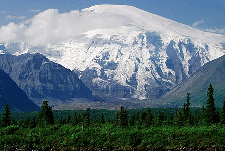
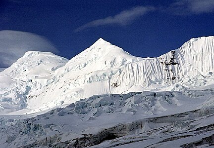 144. Mount Bona in Alaska is the highest volcano in the United States.
 -
 164. Mount Sanford in Alaska is the third highest volcano in the United States.
 -
 183. Wheeler Peak is the highest summit of New Mexico.


See also
 Geography portal
 North America portal
 United States portal
 Mountains portal
 Volcanoes portal


- List of mountain peaks of North America
- List of mountain peaks of Greenland
- List of mountain peaks of Canada
- List of mountain peaks of the Rocky Mountains
- List of mountain peaks of the United States
- List of the highest major summits of the United States
- List of the most prominent summits of the United States
- List of the most isolated major summits of the United States
- List of mountain peaks of Alaska
- List of mountain peaks of California
- List of mountain peaks of Colorado
- List of mountain peaks of Hawaiʻi
- List of mountain peaks of México
- List of mountain peaks of Central America
- List of mountain peaks of the Caribbean
- United States of America
- Geography of the United States
- Geology of the United States
- Category:Mountains of the United States
- commons:Category:Mountains of the United States
- Category:Mountains of the United States
- Physical geography
Notes
- ^ 200 summits in the table below are located within the 50 states and District of Columbia, while 9 summits are located in the U.S. territories — for a total of 209.
- ^ The summit of Denali is the highest point of the Alaska Range, the State of Alaska, the United States of America, and greater North America. Denali is the third most topographically prominent and third most topographically isolated summit on Earth after Mount Everest and Aconcagua.
- ^ The summit of Mauna Kea is the highest point of the Island of Hawaiʻi, the U.S. State of Hawaiʻi, and all islands of the Pacific Ocean.
- ^ Mauna Kea is the tallest mountain on Earth as measured from base to summit. The shield volcano sits on the ocean floor at a depth of 5998 meters (19,678 feet) for a total height of 10,205.3 meters (33,482 feet).
- ^ The summit of Mount Whitney is the highest point of the Sierra Nevada, the State of California, and the contiguous United States.
- ^ Mount Whitney is the southernmost and easternmost summit of its elevation in United States.
- ^ The summit of Mount Mitchell is the highest point of the Appalachian Mountains, the State of North Carolina, and the eastern United States.
- ^ Mount Mitchell is the easternmost 2000-meter (6562-foot) summit of the United States.
- ^ The elevation of Mount Mitchell includes an adjustment of +0.025 m (0.08 ft) from NGVD 29 to NAVD 88.
- ^ The summit of Mount Washington is the highest point of the White Mountains, the State of New Hampshire, and the northeastern United States.
- ^ Mount Washington is the easternmost ultra-prominent summit of the United States.
- ^ The elevation of Mount Washington includes an adjustment of +0.02 m (0.07 ft) from NGVD 29 to NAVD 88.
- ^ The summit of Mount Rainier is the highest point of the Cascade Range and the U.S. State of Washington. Mount Rainier is the most prominent summit in the contiguous United States and the fourth most prominent in North America.
- ^ The elevation of Mount Rainier includes an adjustment of +1.914 m (6.28 ft) from NGVD 29 to NAVD 88.
- ^ The summit of Mount Elbert is the highest point of the U.S. State of Colorado, the Rocky Mountains of North America, and the entire Mississippi River drainage basin.
- ^ The summit of Shishaldin Volcano is the highest point of Unimak Island and the Aleutian Islands.
- ^ Shishaldin Volcano is the westernmost summit of its elevation in Alaska, the United States, and greater North America.
- ^ The summit of Tanaga Volcano is the highest point of Tanaga Island and the Andreanof Islands.
- ^ Tanaga Volcano is the westernmost summit of its elevation in Alaska, the United States, and greater North America.
- ^ The summit of Mount Isto is the highest point of the Brooks Range.
- ^ Mount Isto is the northernmost ultra-prominent summit of Alaska and the United States.
- ^ The summit of Signal Hill is the highest point of the Ouachita Mountains and the U.S. State of Arkansas.
- ^ The elevation of Signal Hill includes an adjustment of +0.075 m (0.25 ft) from NGVD 29 to NAVD 88.
- ^ The summit of Mount Shasta is the highest point of the southern Cascade Range.
- ^ The summit of Gannett Peak is the highest point of the Wind River Range, the U.S. State of Wyoming, and the central Rocky Mountains.
- ^ Gannett Peak is the northernmost and westernmost summit of its elevation in the Rocky Mountains.
- ^ The summit of Mount Osborn is the highest point of the Seward Peninsula.
- ^ The summit of Mount Igikpak is the highest point of the Schwatka Mountains.
- ^ The summit of Humphreys Peak is the highest point of the San Francisco Peaks and the U.S. State of Arizona.
- ^ The elevation of Humphreys Peak includes an adjustment of +1.345 m (4.41 ft) from NGVD 29 to NAVD 88.
- ^ The summit of Wheeler Peak is the highest point of the Snake Range.
- ^ The summit of Mount Vsevidof is the highest point of Umnak Island and the Fox Islands.
- ^ Mount Vsevidof is the westernmost 2000-meter (6562-foot) summit of Alaska, the United States, and greater North America.
- ^ The summit of Mount Veniaminof is the highest point of the Alaska Peninsula.
- ^ The summit of Kawaikini is the highest point of the Island of Kauaʻi.
- ^ The summit of Kuskokwim high point is the highest point of the Kuskokwim Mountains.
- ^ The summit of Spruce Knob is the highest point of the Allegheny Mountains and the U.S. State of West Virginia.
- ^ The summit of Kings Peak is the highest point of the Uinta Mountains, the U.S. State of Utah, and the western Rocky Mountains.
- ^ The elevation of Kings Peak includes an adjustment of +1.807 m (5.93 ft) from NGVD 29 to NAVD 88.
- ^ The summit of Sierra Blanca Peak is the highest point of the Sacramento Mountains.
- ^ The summit of San Gorgonio Mountain is the highest point of the San Bernardino Mountains.
- ^ The elevation of San Gorgonio Mountain includes an adjustment of +1.303 m (4.27 ft) from NGVD 29 to NAVD 88.
- ^ The summit of Katahdin is the highest point of the Longfellow Mountains and the U.S. State of Maine.
- ^ Katahdin is the easternmost 1000-meter (3281-foot) summit of the United States.
- ^ The summit of Peak 4030 is the highest point of the Nulato Hills.
- ^ The summit of Mount Baldy is the highest point of the White Mountains.
- ^ The summit of Borah Peak is the highest point of the Lost River Range and the U.S. State of Idaho.
- ^ The summit of Cloud Peak is the highest point of the Bighorn Mountains.
- ^ Cloud Peak is the northernmost 4000-meter (13,123-foot) summit of the Rocky Mountains.
- ^ The summit of Black Elk Peak is the highest point of the Black Hills and the U.S. State of South Dakota.
- ^ The summit of Slide Mountain is the highest point of the Catskill Mountains.
- ^ The summit of Charleston Peak is the highest point of the Spring Mountains.
- ^ The summit of Junipero Serra Peak is the highest point of the Santa Lucia Range.
- ^ The elevation of Junipero Serra Peak includes an adjustment of +0.971 m (3.19 ft) from NGVD 29 to NAVD 88.
- ^ The summit of Mount Baker is the highest point of the northern Cascade Range.
- ^ The elevation of Mount Baker includes an adjustment of +1.43 m (4.69 ft) from NGVD 29 to NAVD 88.
- ^ The summit of Mount Marcy is the highest point of the Adirondack Mountains, the U.S. State of New York, and the drainage basins of the Gulf of Saint Lawrence and the Hudson River.
- ^ The summit of Mount Marcus Baker is the highest point of the Chugach Mountains.
- ^ The summit of Mount Hayes is the highest point of the Hayes Range.
- ^ Mount Hayes is the northernmost 4000-meter (13,123-foot) summit of Alaska, the United States, and greater North America.
- ^ The summit of Sacajawea Peak is the highest point of the Wallowa Mountains and the Columbia Plateau.
- ^ The elevation of Sacajawea Peak includes an adjustment of +1.56 m (5.12 ft) from NGVD 29 to NAVD 88.
- ^ The elevation of Steens Mountain includes an adjustment of +1.496 m (4.91 ft) from NGVD 29 to NAVD 88.
- ^ Mount Fairweather lies on the international border between Alaska and British Columbia. The peak is the highest point of the Canadian Province of British Columbia and the southernmost and easternmost summit of its elevation in both Canada and the United States.
- ^ The summit of Tooth Benchmark is the highest point of Saint Lawrence Island and the islands of the Bering Sea.
- ^ The summit of Delano Peak is the highest point of the Tushar Mountains.
- ^ The summit of Mount Olympus is the highest point of the Olympic Mountains.
- ^ The summit of Black Mountain is the highest point of the De Long Mountains.
- ^ The summit of Blanca Peak is the highest point of the Sangre de Cristo Mountains and the entire Rio Grande drainage basin.
- ^ Blanca Peak is the southernmost ultra-prominent summit of the Rocky Mountains.
- ^ The elevation of Blanca Peak includes an adjustment of +1.755 m (5.76 ft) from NGVD 29 to NAVD 88.
- ^ The summit of Mount Tozi is the highest point of the Ray Mountains.
- ^ The summit of Mount Cleveland is the highest point of the Lewis Range.
- ^ The summit of Mount Jefferson is the highest point of the Toquima Range.
- ^ The elevation of Mount Jefferson includes an adjustment of +1.666 m (5.47 ft) from NGVD 29 to NAVD 88.
- ^ The summit of Mount Torbert is the highest point of the Tordrillo Mountains.
- ^ Mount Torbert is the westernmost summit of its elevation in Alaska and greater North America.
- ^ The summit of Baldy Peak is the highest point of the Davis Mountains.
- ^ Baldy Peak is the easternmost summit of its elevation in the United States.
- ^ The summit of Hualapai Peak is the highest point of the Hualapai Mountains.
- ^ The summit of Ruby Dome is the highest point of the Ruby Mountains.
- ^ The elevation of Ruby Dome includes an adjustment of +1.429 m (4.69 ft) from NGVD 29 to NAVD 88.
- ^ The summit of Mount Pavlof is the highest point of the Alaska Peninsula.
- ^ The summit of South Baldy is the highest point of the Magdalena Mountains.
- ^ The summit of Truuli Peak is the highest point of the Kenai Mountains.
- ^ The summit of Great Sitkin Volcano is the highest point of Great Sitkin Island.
- ^ The summit of Eagle Peak is the highest point of the Warner Mountains.
- ^ The summit of Mount Taylor is the highest point of the northern San Mateo Mountains.
- ^ The summit of Accomplishment Peak is the highest point of the Philip Smith Mountains.
- ^ The summit of Granite Peak is the highest point of the Beartooth Mountains and the U.S. State of Montana.
- ^ The summit of Kiska Volcano is the highest point of Kiska Island.
- ^ Kiska Volcano is the westernmost 1000-meter (3281-foot) summit of Alaska, the United States, and greater North America.
- ^ The summit of Korovin Volcano is the highest point of Atka Island.
- ^ The summit of Uncompahgre Peak is the highest point of the San Juan Mountains and the entire Gulf of California drainage basin.
- ^ Uncompahgre Peak is the westernmost summit of its elevation in the Rocky Mountains.
- ^ The summit of Devils Paw is the highest point of the Juneau Icefield.
- ^ The summit of Kaʻala is the highest point of the Island of Oʻahu.
- ^ The summit of Koniag Peak is the highest point of Kodiak Island.
- ^ The summit of Makushin Volcano is the highest point of Unalaska Island.
- ^ The summit of Mount Pinos is the highest point of the San Emigdio Mountains.
- ^ The summit of Snowshoe Peak is the highest point of the Cabinet Mountains.
- ^ The elevation of Snowshoe Peak includes an adjustment of +1.367 m (4.48 ft) from NGVD 29 to NAVD 88.
- ^ The summit of Mount Graham is the highest point of the Pinaleño Mountains.
- ^ The summit of Granite Peak is the highest point of the Santa Rosa Range.
- ^ The summit of Cache Peak is the highest point of the Albion Range.
- ^ The summit of West Butte is the highest point of the Sweetgrass Hills.
- ^ The elevation of West Butte includes an adjustment of +1.061 m (3.48 ft) from NGVD 29 to NAVD 88.
- ^ The summit of Veniaminof Peak is the highest point of Baranof Island.
- ^ The summit of McDonald Peak is the highest point of the Mission Range.
- ^ The elevation of McDonald Peak includes an adjustment of +1.318 m (4.32 ft) from NGVD 29 to NAVD 88.
- ^ The summit of Hilgard Peak is the highest point of the Madison Range.
- ^ The elevation of Hilgard Peak includes an adjustment of +1.49 m (4.89 ft) from NGVD 29 to NAVD 88.
- ^ The summit of Haleakalā is the highest point of the Island of Maui and the westernmost 3000 meter (9842.5-foot) summit of the United States.
- ^ The summit of Mount Nebo is the highest point of the Wasatch Range.
- ^ The elevation of Mount Nebo includes an adjustment of +1.395 m (4.58 ft) from NGVD 29 to NAVD 88.
- ^ The summit of Tweedy Mountain is the highest point of the Pioneer Mountains.
- ^ The elevation of Tweedy Mountain includes an adjustment of +1.598 m (5.24 ft) from NGVD 29 to NAVD 88.
- ^ The summit of Buldir Volcano is the highest point of Buldir Island.
- ^ Buldir Volcano is the westernmost 500-meter (1640-foot) summit of Alaska, the United States, and greater North America.
- ^ The summit of Mount Peale is the highest point of the La Sal Mountains and the Colorado Plateau.
- ^ The summit of Guadalupe Peak is the highest point of the Guadalupe Mountains and the U.S. State of Texas.
- ^ The elevation of Guadalupe Peak includes an adjustment of +0.681 m (2.23 ft) from NGVD 29 to NAVD 88.
- ^ The summit of Cinnabar Mountain is the highest point of the Owyhee Mountains.
- ^ Clingmans Dome on the border of North Carolina is the highest point of the U.S. State of Tennessee and the Great Smoky Mountains.
- ^ The elevation of Clingmans Dome includes an adjustment of +0.062 m (0.2 ft) from NGVD 29 to NAVD 88.
- ^ The summit of Anvil Peak is the highest point of Semisopochnoi Island and the Rat Islands.
- ^ Anvil Peak is the westernmost summit of its elevation in Alaska, the United States, and greater North America.
- ^ The summit of Mount McLoughlin is the highest point of the southern Oregon Cascades.
- ^ The elevation of Mount McLoughlin includes an adjustment of +1.306 m (4.28 ft) from NGVD 29 to NAVD 88.
- ^ The summit of Grand Teton is the highest point of the Teton Range.
- ^ Grand Teton is the northernmost and westernmost 4000-meter (13,123-foot) summit of the Rocky Mountains.
- ^ The elevation of Kaibab Plateau high point includes an adjustment of +1.301 m (4.27 ft) from NGVD 29 to NAVD 88.
- ^ The summit of Star Peak is the highest point of the Humboldt Range.
- ^ The summit of White Mountain Peak is the highest point of the White Mountains.
- ^ The summit of Miller Peak is the highest point of the Huachuca Mountains.
- ^ The elevation of Miller Peak includes an adjustment of +1.067 m (3.5 ft) from NGVD 29 to NAVD 88.
- ^ The elevation of Copernicus Peak includes an adjustment of +0.924 m (3.03 ft) from NGVD 29 to NAVD 88.
- ^ The elevation of Sugarloaf Mountain includes an adjustment of -0.119 m (-0.39 ft) from NGVD 29 to NAVD 88.
- ^ The summit of Chiricahua Peak is the highest point of the Chiricahua Mountains.
- ^ The elevation of Chiricahua Peak includes an adjustment of +1.173 m (3.85 ft) from NGVD 29 to NAVD 88.
- ^ The summit of Mount Angayukaqsraq is the highest point of the Baird Mountains.
- ^ The summit of Bearpaw Baldy is the highest point of the Bearpaw Mountains.
- ^ The summit of Naomi Peak is the highest point of the Bear River Mountains.
- ^ The summit of Mount Linn is the highest point of the Northern California Coast Range.
- ^ The elevation of Mount Linn includes an adjustment of +1.148 m (3.77 ft) from NGVD 29 to NAVD 88.
- ^ The elevation of Mount Ajo includes an adjustment of +0.793 m (2.6 ft) from NGVD 29 to NAVD 88.
- ^ The summit of Ibapah Peak is the highest point of the Deep Creek Range.
- ^ The elevation of Ibapah Peak includes an adjustment of +1.517 m (4.98 ft) from NGVD 29 to NAVD 88.
- ^ The summit of Rogers Peak is the highest point of the northern Oregon Coast Range.
- ^ The elevation of Rogers Peak includes an adjustment of +1.109 m (3.64 ft) from NGVD 29 to NAVD 88.
- ^ The summit of Pyre Peak is the highest point of Seguam Island.
- ^ The summit of Mount Blackburn is the highest point of the Wrangell Mountains.
- ^ Pikes Peak is the easternmost 14,000-foot (4267-meter) summit and ultra-prominent summit of the Rocky Mountains. Pikes Peak was the inspiration for the lyrics of America the Beautiful.
- ^ The summit of Matterhorn is the highest point of the Jarbidge Mountains.
- ^ The elevation of Matterhorn includes an adjustment of +1.429 m (4.69 ft) from NGVD 29 to NAVD 88.
- ^ The summit of Roof Butte is the highest point of the Chuska Mountains.
- ^ The summit of Redoubt Volcano is the highest point of the Chigmit Mountains.
- ^ Redoubt Volcano is the westernmost summit of its elevation in Alaska and greater North America.
- ^ The summit of Mount Hesperus is the highest point of the western Alaska Range.
- ^ Mount Hesperus is the westernmost summit of its elevation in Alaska and greater North America.
- ^ The summit of Mount Hood is the highest point of the Oregon Cascades and the U.S. State of Oregon.
- ^ The summit of Telescope Peak is the highest point of the Panamint Range.
- ^ The summit of Virgin Peak is the highest point of the Virgin Mountains.
- ^ The elevation of Virgin Peak includes an adjustment of +0.888 m (2.91 ft) from NGVD 29 to NAVD 88.
- ^ The summit of Mount Cleveland is the highest point of Chuginadak Island.
- ^ The elevation of Glacier Peak includes an adjustment of +1.492 m (4.9 ft) from NGVD 29 to NAVD 88.
- ^ The summit of Mount Ellen is the highest point of the Henry Mountains.
- ^ The elevation of Mount Ellen includes an adjustment of +1.486 m (4.88 ft) from NGVD 29 to NAVD 88.
- ^ The summit of Mount Kimball is the highest point of the Delta Range.
- ^ The summit of Ferris Mountain is the highest point of the Ferris Mountains.
- ^ The summit of Pilot Peak is the highest point of the Pilot Range.
- ^ The summit of Currant Mountain is the highest point of the White Pine Range.
- ^ The summit of Red Mountain is the highest point of the Flathead Range.
- ^ The summit of Mount Mansfield is the highest point of the Green Mountains and the U.S. State of Vermont.
- ^ The elevation of Mount Mansfield includes an adjustment of -0.044 m (-0.14 ft) from NGVD 29 to NAVD 88.
- ^ The summit of Mount Lemmon is the highest point of the Santa Catalina Mountains.
- ^ The elevation of Mount Lemmon includes an adjustment of +1.004 m (3.29 ft) from NGVD 29 to NAVD 88.
- ^ The summit of Wyoming Peak is the highest point of the Wyoming Range.
- ^ The summit of Mount Bona is the highest point of the northwest Saint Elias Mountains.
- ^ The elevation of Mount Jefferson includes an adjustment of +1.388 m (4.55 ft) from NGVD 29 to NAVD 88.
- ^ The summit of Rocky Mountain is the highest point of the Rocky Mountain Front.
- ^ The summit of Francs Peak is the highest point of the Absaroka Range.
- ^ The summit of Oregon Butte is the highest point of the northern Blue Mountains.
- ^ The summit elevation of Oregon Butte includes a vertical offset of +0.203 m (0.7 ft) from the station benchmark.
- ^ The summit of Emory Peak is the highest point of the Chisos Mountains.
- ^ Emory Peak is the easternmost summit of its elevation in the United States.
- ^ The summit of Deseret Peak is the highest point of the Stansbury Mountains.
- ^ The summit of Big Baldy Mountain is the highest point of the Little Belt Mountains.
- ^ The elevation of Big Baldy Mountain includes an adjustment of +1.183 m (3.88 ft) from NGVD 29 to NAVD 88.
- ^ The summit of Sovereign Mountain is the highest point of the Talkeetna Mountains.
- ^ The summit of Chagulak Volcano is the highest point of Chagulak Island.
- ^ The summit of Crazy Peak is the highest point of the Crazy Mountains.
- ^ The elevation of Crazy Peak includes an adjustment of +1.421 m (4.66 ft) from NGVD 29 to NAVD 88.
- ^ The summit of Mount Stuart is the highest point of the Wenatchee Mountains.
- ^ The elevation of Mount Stuart includes an adjustment of +1.388 m (4.55 ft) from NGVD 29 to NAVD 88.
- ^ The summit of Longs Peak is the highest point of the northern Front Range.
- ^ Longs Peak is the northernmost 14,000-foot (4267-meter) summit of the Rocky Mountains.
- ^ The summit of Brian Head is the highest point of the Markagunt Plateau.
- ^ The elevation of Brian Head includes an adjustment of +1.556 m (5.1 ft) from NGVD 29 to NAVD 88.
- ^ The summit of Mount San Antonio is the highest point of the San Gabriel Mountains.
- ^ The elevation of Mount San Antonio includes an adjustment of +1.214 m (3.98 ft) from NGVD 29 to NAVD 88.
- ^ The summit of Truchas Peak is the highest point of the Santa Fe Mountains.
- ^ Truchas Peak is the southernmost summit of its elevation in the Rocky Mountains.
- ^ The summit of Mount Akutan is the highest point of Akutan Island.
- ^ The summit of Mount Kanaga is the highest point of Kanaga Island.
- ^ The summit of Flat Top Mountain is the highest point of the Flat Tops.
- ^ The summit of Trapper Peak is the highest point of the central Bitterroot Range.
- ^ The elevation of Trapper Peak includes an adjustment of +1.367 m (4.48 ft) from NGVD 29 to NAVD 88.
- ^ The summit of Mount Rogers is the highest point of the United States Commonwealth of Virginia.
- ^ The summit of Medicine Bow Peak is the highest point of the Snowy Range.
- ^ The summit of Mount Miller is the highest point of Barkley Ridge.
- ^ The summit of Troy Peak is the highest point of the Grant Range.
- ^ The summit of Abajo Peak is the highest point of the Abajo Mountains.
- ^ The summit of Mount Timpanogos is the highest point of the central Wasatch Range.
- ^ The summit of Summit Peak is the highest point of the southern San Juan Mountains.
- ^ The summit of Willard Peak is the highest point of the northern Wasatch Range.
- ^ The summit of West Goat Peak is the highest point of the Anaconda Range.
- ^ The elevation of West Goat Peak includes an adjustment of +1.52 m (4.99 ft) from NGVD 29 to NAVD 88.
- ^ The summit of Mount Wrightson is the highest point of the Santa Rita Mountains.
- ^ The elevation of Mount Wrightson includes an adjustment of +1.073 m (3.52 ft) from NGVD 29 to NAVD 88.
- ^ The summit of Mount Zirkel is the highest point of the Park Range.
- ^ The elevation of Mount Zirkel includes an adjustment of +1.632 m (5.35 ft) from NGVD 29 to NAVD 88.
- ^ The summit of Wheeler Peak is the highest point of the Taos Mountains and the U.S. State of New Mexico.
- ^ Wheeler Peak is the southernmost 4000-meter (13,123-foot) summit of the Rocky Mountains.
- ^ The summit of Mount Edith is the highest point of the Big Belt Mountains.
- ^ The elevation of Mount Edith includes an adjustment of +1.249 m (4.1 ft) from NGVD 29 to NAVD 88.
- ^ The summit of Thompson Peak is the highest point of the Salmon Mountains.
- ^ The summit of South Tent Mountain is the highest point of the Wasatch Plateau.
- ^ The summit of Kootznoowoo Peak is the highest point of Admiralty Island.
- ^ The summit of Homer Youngs Peak is the highest point of the West Big Hole Mountains.
- ^ The elevation of Homer Youngs Peak includes an adjustment of +1.483 m (4.87 ft) from NGVD 29 to NAVD 88.
- ^ The summit of Mount Tobin is the highest point of the Tobin Range.
- ^ The summit of Culebra Peak is the highest point of the Culebra Range.
- ^ Culebra Peak is the southernmost 14,000-foot (4267-meter) summit of the Rocky Mountains.
- ^ The elevation of Culebra Peak includes an adjustment of +1.74 m (5.71 ft) from NGVD 29 to NAVD 88.
- ^ The summit of Chicoma Mountain is the highest point of the Jemez Mountains.
- ^ The summit of Wind River Peak is the highest point of the southern Wind River Range.
- ^ The summit of Augustine Volcano is the highest point of Augustine Island.
- ^ The summit of Ute Peak is the highest point of Ute Mountain.
- ^ The summit of Hollowtop Mountain is the highest point of the Tobacco Root Mountains.
- ^ The elevation of Hollowtop Mountain includes an adjustment of +1.486 m (4.88 ft) from NGVD 29 to NAVD 88.
- ^ The summit of Mount Tipton is the highest point of the Cerbat Mountains.
- ^ The summit of Thirst Benchmark is the highest point of San Clemente Island.
- ^ The summit of Hayford Peak is the highest point of the Sheep Range.
- ^ The summit of Apple Orchard Mountain is the highest point of the northern Blue Ridge Mountains.
- ^ Iliamna Volcano is the westernmost 3000-meter (9843-foot) summit of Alaska and greater North America.
- ^ The summit of Santiago Peak is the highest point of the Santa Ana Mountains.
- ^ The summit of Tamgas Mountain is the highest point of Annette Island.
- ^ The summit of Mount Wilson is the highest point of the San Miguel Mountains.
- ^ Mount Wilson is the westernmost summit of its elevation in the Rocky Mountains.
- ^ The elevation of Mount Wilson includes an adjustment of +1.899 m (6.23 ft) from NGVD 29 to NAVD 88.
- ^ The summit of Crow Peak is the highest point of the Elkhorn Mountains.
- ^ The elevation of Crow Peak includes an adjustment of +1.353 m (4.44 ft) from NGVD 29 to NAVD 88.
- ^ The summit of North Palisade is the highest point of the Palisades.
- ^ The elevation of North Palisade includes an adjustment of +1.867 m (6.13 ft) from NGVD 29 to NAVD 88.
References
- ^ This article defines a significant summit as a summit with at least 100 meters (328.1 feet) of topographic prominence, and a major summit as a summit with at least 500 meters (1640 feet) of topographic prominence. All summits in this article have at least 500 meters of topographic prominence. An ultra-prominent summit is a summit with at least 1500 meters (4921 feet) of topographic prominence.
- ^ All elevations in the 48 states of the contiguous United States include an elevation adjustment from the National Geodetic Vertical Datum of 1929 (NGVD 29) to the North American Vertical Datum of 1988 (NAVD 88). For further information, please see this United States National Geodetic Survey note.
- ^ a b If the elevation or prominence of a summit is calculated as a range of values, the arithmetic mean is shown.
- ^ The topographic prominence of a summit is the topographic elevation difference between the summit and its highest or key col to a higher summit. The summit may be near its key col or quite far away. The key col for Denali in Alaska is the Isthmus of Rivas in Nicaragua, 7642 kilometers (4749 miles) away.
- ^ The topographic isolation of a summit is the great-circle distance to its nearest point of equal elevation.
- ^ 200 in the 50 states and District of Columbia, plus 9 in the U.S. territories
- ^ "Denali". Peakbagger.com. Retrieved 4 May 2016.
- ^ "Denali". Bivouac.com. Retrieved 4 May 2016.
- ^ "SUMMIT". Datasheet for NGS Station TU2314. U.S. National Geodetic Survey. Retrieved 4 May 2016.
- ^ "Mauna Kea". Peakbagger.com. Retrieved 4 May 2016.
- ^ "Mauna Kea". Bivouac.com. Retrieved 4 May 2016.
- ^ "WHITNEY". Datasheet for NGS Station GT1811. U.S. National Geodetic Survey. Retrieved 4 May 2016.
- ^ "Mount Whitney". Peakbagger.com. Retrieved 4 May 2016.
- ^ "Mount Whitney". Bivouac.com. Retrieved 4 May 2016.
- ^ "Mount Mitchell". Peakbagger.com. Retrieved 4 May 2016.
- ^ "Mount Mitchell". Bivouac.com. Retrieved 4 May 2016.
- ^ Highest point in the Mariana Islands archipelago and all of Micronesia. Most isolated major mountain in the United States that is not located within a state. The world isolation rank of Agrihan is #34.
- ^ https://peakbagger.com/peak.aspx?pid=74397 Peakbagger.com. Agrihan. Retrieved July 4, 2019.
- ^ "MT WASH". Datasheet for NGS Station PF0951. U.S. National Geodetic Survey. Retrieved 4 May 2016.
- ^ "Mount Washington". Peakbagger.com. Retrieved 4 May 2016.
- ^ "Mount Washington". Bivouac.com. Retrieved 4 May 2016.
- ^ "Mount Rainier". Peakbagger.com. Retrieved 4 May 2016.
- ^ "Mount Rainier". Bivouac.com. Retrieved 4 May 2016.
- ^ "MOUNT ELBERT". Datasheet for NGS Station KL0637. U.S. National Geodetic Survey. Retrieved 4 May 2016.
- ^ "Mount Elbert". Peakbagger.com. Retrieved 4 May 2016.
- ^ "Mount Elbert". Bivouac.com. Retrieved 4 May 2016.
- ^ "Shishaldin Volcano". Peakbagger.com. Retrieved 4 May 2016.
- ^ "Shishaldin Volcano". Bivouac.com. Retrieved 4 May 2016.
- ^ "Tanaga Volcano". Peakbagger.com. Retrieved 4 May 2016.
- ^ "Tanaga Volcano". Bivouac.com. Retrieved 4 May 2016.
- ^ "Mount Isto". Peakbagger.com. Retrieved 4 May 2016.
- ^ "Mount Isto". Bivouac.com. Retrieved 4 May 2016.
- ^ "Signal Hill". Peakbagger.com. Retrieved 4 May 2016.
- ^ "Signal Hill". Bivouac.com. Retrieved 4 May 2016.
- ^ "MT SHASTA". Datasheet for NGS Station MX1016. U.S. National Geodetic Survey. Retrieved 4 May 2016.
- ^ "Mount Shasta". Peakbagger.com. Retrieved 4 May 2016.
- ^ "Mount Shasta". Bivouac.com. Retrieved 4 May 2016.
- ^ "GANNETT PEAK CAIRN". Datasheet for NGS Station OW0356. U.S. National Geodetic Survey. Retrieved 4 May 2016.
- ^ "Gannett Peak". Peakbagger.com. Retrieved 4 May 2016.
- ^ "Gannett Peak". Bivouac.com. Retrieved 4 May 2016.
- ^ "MT OSBORN". Datasheet for NGS Station UW3831. U.S. National Geodetic Survey. Retrieved 4 May 2016.
- ^ "Mount Osborn". Peakbagger.com. Retrieved 4 May 2016.
- ^ "Mount Igikpak". Peakbagger.com. Retrieved 4 May 2016.
- ^ "Mount Igikpak". Bivouac.com. Retrieved 4 May 2016.
- ^ "Humphreys Peak". Peakbagger.com. Retrieved 4 May 2016.
- ^ "Humphreys Peak". Bivouac.com. Retrieved 4 May 2016.
- ^ Highest point in the United States outside the 50 states.
- ^ https://peakbagger.com/peak.aspx?pid=8231 Peakbagger.com. Cerro de Punta, Puerto Rico. Retrieved July 4, 2019.
- ^ "WHEELER PEAK". Datasheet for NGS Station JP0339. U.S. National Geodetic Survey. Retrieved 4 May 2016.
- ^ "Wheeler Peak". Peakbagger.com. Retrieved 4 May 2016.
- ^ "Wheeler Peak". Bivouac.com. Retrieved 4 May 2016.
- ^ "Mount Vsevidof". Peakbagger.com. Retrieved 4 May 2016.
- ^ "Mount Vsevidof". Bivouac.com. Retrieved 4 May 2016.
- ^ "Mount Veniaminof". Peakbagger.com. Retrieved 4 May 2016.
- ^ "Mount Veniaminof". Bivouac.com. Retrieved 4 May 2016.
- ^ "Kawaikini". Peakbagger.com. Retrieved 4 May 2016.
- ^ "Kawaikini". Bivouac.com. Retrieved 4 May 2016.
- ^ "Hall Island high point". Peakbagger.com. Retrieved 4 May 2016.
- ^ "Kuskokwim high point". Peakbagger.com. Retrieved 4 May 2016.
- ^ "SPRUCE". Datasheet for NGS Station HW3569. U.S. National Geodetic Survey. Retrieved 4 May 2016.
- ^ "Spruce Knob". Peakbagger.com. Retrieved 4 May 2016.
- ^ "Kings Peak". Peakbagger.com. Retrieved 4 May 2016.
- ^ "Kings Peak". Bivouac.com. Retrieved 4 May 2016.
- ^ "SIERRA BLANCA". Datasheet for NGS Station DR1010. U.S. National Geodetic Survey. Retrieved 4 May 2016.
- ^ "Sierra Blanca Peak". Peakbagger.com. Retrieved 4 May 2016.
- ^ "Sierra Blanca Peak". Bivouac.com. Retrieved 4 May 2016.
- ^ https://volcanoes.usgs.gov/volcanoes/anatahan/status.html USGS. Northern Mariana Islands Information Statement (Anatahan Volcano). Retrieved July 4, 2019.
- ^ "San Gorgonio Mountain". Peakbagger.com. Retrieved 4 May 2016.
- ^ "San Gorgonio Mountain". Bivouac.com. Retrieved 4 May 2016.
- ^ "KATAHDIN 2". Datasheet for NGS Station QG1451. U.S. National Geodetic Survey. Retrieved 4 May 2016.
- ^ "Katahdin". Peakbagger.com. Retrieved 4 May 2016.
- ^ "Peak 4030". Peakbagger.com. Retrieved 4 May 2016.
- ^ "BALDY". Datasheet for NGS Station DT0788. U.S. National Geodetic Survey. Retrieved 4 May 2016.
- ^ "Mount Baldy". Peakbagger.com. Retrieved 4 May 2016.
- ^ "Mount Baldy". Bivouac.com. Retrieved 4 May 2016.
- ^ "BEAUTY RESET". Datasheet for NGS Station PZ0770. U.S. National Geodetic Survey. Retrieved 4 May 2016.
- ^ "Borah Peak". Peakbagger.com. Retrieved 4 May 2016.
- ^ "Borah Peak". Bivouac.com. Retrieved 4 May 2016.
- ^ a b https://peakbagger.com/peak.aspx?pid=11932 Peakbagger.com. Lata Mountain. Retrieved July 4, 2019.
- ^ "CLOUD PEAK". Datasheet for NGS Station PW0524. U.S. National Geodetic Survey. Retrieved 4 May 2016.
- ^ "Cloud Peak". Peakbagger.com. Retrieved 4 May 2016.
- ^ "Cloud Peak". Bivouac.com. Retrieved 4 May 2016.
- ^ "HARNEY". Datasheet for NGS Station OT0810. U.S. National Geodetic Survey. Retrieved 4 May 2016.
- ^ "Black Elk Peak". Peakbagger.com. Retrieved 4 May 2016.
- ^ "Black Elk Peak". Bivouac.com. Retrieved 4 May 2016.
- ^ "SLIDE". Datasheet for NGS Station LY2488. U.S. National Geodetic Survey. Retrieved 4 May 2016.
- ^ "Slide Mountain". Peakbagger.com. Retrieved 4 May 2016.
- ^ "Mount Griggs". Peakbagger.com. Retrieved 4 May 2016.
- ^ "Mount Griggs". Bivouac.com. Retrieved 4 May 2016.
- ^ "CHARLESTON". Datasheet for NGS Station GR1965. U.S. National Geodetic Survey. Retrieved 4 May 2016.
- ^ "Charleston Peak". Peakbagger.com. Retrieved 4 May 2016.
- ^ "Charleston Peak". Bivouac.com. Retrieved 4 May 2016.
- ^ "Junipero Serra Peak". Peakbagger.com. Retrieved 4 May 2016.
- ^ "Junipero Serra Peak". Bivouac.com. Retrieved 4 May 2016.
- ^ "Mount Baker". Peakbagger.com. Retrieved 4 May 2016.
- ^ "Mount Baker". Bivouac.com. Retrieved 4 May 2016.
- ^ "MARCY". Datasheet for NGS Station PG2096. U.S. National Geodetic Survey. Retrieved 4 May 2016.
- ^ "Mount Marcy". Peakbagger.com. Retrieved 4 May 2016.
- ^ "Mount Marcus Baker". Peakbagger.com. Retrieved 4 May 2016.
- ^ "Mount Marcus Baker". Bivouac.com. Retrieved 4 May 2016.
- ^ "Mount Hayes". Peakbagger.com. Retrieved 4 May 2016.
- ^ "Mount Hayes". Bivouac.com. Retrieved 4 May 2016.
- ^ "Sacajawea Peak". Peakbagger.com. Retrieved 4 May 2016.
- ^ "Sacajawea Peak". Bivouac.com. Retrieved 4 May 2016.
- ^ "Steens Mountain". Peakbagger.com. Retrieved 4 May 2016.
- ^ "Steens Mountain". Bivouac.com. Retrieved 4 May 2016.
- ^ "Mount Fairweather". Peakbagger.com. Retrieved 4 May 2016.
- ^ "Mount Fairweather". Bivouac.com. Retrieved 4 May 2016.
- ^ "TOOTH". Datasheet for NGS Station UW3479. U.S. National Geodetic Survey. Retrieved 4 May 2016.
- ^ "Tooth Benchmark". Peakbagger.com. Retrieved 4 May 2016.
- ^ "DELANO PEAK M 5". Datasheet for NGS Station JO0502. U.S. National Geodetic Survey. Retrieved 4 May 2016.
- ^ "Delano Peak". Peakbagger.com. Retrieved 4 May 2016.
- ^ "Delano Peak". Bivouac.com. Retrieved 4 May 2016.
- ^ "MT OLYMPUS". Datasheet for NGS Station SY1857. U.S. National Geodetic Survey. Retrieved 4 May 2016.
- ^ "Mount Olympus". Peakbagger.com. Retrieved 4 May 2016.
- ^ "Mount Olympus". Bivouac.com. Retrieved 4 May 2016.
- ^ "Black Mountain". Peakbagger.com. Retrieved 4 May 2016.
- ^ "Blanca Peak". Peakbagger.com. Retrieved 4 May 2016.
- ^ "Blanca Peak". Bivouac.com. Retrieved 4 May 2016.
- ^ "Mount Tozi". Peakbagger.com. Retrieved 4 May 2016.
- ^ "CLEVELAND". Datasheet for NGS Station TM1009. U.S. National Geodetic Survey. Retrieved 4 May 2016.
- ^ "Mount Cleveland". Peakbagger.com. Retrieved 4 May 2016.
- ^ "Mount Cleveland". Bivouac.com. Retrieved 4 May 2016.
- ^ "Mount Jefferson". Peakbagger.com. Retrieved 4 May 2016.
- ^ "Mount Jefferson". Bivouac.com. Retrieved 4 May 2016.
- ^ "Mount Torbert". Peakbagger.com. Retrieved 4 May 2016.
- ^ "Mount Torbert". Bivouac.com. Retrieved 4 May 2016.
- ^ "Mount Chiginagak". Peakbagger.com. Retrieved 4 May 2016.
- ^ "Mount Chiginagak". Bivouac.com. Retrieved 4 May 2016.
- ^ "BALDY". Datasheet for NGS Station BQ0414. U.S. National Geodetic Survey. Retrieved 4 May 2016.
- ^ "Baldy Peak". Peakbagger.com. Retrieved 4 May 2016.
- ^ "HUALPAI". Datasheet for NGS Station FR0973. U.S. National Geodetic Survey. Retrieved 4 May 2016.
- ^ "Hualapai Peak". Peakbagger.com. Retrieved 4 May 2016.
- ^ "Hualapai Peak". Bivouac.com. Retrieved 4 May 2016.
- ^ "RUBY DOME CAIRN". Datasheet for NGS Station LQ0693. U.S. National Geodetic Survey. Retrieved 4 May 2016.
- ^ "Ruby Dome". Peakbagger.com. Retrieved 4 May 2016.
- ^ "Ruby Dome". Bivouac.com. Retrieved 4 May 2016.
- ^ "Mount Pavlof". Peakbagger.com. Retrieved 4 May 2016.
- ^ "Mount Pavlof". Bivouac.com. Retrieved 4 May 2016.
- ^ "SOUTH". Datasheet for NGS Station DS1463. U.S. National Geodetic Survey. Retrieved 4 May 2016.
- ^ "South Baldy". Peakbagger.com. Retrieved 4 May 2016.
- ^ "South Baldy". Bivouac.com. Retrieved 4 May 2016.
- ^ "Truuli Peak". Peakbagger.com. Retrieved 4 May 2016.
- ^ "Truuli Peak". Bivouac.com. Retrieved 4 May 2016.
- ^ "Great Sitkin Volcano". Peakbagger.com. Retrieved 4 May 2016.
- ^ "Great Sitkin Volcano". Bivouac.com. Retrieved 4 May 2016.
- ^ "EAGLE PEAK CAIRN 1931". Datasheet for NGS Station MW0748. U.S. National Geodetic Survey. Retrieved 4 May 2016.
- ^ "Eagle Peak". Peakbagger.com. Retrieved 4 May 2016.
- ^ "Eagle Peak". Bivouac.com. Retrieved 4 May 2016.
- ^ "TAYLOR". Datasheet for NGS Station FO1614. U.S. National Geodetic Survey. Retrieved 4 May 2016.
- ^ "Mount Taylor". Peakbagger.com. Retrieved 4 May 2016.
- ^ "Mount Taylor". Bivouac.com. Retrieved 4 May 2016.
- ^ "Accomplishment Peak". Peakbagger.com. Retrieved 4 May 2016.
- ^ "Accomplishment Peak". Bivouac.com. Retrieved 4 May 2016.
- ^ "GRANITE PEAK". Datasheet for NGS Station QW0616. U.S. National Geodetic Survey. Retrieved 4 May 2016.
- ^ "Granite Peak". Peakbagger.com. Retrieved 4 May 2016.
- ^ "Granite Peak". Bivouac.com. Retrieved 4 May 2016.
- ^ "Kiska Volcano". Peakbagger.com. Retrieved 4 May 2016.
- ^ "Kiska Volcano". Bivouac.com. Retrieved 4 May 2016.
- ^ "Korovin Volcano". Peakbagger.com. Retrieved 4 May 2016.
- ^ "Korovin Volcano". Bivouac.com. Retrieved 4 May 2016.
- ^ "UNCOMPAHGRE". Datasheet for NGS Station JL0798. U.S. National Geodetic Survey. Retrieved 4 May 2016.
- ^ "Uncompahgre Peak". Peakbagger.com. Retrieved 4 May 2016.
- ^ "Uncompahgre Peak". Bivouac.com. Retrieved 4 May 2016.
- ^ "Devils Paw". Peakbagger.com. Retrieved 4 May 2016.
- ^ "Devils Paw". Bivouac.com. Retrieved 4 May 2016.
- ^ "Kaʻala". Peakbagger.com. Retrieved 4 May 2016.
- ^ "Koniag Peak". Peakbagger.com. Retrieved 4 May 2016.
- ^ "Koniag Peak". Bivouac.com. Retrieved 4 May 2016.
- ^ "Makushin Volcano". Peakbagger.com. Retrieved 4 May 2016.
- ^ "Makushin Volcano". Bivouac.com. Retrieved 4 May 2016.
- ^ "MOUNT PINOS". Datasheet for NGS Station EW7674. U.S. National Geodetic Survey. Retrieved 4 May 2016.
- ^ "Mount Pinos". Peakbagger.com. Retrieved 4 May 2016.
- ^ "Mount Pinos". Bivouac.com. Retrieved 4 May 2016.
- ^ "Snowshoe Peak". Peakbagger.com. Retrieved 4 May 2016.
- ^ "Snowshoe Peak". Bivouac.com. Retrieved 4 May 2016.
- ^ "GRAHAM". Datasheet for NGS Station CY1235. U.S. National Geodetic Survey. Retrieved 4 May 2016.
- ^ "Mount Graham". Peakbagger.com. Retrieved 4 May 2016.
- ^ "Mount Graham". Bivouac.com. Retrieved 4 May 2016.
- ^ "SPRING BUTTE". Datasheet for NGS Station MU0442. U.S. National Geodetic Survey. Retrieved 4 May 2016.
- ^ "Granite Peak". Peakbagger.com. Retrieved 4 May 2016.
- ^ "Granite Peak". Bivouac.com. Retrieved 4 May 2016.
- ^ "CACHE". Datasheet for NGS Station NU1721. U.S. National Geodetic Survey. Retrieved 4 May 2016.
- ^ "Cache Peak". Peakbagger.com. Retrieved 4 May 2016.
- ^ "Cache Peak". Bivouac.com. Retrieved 4 May 2016.
- ^ "West Butte". Peakbagger.com. Retrieved 4 May 2016.
- ^ "West Butte". Bivouac.com. Retrieved 4 May 2016.
- ^ https://volcano.si.edu/volcano.cfm?vn=284180 Smithsonian Institution. National Museum of Natural History. Global Volcanism Program. Alamagan. (volcano.si.edu.) Retrieved July 4, 2019.
- ^ "Veniaminof Peak". Peakbagger.com. Retrieved 4 May 2016.
- ^ "Veniaminof Peak". Bivouac.com. Retrieved 4 May 2016.
- ^ "McDonald Peak". Peakbagger.com. Retrieved 4 May 2016.
- ^ "McDonald Peak". Bivouac.com. Retrieved 4 May 2016.
- ^ "Hilgard Peak". Peakbagger.com. Retrieved 4 May 2016.
- ^ "Hilgard Peak". Bivouac.com. Retrieved 4 May 2016.
- ^ "Haleakalā". Peakbagger.com. Retrieved 4 May 2016.
- ^ "Haleakalā". Bivouac.com. Retrieved 4 May 2016.
- ^ "Mount Nebo". Peakbagger.com. Retrieved 4 May 2016.
- ^ "Mount Nebo". Bivouac.com. Retrieved 4 May 2016.
- ^ "TWEEDY MTN SOUTH PEAK". Datasheet for NGS Station QY0549. U.S. National Geodetic Survey. Retrieved 4 May 2016.
- ^ "Tweedy Mountain". Peakbagger.com. Retrieved 4 May 2016.
- ^ "Tweedy Mountain". Bivouac.com. Retrieved 4 May 2016.
- ^ "BLACKBURN". Datasheet for NGS Station UW3260. U.S. National Geodetic Survey. Retrieved 4 May 2016.
- ^ "Blackburn Hills". Peakbagger.com. Retrieved 4 May 2016.
- ^ "BULDIR". Datasheet for NGS Station TT5847. U.S. National Geodetic Survey. Retrieved 4 May 2016.
- ^ "Buldir Volcano". Peakbagger.com. Retrieved 4 May 2016.
- ^ "Buldir Volcano". Bivouac.com. Retrieved 4 May 2016.
- ^ "Mount Tom White". Peakbagger.com. Retrieved 4 May 2016.
- ^ "Mount Tom White". Bivouac.com. Retrieved 4 May 2016.
- ^ "MOUNT PEALE". Datasheet for NGS Station JM0496. U.S. National Geodetic Survey. Retrieved 4 May 2016.
- ^ "Mount Peale". Peakbagger.com. Retrieved 4 May 2016.
- ^ "Mount Peale". Bivouac.com. Retrieved 4 May 2016.
- ^ "GUADALUPE PEAK CAIRN". Datasheet for NGS Station CD0988. U.S. National Geodetic Survey. Retrieved 4 May 2016.
- ^ "Guadalupe Peak". Peakbagger.com. Retrieved 4 May 2016.
- ^ "Guadalupe Peak". Bivouac.com. Retrieved 4 May 2016.
- ^ "SILVER". Datasheet for NGS Station NW0395. U.S. National Geodetic Survey. Retrieved 4 May 2016.
- ^ "Cinnabar Mountain". Peakbagger.com. Retrieved 4 May 2016.
- ^ "LASSEN". Datasheet for NGS Station LT0688. U.S. National Geodetic Survey. Retrieved 4 May 2016.
- ^ "Lassen Peak". Peakbagger.com. Retrieved 4 May 2016.
- ^ "Lassen Peak". Bivouac.com. Retrieved 4 May 2016.
- ^ "Clingmans Dome". Peakbagger.com. Retrieved 4 May 2016.
- ^ "Anvil Peak". Peakbagger.com. Retrieved 4 May 2016.
- ^ "Anvil Peak". Bivouac.com. Retrieved 4 May 2016.
- ^ "MOUNT MCLOUGHLIN LOH". Datasheet for NGS Station NZ1067. U.S. National Geodetic Survey. Retrieved 4 May 2016.
- ^ "Mount McLoughlin". Peakbagger.com. Retrieved 4 May 2016.
- ^ "Mount McLoughlin". Bivouac.com. Retrieved 4 May 2016.
- ^ "GRAND TETON". Datasheet for NGS Station OX0838. U.S. National Geodetic Survey. Retrieved 4 May 2016.
- ^ "Grand Teton". Peakbagger.com. Retrieved 4 May 2016.
- ^ "Grand Teton". Bivouac.com. Retrieved 4 May 2016.
- ^ "Kaibab Plateau high point". Peakbagger.com. Retrieved 4 May 2016.
- ^ "Kaibab Plateau high point". Bivouac.com. Retrieved 4 May 2016.
- ^ "STAR PEAK RESET". Datasheet for NGS Station LS0554. U.S. National Geodetic Survey. Retrieved 4 May 2016.
- ^ "Star Peak". Peakbagger.com. Retrieved 4 May 2016.
- ^ "Star Peak". Bivouac.com. Retrieved 4 May 2016.
- ^ "WHITE MOUNTAIN PEAK". Datasheet for NGS Station HR2559. U.S. National Geodetic Survey. Retrieved 4 May 2016.
- ^ "White Mountain Peak". Peakbagger.com. Retrieved 4 May 2016.
- ^ "White Mountain Peak". Bivouac.com. Retrieved 4 May 2016.
- ^ "LARAMIE PEAK". Datasheet for NGS Station NQ0621. U.S. National Geodetic Survey. Retrieved 4 May 2016.
- ^ "Laramie Peak". Peakbagger.com. Retrieved 4 May 2016.
- ^ "Laramie Peak". Bivouac.com. Retrieved 4 May 2016.
- ^ "Miller Peak". Peakbagger.com. Retrieved 4 May 2016.
- ^ "Miller Peak". Bivouac.com. Retrieved 4 May 2016.
- ^ "Kusilvak high point". Peakbagger.com. Retrieved 4 May 2016.
- ^ "MOUNT HAMILTON LOOKOUT HOUSE". Datasheet for NGS Station HS4864. U.S. National Geodetic Survey. Retrieved 4 May 2016.
- ^ "Copernicus Peak". Peakbagger.com. Retrieved 4 May 2016.
- ^ "Copernicus Peak". Bivouac.com. Retrieved 4 May 2016.
- ^ "Sugarloaf Mountain". Peakbagger.com. Retrieved 4 May 2016.
- ^ "Sugarloaf Mountain". Bivouac.com. Retrieved 4 May 2016.
- ^ https://www.peakbagger.com/peak.aspx?pid=52209 Peakbagger.com. Asuncion Island. Retrieved July 4, 2019.
- ^ "Chiricahua Peak". Peakbagger.com. Retrieved 4 May 2016.
- ^ "Chiricahua Peak". Bivouac.com. Retrieved 4 May 2016.
- ^ "Mount Harper". Peakbagger.com. Retrieved 4 May 2016.
- ^ "Mount Angayukaqsraq". Peakbagger.com. Retrieved 4 May 2016.
- ^ "Mount Angayukaqsraq". Bivouac.com. Retrieved 4 May 2016.
- ^ "Mount Prindle". Peakbagger.com. Retrieved 4 May 2016.
- ^ "BALDY". Datasheet for NGS Station TK0492. U.S. National Geodetic Survey. Retrieved 4 May 2016.
- ^ "Bearpaw Baldy". Peakbagger.com. Retrieved 4 May 2016.
- ^ "NAOMI". Datasheet for NGS Station MR0721. U.S. National Geodetic Survey. Retrieved 4 May 2016.
- ^ "Naomi Peak". Peakbagger.com. Retrieved 4 May 2016.
- ^ "Naomi Peak". Bivouac.com. Retrieved 4 May 2016.
- ^ "Mount Linn". Peakbagger.com. Retrieved 4 May 2016.
- ^ "Mount Linn". Bivouac.com. Retrieved 4 May 2016.
- ^ "Mount Ajo". Peakbagger.com. Retrieved 4 May 2016.
- ^ "Ibapah Peak". Peakbagger.com. Retrieved 4 May 2016.
- ^ "Ibapah Peak". Bivouac.com. Retrieved 4 May 2016.
- ^ "Rogers Peak". Peakbagger.com. Retrieved 4 May 2016.
- ^ "PYRE". Datasheet for NGS Station TT5609. U.S. National Geodetic Survey. Retrieved 4 May 2016.
- ^ "Pyre Peak". Peakbagger.com. Retrieved 4 May 2016.
- ^ "Pyre Peak". Bivouac.com. Retrieved 4 May 2016.
- ^ "MT BLACKBURN". Datasheet for NGS Station UV4136. U.S. National Geodetic Survey. Retrieved 4 May 2016.
- ^ "Mount Blackburn". Peakbagger.com. Retrieved 4 May 2016.
- ^ "Mount Blackburn". Bivouac.com. Retrieved 4 May 2016.
- ^ "PIKES PEAK". Datasheet for NGS Station JK1242. U.S. National Geodetic Survey. Retrieved 4 May 2016.
- ^ "Pikes Peak". Peakbagger.com. Retrieved 4 May 2016.
- ^ "Pikes Peak". Bivouac.com. Retrieved 4 May 2016.
- ^ https://www.peakbagger.com/peak.aspx?pid=11933 Matafao Peak, American Samoa. Peakbagger. Retrieved July 4, 2019.
- ^ "Matterhorn". Peakbagger.com. Retrieved 4 May 2016.
- ^ "Matterhorn". Bivouac.com. Retrieved 4 May 2016.
- ^ "ROOF". Datasheet for NGS Station GO0270. U.S. National Geodetic Survey. Retrieved 4 May 2016.
- ^ "Roof Butte". Peakbagger.com. Retrieved 4 May 2016.
- ^ "Roof Butte". Bivouac.com. Retrieved 4 May 2016.
- ^ "Redoubt Volcano". Peakbagger.com. Retrieved 4 May 2016.
- ^ "Redoubt Volcano". Bivouac.com. Retrieved 4 May 2016.
- ^ "MOOSEHEART MOUNTAIN". Datasheet for NGS Station TT6777. U.S. National Geodetic Survey. Retrieved 4 May 2016.
- ^ "Mooseheart Mountain". Peakbagger.com. Retrieved 4 May 2016.
- ^ "Mount Hesperus". Peakbagger.com. Retrieved 4 May 2016.
- ^ "Mount Hesperus". Bivouac.com. Retrieved 4 May 2016.
- ^ "MOUNT HOOD HIGHEST POINT". Datasheet for NGS Station RC2244. U.S. National Geodetic Survey. Retrieved 4 May 2016.
- ^ "Mount Hood". Peakbagger.com. Retrieved 4 May 2016.
- ^ "Mount Hood". Bivouac.com. Retrieved 4 May 2016.
- ^ "TELESCOPE". Datasheet for NGS Station GS0799. U.S. National Geodetic Survey. Retrieved 4 May 2016.
- ^ "Telescope Peak". Peakbagger.com. Retrieved 4 May 2016.
- ^ "Telescope Peak". Bivouac.com. Retrieved 4 May 2016.
- ^ "Virgin Peak". Peakbagger.com. Retrieved 4 May 2016.
- ^ "Virgin Peak". Bivouac.com. Retrieved 4 May 2016.
- ^ "MOUNT CLEVELAND". Datasheet for NGS Station UV9122. U.S. National Geodetic Survey. Retrieved 4 May 2016.
- ^ "Mount Cleveland". Peakbagger.com. Retrieved 4 May 2016.
- ^ "Mount Cleveland". Bivouac.com. Retrieved 4 May 2016.
- ^ "Prince of Wales Island high point". Peakbagger.com. Retrieved 4 May 2016.
- ^ "GLACIER PEAK". Datasheet for NGS Station TQ0506. U.S. National Geodetic Survey. Retrieved 4 May 2016.
- ^ "Glacier Peak". Peakbagger.com. Retrieved 4 May 2016.
- ^ "Glacier Peak". Bivouac.com. Retrieved 4 May 2016.
- ^ "Mount Ellen". Peakbagger.com. Retrieved 4 May 2016.
- ^ "Mount Ellen". Bivouac.com. Retrieved 4 May 2016.
- ^ "Mount Kimball". Peakbagger.com. Retrieved 4 May 2016.
- ^ "Mount Kimball". Bivouac.com. Retrieved 4 May 2016.
- ^ "FERRIS". Datasheet for NGS Station NR0432. U.S. National Geodetic Survey. Retrieved 4 May 2016.
- ^ "Ferris Mountain". Peakbagger.com. Retrieved 4 May 2016.
- ^ "Ferris Mountain". Bivouac.com. Retrieved 4 May 2016.
- ^ "PILOT PEAK". Datasheet for NGS Station MT0738. U.S. National Geodetic Survey. Retrieved 4 May 2016.
- ^ "Pilot Peak". Peakbagger.com. Retrieved 4 May 2016.
- ^ "Pilot Peak". Bivouac.com. Retrieved 4 May 2016.
- ^ "CURRANT MT". Datasheet for NGS Station JP0700. U.S. National Geodetic Survey. Retrieved 4 May 2016.
- ^ "Currant Mountain". Peakbagger.com. Retrieved 4 May 2016.
- ^ "Currant Mountain". Bivouac.com. Retrieved 4 May 2016.
- ^ "RED". Datasheet for NGS Station ST0521. U.S. National Geodetic Survey. Retrieved 4 May 2016.
- ^ "Red Mountain". Peakbagger.com. Retrieved 4 May 2016.
- ^ "Red Mountain". Bivouac.com. Retrieved 4 May 2016.
- ^ "Mount Mansfield". Peakbagger.com. Retrieved 4 May 2016.
- ^ "Mount Lemmon". Peakbagger.com. Retrieved 4 May 2016.
- ^ "Mount Lemmon". Bivouac.com. Retrieved 4 May 2016.
- ^ "WYOMING PEAK". Datasheet for NGS Station NT0655. U.S. National Geodetic Survey. Retrieved 4 May 2016.
- ^ "Wyoming Peak". Peakbagger.com. Retrieved 4 May 2016.
- ^ "Wyoming Peak". Bivouac.com. Retrieved 4 May 2016.
- ^ "Mount Bona". Peakbagger.com. Retrieved 4 May 2016.
- ^ "Mount Bona". Bivouac.com. Retrieved 4 May 2016.
- ^ "Peak 4085". Peakbagger.com. Retrieved 4 May 2016.
- ^ "MOUNT JEFFERSON". Datasheet for NGS Station QD1739. U.S. National Geodetic Survey. Retrieved 4 May 2016.
- ^ "Mount Jefferson". Peakbagger.com. Retrieved 4 May 2016.
- ^ "Mount Jefferson". Bivouac.com. Retrieved 4 May 2016.
- ^ "ROCKY". Datasheet for NGS Station ST0546. U.S. National Geodetic Survey. Retrieved 4 May 2016.
- ^ "Rocky Mountain". Peakbagger.com. Retrieved 4 May 2016.
- ^ "Rocky Mountain". Bivouac.com. Retrieved 4 May 2016.
- ^ "FRANCS PK 2". Datasheet for NGS Station OW0325. U.S. National Geodetic Survey. Retrieved 4 May 2016.
- ^ "Francs Peak". Peakbagger.com. Retrieved 4 May 2016.
- ^ "Francs Peak". Bivouac.com. Retrieved 4 May 2016.
- ^ "OREGON BUTTE". Datasheet for NGS Station RZ1678. U.S. National Geodetic Survey. Retrieved 4 May 2016.
- ^ "Oregon Butte". Peakbagger.com. Retrieved 4 May 2016.
- ^ "Oregon Butte". Bivouac.com. Retrieved 4 May 2016.
- ^ "CHISOS". Datasheet for NGS Station BA0431. U.S. National Geodetic Survey. Retrieved 4 May 2016.
- ^ "Emory Peak". Peakbagger.com. Retrieved 4 May 2016.
- ^ "Emory Peak". Bivouac.com. Retrieved 4 May 2016.
- ^ "Deseret Peak". Peakbagger.com. Retrieved 4 May 2016.
- ^ "Deseret Peak". Bivouac.com. Retrieved 4 May 2016.
- ^ "Big Baldy Mountain". Peakbagger.com. Retrieved 4 May 2016.
- ^ "Big Baldy Mountain". Bivouac.com. Retrieved 4 May 2016.
- ^ "MOUNT ADAMS". Datasheet for NGS Station SB1004. U.S. National Geodetic Survey. Retrieved 4 May 2016.
- ^ "Mount Adams". Peakbagger.com. Retrieved 4 May 2016.
- ^ "Mount Adams". Bivouac.com. Retrieved 4 May 2016.
- ^ "Sovereign Mountain". Peakbagger.com. Retrieved 4 May 2016.
- ^ "Sovereign Mountain". Bivouac.com. Retrieved 4 May 2016.
- ^ "Chagulak Volcano". Peakbagger.com. Retrieved 4 May 2016.
- ^ "Chagulak Volcano". Bivouac.com. Retrieved 4 May 2016.
- ^ "Crazy Peak". Peakbagger.com. Retrieved 4 May 2016.
- ^ "Crazy Peak". Bivouac.com. Retrieved 4 May 2016.
- ^ "MOUNT STUART". Datasheet for NGS Station SX1189. U.S. National Geodetic Survey. Retrieved 4 May 2016.
- ^ "Mount Stuart". Peakbagger.com. Retrieved 4 May 2016.
- ^ "Mount Stuart". Bivouac.com. Retrieved 4 May 2016.
- ^ "LONGS PEAK". Datasheet for NGS Station LL1346. U.S. National Geodetic Survey. Retrieved 4 May 2016.
- ^ "Longs Peak". Peakbagger.com. Retrieved 4 May 2016.
- ^ "Longs Peak". Bivouac.com. Retrieved 4 May 2016.
- ^ El Toro is the highest mountain in eastern Puerto Rico (El Toro Wilderness)
- ^ https://www.peakbagger.com/peak.aspx?pid=34044 Peakbagger.com. El Toro, Puerto Rico. Retrieved July 4, 2019.
- ^ "De Long Peak". Peakbagger.com. Retrieved 4 May 2016.
- ^ "Mount Douglas". Peakbagger.com. Retrieved 4 May 2016.
- ^ "Mount Douglas". Bivouac.com. Retrieved 4 May 2016.
- ^ "Brian Head". Peakbagger.com. Retrieved 4 May 2016.
- ^ "Brian Head". Bivouac.com. Retrieved 4 May 2016.
- ^ "Mount San Antonio". Peakbagger.com. Retrieved 4 May 2016.
- ^ "Mount San Antonio". Bivouac.com. Retrieved 4 May 2016.
- ^ "TRUCHAS". Datasheet for NGS Station FN0666. U.S. National Geodetic Survey. Retrieved 4 May 2016.
- ^ "Truchas Peak". Peakbagger.com. Retrieved 4 May 2016.
- ^ "Truchas Peak". Bivouac.com. Retrieved 4 May 2016.
- ^ "Mount Akutan". Peakbagger.com. Retrieved 4 May 2016.
- ^ "Mount Akutan". Bivouac.com. Retrieved 4 May 2016.
- ^ "Mount Kanaga". Peakbagger.com. Retrieved 4 May 2016.
- ^ "Mount Kanaga". Bivouac.com. Retrieved 4 May 2016.
- ^ "FLATTOP". Datasheet for NGS Station LM0694. U.S. National Geodetic Survey. Retrieved 4 May 2016.
- ^ "Flat Top Mountain". Peakbagger.com. Retrieved 4 May 2016.
- ^ "Flat Top Mountain". Bivouac.com. Retrieved 4 May 2016.
- ^ "Trapper Peak". Peakbagger.com. Retrieved 4 May 2016.
- ^ "Trapper Peak". Bivouac.com. Retrieved 4 May 2016.
- ^ "ROGERS RESET". Datasheet for NGS Station FZ2155. U.S. National Geodetic Survey. Retrieved 4 May 2016.
- ^ "Mount Rogers". Peakbagger.com. Retrieved 4 May 2016.
- ^ "MEDICINE BOW". Datasheet for NGS Station MP0546. U.S. National Geodetic Survey. Retrieved 4 May 2016.
- ^ "Medicine Bow Peak". Peakbagger.com. Retrieved 4 May 2016.
- ^ "Medicine Bow Peak". Bivouac.com. Retrieved 4 May 2016.
- ^ "Mount Miller". Peakbagger.com. Retrieved 4 May 2016.
- ^ "Mount Miller". Bivouac.com. Retrieved 4 May 2016.
- ^ "Mount Sanford". Peakbagger.com. Retrieved 4 May 2016.
- ^ "Mount Sanford". Bivouac.com. Retrieved 4 May 2016.
- ^ "WHITE PINE RESET". Datasheet for NGS Station JP0387. U.S. National Geodetic Survey. Retrieved 4 May 2016.
- ^ "Troy Peak". Peakbagger.com. Retrieved 4 May 2016.
- ^ "Troy Peak". Bivouac.com. Retrieved 4 May 2016.
- ^ "ABAJO PEAK". Datasheet for NGS Station HM0536. U.S. National Geodetic Survey. Retrieved 4 May 2016.
- ^ "Abajo Peak". Peakbagger.com. Retrieved 4 May 2016.
- ^ "Abajo Peak". Bivouac.com. Retrieved 4 May 2016.
- ^ "TIMPANOGOS". Datasheet for NGS Station LO0769. U.S. National Geodetic Survey. Retrieved 4 May 2016.
- ^ "Mount Timpanogos". Peakbagger.com. Retrieved 4 May 2016.
- ^ "Mount Timpanogos". Bivouac.com. Retrieved 4 May 2016.
- ^ "SUMMIT". Datasheet for NGS Station HL0503. U.S. National Geodetic Survey. Retrieved 4 May 2016.
- ^ "Summit Peak". Peakbagger.com. Retrieved 4 May 2016.
- ^ "Summit Peak". Bivouac.com. Retrieved 4 May 2016.
- ^ "WILLARD". Datasheet for NGS Station MR0719. U.S. National Geodetic Survey. Retrieved 4 May 2016.
- ^ "Willard Peak". Peakbagger.com. Retrieved 4 May 2016.
- ^ "Willard Peak". Bivouac.com. Retrieved 4 May 2016.
- ^ "SOUTH SISTER". Datasheet for NGS Station QD1872. U.S. National Geodetic Survey. Retrieved 4 May 2016.
- ^ "South Sister". Peakbagger.com. Retrieved 4 May 2016.
- ^ "South Sister". Bivouac.com. Retrieved 4 May 2016.
- ^ "West Goat Peak". Peakbagger.com. Retrieved 4 May 2016.
- ^ "West Goat Peak". Bivouac.com. Retrieved 4 May 2016.
- ^ "Mount Wrightson". Peakbagger.com. Retrieved 4 May 2016.
- ^ "Mount Wrightson". Bivouac.com. Retrieved 4 May 2016.
- ^ "Mount Zirkel". Peakbagger.com. Retrieved 4 May 2016.
- ^ "Mount Zirkel". Bivouac.com. Retrieved 4 May 2016.
- ^ "Kichatna Spire". Peakbagger.com. Retrieved 4 May 2016.
- ^ "Kichatna Spire". Bivouac.com. Retrieved 4 May 2016.
- ^ "WHEELER". Datasheet for NGS Station GM0779. U.S. National Geodetic Survey. Retrieved 4 May 2016.
- ^ "Wheeler Peak". Peakbagger.com. Retrieved 4 May 2016.
- ^ "Wheeler Peak". Bivouac.com. Retrieved 4 May 2016.
- ^ "Mount Edith". Peakbagger.com. Retrieved 4 May 2016.
- ^ "Mount Edith". Bivouac.com. Retrieved 4 May 2016.
- ^ "THOMPSON PK CAIRN 1961". Datasheet for NGS Station MX1198. U.S. National Geodetic Survey. Retrieved 4 May 2016.
- ^ "Thompson Peak". Peakbagger.com. Retrieved 4 May 2016.
- ^ "Thompson Peak". Bivouac.com. Retrieved 4 May 2016.
- ^ https://www.peakbagger.com/peak.aspx?pid=11785 Peakbagger.com. Pagan Hight Point, Northern Marianas. Retrieved July 4, 2019.
- ^ "SOUTH TENT". Datasheet for NGS Station KN0397. U.S. National Geodetic Survey. Retrieved 4 May 2016.
- ^ "South Tent Mountain". Peakbagger.com. Retrieved 4 May 2016.
- ^ "South Tent Mountain". Bivouac.com. Retrieved 4 May 2016.
- ^ "Kootznoowoo Peak". Peakbagger.com. Retrieved 4 May 2016.
- ^ "Homer Youngs Peak". Peakbagger.com. Retrieved 4 May 2016.
- ^ "Homer Youngs Peak". Bivouac.com. Retrieved 4 May 2016.
- ^ "TOBIN". Datasheet for NGS Station LR0842. U.S. National Geodetic Survey. Retrieved 4 May 2016.
- ^ "Mount Tobin". Peakbagger.com. Retrieved 4 May 2016.
- ^ "Mount Tobin". Bivouac.com. Retrieved 4 May 2016.
- ^ "Culebra Peak". Peakbagger.com. Retrieved 4 May 2016.
- ^ "Culebra Peak". Bivouac.com. Retrieved 4 May 2016.
- ^ "Frosty Peak". Peakbagger.com. Retrieved 4 May 2016.
- ^ "Frosty Peak". Bivouac.com. Retrieved 4 May 2016.
- ^ "LANGLEY". Datasheet for NGS Station GN0677. U.S. National Geodetic Survey. Retrieved 4 May 2016.
- ^ "Chicoma Mountain". Peakbagger.com. Retrieved 4 May 2016.
- ^ "Chicoma Mountain". Bivouac.com. Retrieved 4 May 2016.
- ^ "WIND". Datasheet for NGS Station NS0274. U.S. National Geodetic Survey. Retrieved 4 May 2016.
- ^ "Wind River Peak". Peakbagger.com. Retrieved 4 May 2016.
- ^ "Wind River Peak". Bivouac.com. Retrieved 4 May 2016.
- ^ "Augustine Volcano". Peakbagger.com. Retrieved 4 May 2016.
- ^ "Augustine Volcano". Bivouac.com. Retrieved 4 May 2016.
- ^ "UTE". Datasheet for NGS Station HM0511. U.S. National Geodetic Survey. Retrieved 4 May 2016.
- ^ "Ute Peak". Peakbagger.com. Retrieved 4 May 2016.
- ^ "Ute Peak". Bivouac.com. Retrieved 4 May 2016.
- ^ "Hollowtop Mountain". Peakbagger.com. Retrieved 4 May 2016.
- ^ "Hollowtop Mountain". Bivouac.com. Retrieved 4 May 2016.
- ^ "TIPTON". Datasheet for NGS Station FS1023. U.S. National Geodetic Survey. Retrieved 4 May 2016.
- ^ "Mount Tipton". Peakbagger.com. Retrieved 4 May 2016.
- ^ "THIRST RESET". Datasheet for NGS Station TZ1944. U.S. National Geodetic Survey. Retrieved 4 May 2016.
- ^ "Thirst Benchmark". Peakbagger.com. Retrieved 4 May 2016.
- ^ "HAYFORD". Datasheet for NGS Station GR1917. U.S. National Geodetic Survey. Retrieved 4 May 2016.
- ^ "Hayford Peak". Peakbagger.com. Retrieved 4 May 2016.
- ^ "Hayford Peak". Bivouac.com. Retrieved 4 May 2016.
- ^ "APPLE 2". Datasheet for NGS Station GW2265. U.S. National Geodetic Survey. Retrieved 4 May 2016.
- ^ "Apple Orchard Mountain". Peakbagger.com. Retrieved 4 May 2016.
- ^ "Iliamna Volcano". Peakbagger.com. Retrieved 4 May 2016.
- ^ "Iliamna Volcano". Bivouac.com. Retrieved 4 May 2016.
- ^ "SANTIAGO". Datasheet for NGS Station DX1779. U.S. National Geodetic Survey. Retrieved 4 May 2016.
- ^ "Santiago Peak". Peakbagger.com. Retrieved 4 May 2016.
- ^ "Santiago Peak". Bivouac.com. Retrieved 4 May 2016.
- ^ "Tamgas Mountain". Peakbagger.com. Retrieved 4 May 2016.
- ^ "Mount Wilson". Peakbagger.com. Retrieved 4 May 2016.
- ^ "Mount Wilson". Bivouac.com. Retrieved 4 May 2016.
- ^ "Crow Peak". Peakbagger.com. Retrieved 4 May 2016.
- ^ "MOUNT DIABLO". Datasheet for NGS Station HS5120. U.S. National Geodetic Survey. Retrieved 4 May 2016.
- ^ "Mount Diablo". Peakbagger.com. Retrieved 4 May 2016.
- ^ "Mount Diablo". Bivouac.com. Retrieved 4 May 2016.
- ^ "Isthmus Peak". Peakbagger.com. Retrieved 4 May 2016.
- ^ "Isthmus Peak". Bivouac.com. Retrieved 4 May 2016.
- ^ "NORTH PALISADE". Datasheet for NGS Station HR2629. U.S. National Geodetic Survey. Retrieved 4 May 2016.
- ^ "North Palisade". Peakbagger.com. Retrieved 4 May 2016.
- ^ "North Palisade". Bivouac.com. Retrieved 4 May 2016.
External links
Mountains of the United States at Wikipedia's sister projects
 Definitions from Wiktionary
 Media from Commons
 News from Wikinews
 Quotations from Wikiquote
 Texts from Wikisource
 Textbooks from Wikibooks
 Resources from Wikiversity
- United States Geological Survey (USGS)
- Geographic Names Information System @ USGS
- United States National Geodetic Survey (NGS)
- Geodetic Glossary @ NGS
- NGVD 29 to NAVD 88 online elevation converter @ NGS
- Survey Marks and Datasheets @ NGS
- Bivouac.com
- Peakbagger.com
- Peaklist.org
- Peakware.com
- Summitpost.org
- v
- t
- e
- Alabama
- Alaska
- Arizona
- Arkansas
- California
- Colorado
- Connecticut
- Delaware
- Florida
- Georgia
- Hawaii
- Idaho
- Illinois
- Indiana
- Iowa
- Kansas
- Kentucky
- Louisiana
- Maine
- Maryland
- Massachusetts
- Michigan
- Minnesota
- Mississippi
- Missouri
- Montana
- Nebraska
- Nevada
- New Hampshire
- New Jersey
- New Mexico
- New York
- North Carolina
- North Dakota
- Ohio
- Oklahoma
- Oregon
- Pennsylvania
- Rhode Island
- South Carolina
- South Dakota
- Tennessee
- Texas
- Utah
- Vermont
- Virginia
- Washington
- West Virginia
- Wisconsin
- Wyoming
63°04′08″N 151°00′23″W / 63.0690°N 151.0063°W / 63.0690; -151.0063 (Denali)


