Ločič
Place in Styria, Slovenia
46°30′34.15″N 15°54′32.57″E / 46.5094861°N 15.9090472°E / 46.5094861; 15.9090472 Slovenia
 (2002)
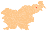
Ločič (pronounced [ˈloːtʃitʃ]) is a village on the left bank of the Pesnica River in the Municipality of Trnovska Vas in northeastern Slovenia. The area is part of the traditional region of Styria. It is now included in the Drava Statistical Region.[2]
There is a small chapel-shrine and a plague column right next to it in the centre of the settlement. The column dates to the 16th century and the shrine was built in the early 20th century.[3]
Two Roman-era burial mounds have been identified near the settlement.[4]
References
External links
- Ločič on Geopedia
- v
- t
- e
Administrative seat: Trnovska Vas
- Biš
- Bišečki Vrh
- Črmlja
- Ločič
- Sovjak
- Trnovski Vrh

 | This article about the Municipality of Trnovska vas in Slovenia is a stub. You can help Wikipedia by expanding it. |
- v
- t
- e


