Louisiade Plateau
Louisiade Rise | |
|---|---|
| Coordinates: 12°30′S 156°00′E / 12.500°S 156.000°E | |
| Location | Coral Sea |
| Part of | Pacific Ocean floor |
| Age | |
| Volcanic belt | Tasmantid Seamount Chain |
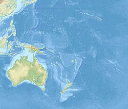
The Louisiade Plateau, also called the Louisiade Rise, is a poorly studied oceanic plateau in the northern Coral Sea of the South Pacific Ocean.[3] To its west is the Louisiade Archipelago that it is named after. It has been described as a continental fragment that rifted away from the northwestern continental margin of Australia but its position at the northern end of the Tasmantid Seamount Chain also suggests that the Louisiade Plateau might be a large igneous province formed by the arrival of the Tasmantid hotspot.[3][4] A sample of volcanic rock from the southern spur of the Louisiade Plateau was dated at 56.4 ± 0.6 million years ago by Ar-Ar methodology which is not inconsistent with Tasmantid Seamount Chain timings.[1] Recent sampling however along the northernmost part of the plateau found serpentinized peridotites, mid-ocean ridge basalt and volcaniclastic breccia–conglomerates consistent with placement of oceanic crust during a subduction initiation event in the formation of this part of the plateau.[5]
References
[edit]- ^ a b Douglas (Smethurst), Amelia (2022). The East Australian, Tasmantid and Lord Howe volcanoes : exploring the origins of three, contemporaneous, parallel chains of volcanism. (PhD thesis) (Thesis). doi:10.7488/era/2805. Retrieved 2023-03-30.
- ^ "GEBCO Undersea Feature Names Gazetteer".
- ^ a b Cowley, Shane; Mann, Paul; Coffin, M. F.; Shipley, Thomas H. (2004). "Oligocene to Recent tectonic history of the Central Solomon intra-arc basin as determined from marine seismic reflection data and compilation of onland geology". Solomon Island Arc Basement Rocks of the CSB. 389 (3–4). Elsevier: 6. Bibcode:2004Tectp.389..267C. doi:10.1016/j.tecto.2004.01.008.
- ^ Kalnins, L. M.; Cohen, B. E.; Fitton, J. G.; Mark, D. F.; Richards, F. D.; Barfod, D. N. (2015). "The East Australian, Tasmantid, and Lord Howe Volcanic Chains: Possible mechanisms behind a trio of hotspot trails". AGU Fall Meeting Abstracts. 2015. American Geophysical Union: DI41A–2591. Bibcode:2015AGUFMDI41A2591K.
- ^ McCarthy, A; Magri, L; Sauermilch, I; Fox, J; Seton, M; Mohn, G; Tugend, J; Feig, S; Falloon, T; Whittaker, JM (2022). "The Louisiade ophiolite: a missing link in the western Pacific". Terra Nova. 34 (2): 146–54. doi:10.1111/ter.12578.

