Mlele District
District in Katavi Region, Tanzania
Mlele District | |
|---|---|
District | |
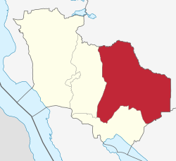 Mlele District of Katavi Region | |
| Country |  Tanzania Tanzania |
| Region | Katavi Region |
| Area | |
| • Total | 15,539 km2 (6,000 sq mi) |
| Population (2022 census) | |
| • Total | 118,818 |
| • Density | 7.6/km2 (20/sq mi) |
Mlele District is one of the five districts of the Katavi Region of Tanzania.
Mlele District was formed in 2012 out of part of Mpanda District. The population in 2022 was 118,818.[1]
Administrative subdivisions
Mlele District is administratively divided into twenty-three wards:[2]
- Ikuba
- Ilela
- Inyonga
- Itenka
- Kapalala
- Kasansa
- Kasokola
- Kibaoni
- Litapunga
- Machimboni
- Magamba
- Majimoto
- Mamba
- Mbede
- Mtapenda
- Mwamapuli
- Nsekwa
- Nsimbo
- Sitalike
- Ugalla
- Urwira
- Usevya
- Utende
References
- v
- t
- e
Districts of Katavi Region, Tanzania
- Mpanda Town
- Mlele
- Mpanda
- Mpimbwe
- Nsimbo
6°35′24″S 31°45′54″E / 6.590°S 31.765°E / -6.590; 31.765
 | This Katavi Region location article is a stub. You can help Wikipedia by expanding it. |
- v
- t
- e


