Mount Iba
Mountain in Tarlac, Philippines

Mount Iba

Mount Iba
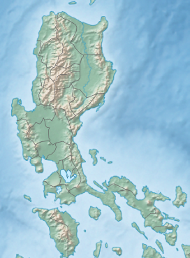
Mount Iba is the second-tallest mountain in the Zambales Mountains and the highest point in the province of Tarlac, Philippines.[2] It is located in municipality of San Jose, Tarlac. Water from the mountain drains to the Agno River.[3] With an elevation of 1,605 metres (5,266 ft), between Mount Tapulao (2,037m) and Mount Negron (1,583m).
References
- ^ Dickerson, Roy Ernest (1914). Collected papers. p. 33. Retrieved 17 February 2024.
- ^ Roddy, Henry Justin (1915). Complete Geography. American Book Company. p. 26. Retrieved 17 February 2024.
- ^ Sawyer, Frederic Henry Read (1900). The Inhabitants of the Philippines. S. Low, Marston. p. 195. Retrieved 17 February 2024.
External links
- https://www.britannica.com/place/Zambales-Mountains
- https://peakvisor.com/peak/mount-iba-scor1sbg.html
- v
- t
- e
 | This article about a location in Central Luzon region is a stub. You can help Wikipedia by expanding it. |
- v
- t
- e


