National Register of Historic Places listings in Winchester, Massachusetts
This is a list of properties and historic districts in Winchester, Massachusetts, that are listed on the National Register of Historic Places.
Map all coordinates using OpenStreetMap
Download coordinates as:
- KML
- GPX (all coordinates)
- GPX (primary coordinates)
- GPX (secondary coordinates)
The locations of National Register properties and districts (at least for all showing latitude and longitude coordinates below) may be seen in an online map by clicking on "Map of all coordinates".[1]
This National Park Service list is complete through NPS recent listings posted June 21, 2024.[2]
Current listings
| [3] | Name on the Register | Image | Date listed[4] | Location | City or town | Description |
|---|---|---|---|---|---|---|
| 1 | Albert Ayer House |  | July 5, 1989 (#89000635) | 8 Brooks St. 42°26′31″N 71°08′15″W / 42.441830°N 71.137637°W / 42.441830; -71.137637 (Albert Ayer House) | ||
| 2 | Thomas Ayer House |  | July 5, 1989 (#89000630) | 8 Grove St. 42°26′32″N 71°08′14″W / 42.442317°N 71.137165°W / 42.442317; -71.137165 (Thomas Ayer House) | ||
| 3 | Robert Bacon House |  | July 5, 1989 (#89000611) | 6 Mystic Valley Parkway 42°26′36″N 71°08′34″W / 42.443333°N 71.142778°W / 42.443333; -71.142778 (Robert Bacon House) | ||
| 4 | Kenelum Baker House |  | July 5, 1989 (#89000632) | 4 Norwood St. 42°26′58″N 71°08′41″W / 42.449476°N 71.144703°W / 42.449476; -71.144703 (Kenelum Baker House) | ||
| 5 | Edward A. Brackett House | 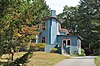 | July 5, 1989 (#89000626) | 290 Highland Ave. 42°27′00″N 71°07′45″W / 42.45°N 71.129167°W / 42.45; -71.129167 (Edward A. Brackett House) | ||
| 6 | Edward Braddock House |  | July 5, 1989 (#89000651) | 112 Highland Ave. 42°27′41″N 71°07′27″W / 42.461389°N 71.124167°W / 42.461389; -71.124167 (Edward Braddock House) | ||
| 7 | George Brine House |  | July 5, 1989 (#89000638) | 219 Washington St. 42°27′22″N 71°07′51″W / 42.456111°N 71.130833°W / 42.456111; -71.130833 (George Brine House) | ||
| 8 | Carr-Jeeves House |  | August 2, 1989 (#89000639) | 57 Lake St. 42°27′23″N 71°08′30″W / 42.456389°N 71.141667°W / 42.456389; -71.141667 (Carr-Jeeves House) | ||
| 9 | Webster Childs House |  | July 5, 1989 (#89000644) | 9 Meadowcroft Rd. 42°26′49″N 71°08′27″W / 42.446944°N 71.140833°W / 42.446944; -71.140833 (Webster Childs House) | ||
| 10 | Cole House |  | July 5, 1989 (#89000646) | Highland Ave. 42°27′00″N 71°07′46″W / 42.450109°N 71.129324°W / 42.450109; -71.129324 (Cole House) | Listed as demolished;[5] house has actually been moved a short distance to a new foundation. | |
| 11 | DeRochmont House |  | July 5, 1989 (#89000642) | 2–4 Rangeley Rd. 42°27′03″N 71°08′23″W / 42.450833°N 71.139722°W / 42.450833; -71.139722 (DeRochmont House) | ||
| 12 | Dike-Orne House | 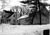 | July 5, 1989 (#89000621) | 257 Forest St. 42°28′23″N 71°06′47″W / 42.473056°N 71.113056°W / 42.473056; -71.113056 (Dike-Orne House) | Demolished.[6] | |
| 13 | Edmund Dwight House |  | July 5, 1989 (#89000633) | 5 Cambridge St. 42°26′10″N 71°09′15″W / 42.436111°N 71.154167°W / 42.436111; -71.154167 (Edmund Dwight House) | Property straddles the town line with Arlington | |
| 14 | Samuel Elder House |  | July 5, 1989 (#89000643) | 38 Rangeley Rd. 42°26′51″N 71°08′30″W / 42.4475°N 71.141667°W / 42.4475; -71.141667 (Samuel Elder House) | ||
| 15 | Everett Avenue-Sheffield Road Historic District |  | July 5, 1989 (#89000661) | Roughly bounded by Bacon St., Mystic Valley Parkway, Mystic Lake, Niles Ln., Everett Ave., Sheffield Rd., and Church St. 42°26′43″N 71°08′49″W / 42.445278°N 71.146944°W / 42.445278; -71.146944 (Everett Avenue-Sheffield Road Historic District) | ||
| 16 | Firth-Glengarry Historic District |  | July 5, 1989 (#89000662) | Roughly bounded by Pine St., Grassmere Ave., Dix St., and Wildwood St. 42°27′05″N 71°08′38″W / 42.451389°N 71.143889°W / 42.451389; -71.143889 (Firth-Glengarry Historic District) | ||
| 17 | Edward Gardner House |  | July 5, 1989 (#89000605) | Zero Gardner Place 42°26′39″N 71°09′08″W / 42.444167°N 71.152222°W / 42.444167; -71.152222 (Edward Gardner House) | ||
| 18 | O. W. Gardner House |  | July 5, 1989 (#89000791) | 5 Myrtle St. 42°27′08″N 71°07′59″W / 42.452222°N 71.133056°W / 42.452222; -71.133056 (O. W. Gardner House) | ||
| 19 | Patience and Sarah Gardner House |  | July 5, 1989 (#89000608) | 103–105 Cambridge St. 42°26′40″N 71°09′08″W / 42.444444°N 71.152222°W / 42.444444; -71.152222 (Patience and Sarah Gardner House) | ||
| 20 | Ginn Carriage House |  | July 5, 1989 (#89000655) | 24 Ginn Rd. 42°26′48″N 71°08′28″W / 42.446667°N 71.141111°W / 42.446667; -71.141111 (Ginn Carriage House) | ||
| 21 | Ginn Gardener's House |  | July 5, 1989 (#89000654) | 22 Ginn Rd. 42°26′47″N 71°08′26″W / 42.446389°N 71.140556°W / 42.446389; -71.140556 (Ginn Gardener's House) | ||
| 22 | Henry Grover House |  | July 5, 1989 (#89000641) | 223–225 Cambridge St. 42°27′13″N 71°09′31″W / 42.453611°N 71.158611°W / 42.453611; -71.158611 (Henry Grover House) | ||
| 23 | Horace Hatch House |  | July 5, 1989 (#89000612) | 26 Grove St. 42°26′27″N 71°08′27″W / 42.440833°N 71.140833°W / 42.440833; -71.140833 (Horace Hatch House) | ||
| 24 | Hovey-Winn House |  | July 5, 1989 (#89000616) | 384 Main St. 42°26′51″N 71°08′06″W / 42.4475°N 71.135°W / 42.4475; -71.135 (Hovey-Winn House) | ||
| 25 | Hutchinson-Blood House |  | July 5, 1989 (#89000615) | 394-396 Main St. 42°26′54″N 71°08′07″W / 42.448333°N 71.135278°W / 42.448333; -71.135278 (Hutchinson-Blood House) | ||
| 26 | Johnson-Thompson House |  | July 5, 1989 (#89000604) | 201 Ridge St. 42°26′54″N 71°10′36″W / 42.448333°N 71.176667°W / 42.448333; -71.176667 (Johnson-Thompson House) | ||
| 27 | Marshall W. Jones House |  | July 5, 1989 (#89000649) | 326 Highland Ave. 42°26′53″N 71°07′46″W / 42.448056°N 71.129444°W / 42.448056; -71.129444 (Marshall W. Jones House) | ||
| 28 | Asa Locke House | 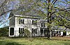 | July 5, 1989 (#89000631) | 68 High St. 42°26′36″N 71°09′37″W / 42.443333°N 71.160278°W / 42.443333; -71.160278 (Asa Locke House) | ||
| 29 | Capt. Josiah Locke House |  | March 2, 1979 (#79000356) | 195 High St. 42°26′37″N 71°10′24″W / 42.443611°N 71.173333°W / 42.443611; -71.173333 (Capt. Josiah Locke House) | ||
| 30 | James H. Mann House |  | July 5, 1989 (#89000624) | 23 Hancock St. 42°27′24″N 71°07′44″W / 42.456667°N 71.128889°W / 42.456667; -71.128889 (James H. Mann House) | ||
| 31 | John Mason House |  | July 5, 1989 (#89000634) | 10 Hillside Ave. 42°26′59″N 71°07′57″W / 42.449722°N 71.1325°W / 42.449722; -71.1325 (John Mason House) | ||
| 32 | Louis N. Maxwell House |  | July 5, 1989 (#89000650) | 16 Herrick St. 42°26′47″N 71°07′57″W / 42.446389°N 71.1325°W / 42.446389; -71.1325 (Louis N. Maxwell House) | ||
| 33 | Middlesex Canal Historic and Archaeological District |  | November 19, 2009 (#09000936) | Numerous locations along the historic route of the Middlesex Canal 42°26′29″N 71°08′55″W / 42.4413°N 71.1486°W / 42.4413; -71.1486 (Middlesex Canal Historic and Archaeological District) | Extends into other Middlesex County communities and Boston in Suffolk County; encompasses entire Middlesex Canal route. | |
| 34 | Middlesex Fells Reservation Parkways |  | February 4, 2003 (#02001749) | E Border Rd., Fellsway E., Fellsway W., Hillcrest Parkway, South St., Pond St., S. Border Rd., Ravine Rd., and Woodland Rd. 42°26′43″N 71°06′10″W / 42.445278°N 71.102778°W / 42.445278; -71.102778 (Middlesex Fells Reservation Parkways) | ||
| 35 | Amy B. Mitchell House |  | July 5, 1989 (#89000653) | 237 Highland Ave. 42°27′12″N 71°07′47″W / 42.453333°N 71.129722°W / 42.453333; -71.129722 (Amy B. Mitchell House) | ||
| 36 | Moore House |  | July 5, 1989 (#89000620) | 85 Walnut St. 42°27′04″N 71°07′49″W / 42.451111°N 71.130278°W / 42.451111; -71.130278 (Moore House) | ||
| 37 | Mystic Valley Parkway, Metropolitan Park System of Greater Boston MPS |  | January 18, 2006 (#05001529) | Mystic Valley Parkway 42°25′47″N 71°07′49″W / 42.429722°N 71.130278°W / 42.429722; -71.130278 (Mystic Valley Parkway, Metropolitan Park System of Greater Boston MPS) | Extends from Winchester through Medford, Arlington, and Somerville | |
| 38 | Oak Knoll |  | July 5, 1989 (#89000648) | 17 Brooks Street 42°26′25″N 71°08′21″W / 42.440278°N 71.139167°W / 42.440278; -71.139167 (Oak Knoll) | ||
| 39 | Parker House |  | July 5, 1989 (#89000628) | 180 Mystic Valley Parkway 42°26′56″N 71°07′59″W / 42.448889°N 71.133056°W / 42.448889; -71.133056 (Parker House) | ||
| 40 | Edmund Parker Jr. House |  | July 5, 1989 (#89000610) | 287 Cambridge St. 42°27′22″N 71°09′35″W / 42.456111°N 71.159722°W / 42.456111; -71.159722 (Edmund Parker Jr. House) | ||
| 41 | Harrison Parker Sr. House |  | July 5, 1989 (#89000627) | 60 Lloyd St. 42°26′50″N 71°08′18″W / 42.447222°N 71.138333°W / 42.447222; -71.138333 (Harrison Parker Sr. House) | ||
| 42 | Pressey-Eustis House |  | July 5, 1989 (#89000623) | 14 Stevens St. 42°27′13″N 71°07′51″W / 42.453611°N 71.130833°W / 42.453611; -71.130833 (Pressey-Eustis House) | ||
| 43 | Joseph Remick House |  | July 5, 1989 (#89000656) | 84 Cambridge St./4 Swan Rd. 42°26′37″N 71°09′11″W / 42.443611°N 71.153056°W / 42.443611; -71.153056 (Joseph Remick House) | ||
| 44 | Zachariah Richardson House |  | July 5, 1989 (#89000618) | 597 Washington St. 42°28′08″N 71°07′31″W / 42.468889°N 71.125278°W / 42.468889; -71.125278 (Zachariah Richardson House) | ||
| 45 | Arthur H. Russell House |  | July 5, 1989 (#89000652) | 10 Mt. Pleasant St. 42°26′53″N 71°08′29″W / 42.448056°N 71.141389°W / 42.448056; -71.141389 (Arthur H. Russell House) | ||
| 46 | Charles Russell House |  | July 5, 1989 (#89000617) | 993 Main St. 42°27′52″N 71°08′43″W / 42.464444°N 71.145278°W / 42.464444; -71.145278 (Charles Russell House) | ||
| 47 | St. Mary's Catholic Church |  | July 5, 1989 (#89000625) | 159 Washington St. 42°27′15″N 71°07′57″W / 42.454167°N 71.1325°W / 42.454167; -71.1325 (St. Mary's Catholic Church) | ||
| 48 | Sanborn House |  | December 14, 1981 (#81000286) | 21 High St. 42°26′44″N 71°09′24″W / 42.445556°N 71.156667°W / 42.445556; -71.156667 (Sanborn House) | ||
| 49 | Sharon House |  | July 5, 1989 (#89000613) | 403 Main St. 42°26′53″N 71°08′04″W / 42.448056°N 71.134444°W / 42.448056; -71.134444 (Sharon House) | ||
| 50 | William Simonds House |  | July 5, 1989 (#89000640) | 420 Main St. 42°26′56″N 71°08′07″W / 42.448889°N 71.135278°W / 42.448889; -71.135278 (William Simonds House) | ||
| 51 | Skillings Estate House |  | July 5, 1989 (#89000645) | 37 Rangeley Rd. 42°26′53″N 71°08′29″W / 42.448056°N 71.141389°W / 42.448056; -71.141389 (Skillings Estate House) | ||
| 52 | Jacob Stanton House |  | July 5, 1989 (#89000614) | 21 Washington St. 42°26′59″N 71°08′04″W / 42.449722°N 71.134444°W / 42.449722; -71.134444 (Jacob Stanton House) | ||
| 53 | Edward Sullivan House |  | July 5, 1989 (#89000636) | 9 Kendall St. 42°27′10″N 71°07′55″W / 42.452778°N 71.131944°W / 42.452778; -71.131944 (Edward Sullivan House) | ||
| 54 | Deacon John Symmes House |  | July 5, 1989 (#89000606) | 212 Main St. 42°26′29″N 71°08′11″W / 42.441389°N 71.136389°W / 42.441389; -71.136389 (Deacon John Symmes House) | ||
| 55 | Marshall Symmes House |  | July 5, 1989 (#89000607) | 230 Main St. 42°26′33″N 71°08′12″W / 42.4425°N 71.136667°W / 42.4425; -71.136667 (Marshall Symmes House) | ||
| 56 | Marshall Symmes Tenant House |  | July 5, 1989 (#89000637) | 233 Main St. 42°26′35″N 71°08′11″W / 42.443056°N 71.136389°W / 42.443056; -71.136389 (Marshall Symmes Tenant House) | ||
| 57 | Abijah Thompson House |  | July 5, 1989 (#89000619) | 81 Walnut St. 42°27′03″N 71°08′19″W / 42.450833°N 71.138611°W / 42.450833; -71.138611 (Abijah Thompson House) | ||
| 58 | Trowbridge-Badger House |  | July 5, 1989 (#89000647) | 12 Prospect St. 42°26′49″N 71°08′00″W / 42.446944°N 71.133333°W / 42.446944; -71.133333 (Trowbridge-Badger House) | ||
| 59 | US Post Office-Winchester Main | 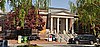 | October 19, 1987 (#87001773) | 48 Waterfield Rd. 42°27′04″N 71°08′13″W / 42.45117°N 71.13706°W / 42.45117; -71.13706 (US Post Office-Winchester Main) | ||
| 60 | Alfred Vinton House |  | July 5, 1989 (#89000629) | 417 Main St. 42°26′55″N 71°08′04″W / 42.448611°N 71.134444°W / 42.448611; -71.134444 (Alfred Vinton House) | ||
| 61 | Wedgemere Historic District | 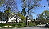 | July 5, 1989 (#89000659) | Roughly bounded by Foxcroft, Fletcher, Church, and Cambridge 42°27′08″N 71°09′02″W / 42.452222°N 71.150556°W / 42.452222; -71.150556 (Wedgemere Historic District) | ||
| 62 | S. B. White House |  | July 5, 1989 (#89000622) | 8 Stevens St. 42°27′12″N 71°07′51″W / 42.453333°N 71.130833°W / 42.453333; -71.130833 (S. B. White House) | ||
| 63 | Wildwood Cemetery |  | July 5, 1989 (#89000658) | 34 Palmer St. 42°27′17″N 71°08′48″W / 42.454722°N 71.146667°W / 42.454722; -71.146667 (Wildwood Cemetery) | ||
| 64 | Winchester Center Historic District |  | November 21, 1986 (#86002943) | Roughly bounded by Mt. Vernon and Washington Sts., Waterfield Rd., Church and Main Sts. 42°27′07″N 71°08′13″W / 42.451944°N 71.136944°W / 42.451944; -71.136944 (Winchester Center Historic District) | ||
| 65 | Winchester Savings Bank |  | June 19, 1979 (#79000361) | 26 Mt. Vernon St. 42°27′12″N 71°08′08″W / 42.453333°N 71.135556°W / 42.453333; -71.135556 (Winchester Savings Bank) | ||
| 66 | Winchester Town Hall |  | March 31, 1983 (#83000837) | 71 Mount Vernon St. 42°27′09″N 71°08′06″W / 42.4525°N 71.135°W / 42.4525; -71.135 (Winchester Town Hall) | ||
| 67 | Philemon Wright/Asa Locke Farm |  | March 10, 1983 (#83000838) | 78 Ridge St. 42°26′29″N 71°10′35″W / 42.441389°N 71.176389°W / 42.441389; -71.176389 (Philemon Wright/Asa Locke Farm) | ||
| 68 | George Wyman House |  | July 5, 1989 (#89000609) | 195 Cambridge St. 42°27′09″N 71°09′29″W / 42.4525°N 71.158056°W / 42.4525; -71.158056 (George Wyman House) |
References
Wikimedia Commons has media related to National Register of Historic Places in Winchester, Massachusetts.
- ^ The latitude and longitude information provided in this table was derived originally from the National Register Information System, which has been found to be fairly accurate for about 99% of listings. Some locations in this table may have been corrected to current GPS standards.
- ^ National Park Service, United States Department of the Interior, "National Register of Historic Places: Weekly List Actions", retrieved June 21, 2024.
- ^ Numbers represent an alphabetical ordering by significant words. Various colorings, defined here, differentiate National Historic Landmarks and historic districts from other NRHP buildings, structures, sites or objects.
- ^ The eight-digit number below each date is the number assigned to each location in the National Register Information System database, which can be viewed by clicking the number.
- ^ "Massachusetts Cultural Resource Information System: Frank Cole House". Massachusetts Historical Commission. Retrieved November 20, 2013.
- ^ "MACRIS inventory record for Dike-Orne House". Commonwealth of Massachusetts. Retrieved 2014-03-13.
- v
- t
- e

| Barnstable County | |
|---|---|
| Bristol County | |
| Essex County | |
| Hampden County | |
| Middlesex County | |
| Norfolk County | |
| Suffolk County | |
| Worcester County |
 Category
 National Register of Historic Places portal
 United States portal


