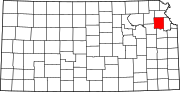
Ozawkie Township, Jefferson County, Kansas
Township in Kansas, United States
39°15′35″N 95°25′51″W / 39.25972°N 95.43083°W / 39.25972; -95.43083 (2000)
Ozawkie Township is a township in Jefferson County, Kansas, USA. As of the 2000 census, its population was 1,408.
Geography
Ozawkie Township covers an area of 42.78 square miles (110.79 square kilometers); of this, 5.45 square miles (14.11 square kilometers) or 12.74 percent is water. The streams of Bowies Branch, Duck Creek, Fishpond Creek and French Creek run through this township.
Cities and towns
- Ozawkie
Unincorporated towns
- Indian Ridge
- Lake Shore
(This list is based on USGS data and may include former settlements.)
Adjacent townships
- Jefferson Township (northeast)
- Oskaloosa Township (east)
- Fairview Township (south)
- Rock Creek Township (west)
- Delaware Township (northwest)
Cemeteries
The township contains one cemetery, Fairview.
Major highways
- K-4
- K-92
References
- U.S. Board on Geographic Names (GNIS)
- United States Census Bureau cartographic boundary files
External links
- US-Counties.com
- City-Data.com
- v
- t
- e
Municipalities and communities of Jefferson County, Kansas, United States
County seat: Oskaloosa
communities
- Kansas portal
- United States portal
Authority control databases | |
|---|---|
| International |
|
| National |
|
 | This article about a location in Jefferson County, Kansas is a stub. You can help Wikipedia by expanding it. |
- v
- t
- e


