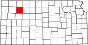
Parnell Township, Sheridan County, Kansas
Township in Kansas, United States
39°26′15″N 100°30′32″W / 39.43750°N 100.50889°W / 39.43750; -100.50889[1]
(2010)
Parnell Township is a township in Sheridan County, Kansas, United States. As of the 2010 Census, it had a population of 102.[3]
References
- ^ "US Gazetteer files: 2010, 2000, and 1990". United States Census Bureau. February 12, 2011. Retrieved April 23, 2011.
- ^ "Township of Parnell". Geographic Names Information System. United States Geological Survey, United States Department of the Interior.
- ^ "U.S. Census website". United States Census Bureau. Retrieved May 14, 2011.
- v
- t
- e
Municipalities and communities of Sheridan County, Kansas, United States
County seat: Hoxie
- Hoxie
- Selden
communities
- Kansas portal
- United States portal
 | This article about a location in Sheridan County, Kansas is a stub. You can help Wikipedia by expanding it. |
- v
- t
- e


