San Rafael – El Placer
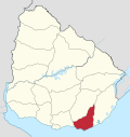
Resort in Maldonado Department, Uruguay
34°55′32″S 54°53′43″W / 34.92556°S 54.89528°W / -34.92556; -54.89528 Uruguay
 (2011)
20100
San Rafael – El Placer is a resort in the Maldonado Department of southeastern Uruguay.
Geography
The resort is located on the coast of the Atlantic Ocean, on Route 10 and borders Punta del Este to the west and the resort La Barra to the east, across the mouth of the stream Arroyo Maldonado.
Population
In 2011 San Rafael – El Placer had a population of 3,146 permanent inhabitants[1] and 2,302 dwellings.[2]
| Year | Population | Dwellings |
|---|---|---|
| 1963 | 87 | 193 |
| 1975 | 219 | 335 |
| 1985 | 491 | 648 |
| 1996 | 1,950 | 1,335 |
| 2004 | 1,994 | 1,701 |
| 2011 | 3,146 | 2,302 |
Source: Instituto Nacional de Estadística de Uruguay[3]
References
External links
- INE map of Punta del Este and San Rafael–El Placer
- v
- t
- e
 Coast of Maldonado
and
Landforms
- Solís
- Punta Animas
- Pta Solís
- Bella Vista
- Las Flores
- Playa Verde
- Pta Piedras
- Playa Hermosa
- Playa Grande
- Pta de los Burros
- Piriápolis
- Playa de la Rambla
- Pta Fria
- Playa San Francisco
- Punta Colorada
- Pta Colorada
- Playa Punta Colorada
- Punta Negra
- Pta Negra
- Playa Pta Negra
- Sauce de Portezuelo
- Ocean Park
- Chihuahua
- Barra del Potrero
- see also: Laguna del Sauce
- Punta Ballena
- Playa Solanas
- Portezuelo
- Pta Ballena
- Playa de las Grutas
- Pta del Chileno
- Pinares - Las Delicias
- Playa de Pinares
- Playa Mansa
- Punta del Este
- Puerto Jardín
- Playa Honda
- Puerto Cañón
- Pta del Este
- Playa de los Ingleses
- Pta del Vapor
- Playa Brava
- San Rafael - El Placer
- Playa San Rafael
- Pta de la Barra
- El Tesoro - La Barra
- Barra de Maldonado
- Pta Maldonado
- Playa de la Barra
- El Chorro
- Manantiales
- Pta Manantiales
- Playa Bikini
- Pta de Piedras
- Balneario Buenos Aires
- Edén Rock
- Santa Mónica
- Laguna José Ignacio
- Barra de José Ignacio
- José Ignacio
- Playa Juanita
- Pta José Ignacio
- Arenas de José Ignacio
- Playa Garzón
- Laguna Garzón
Glossary : Balneario = Resort , Barra = Mouth (of river) , Laguna = Lagoon , Playa = Beach , Puerto = Port , Punta (or Pta) = Point, Small Peninsula
| ||
|---|---|---|
Capital:  Maldonado Maldonado | ||
| Municipalities |
|  |
| Towns and villages | ||
| Sights | ||
 | This article about a place in Maldonado Department is a stub. You can help Wikipedia by expanding it. |
- v
- t
- e


