Shadegan, Kohgiluyeh and Boyer-Ahmad
Village in Kohgiluyeh and Boyer-Ahmad, Iran
Shadegan شادگان Goru Gowrū گورو | |
|---|---|
village | |
 A View of the Village | |
| 30°33′45″N 50°55′11″E / 30.56250°N 50.91972°E / 30.56250; 50.91972 | |
| Country |  Iran Iran |
| Province | Kohgiluyeh and Boyer-Ahmad |
| County | Basht |
| District | Central |
| Rural District | Kuh Mareh Khami |
| Population (2006) | |
| • Total | 26 |
| Time zone | UTC+3:30 (IRST) |
| • Summer (DST) | UTC+4:30 (IRDT) |
Shadegan (Persian: شادگان, also Romanized as Shādegān ([ʃɒːdeɡɒːn]), locally known as Guru (گورو) ([ɡuɾuː]))[1] is a village in Kuh Mareh Khami Rural District, in the Central District of Basht County, Kohgiluyeh and Boyer-Ahmad Province, Iran. At the 2006 census, its population was 26, in 8 families.[2]
Gallery
-
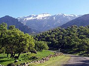
 The village of Shadegan and the surrounding landscape
 -
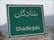 Shadegan road sign
 -
 Shadegan road
 -
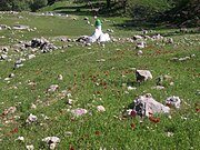 The Tombs of the Do Pir-e-Jofteh
 -
 The local river, Roo Bashti


References
- ^ Shadegan can be found at GEOnet Names Server, at this link, by opening the Advanced Search box, entering "-3083799" in the "Unique Feature Id" form, and clicking on "Search Database".
- ^ "Census of the Islamic Republic of Iran, 1385 (2006)" (Excel). Statistical Center of Iran. Archived from the original on 2011-09-20.
External links
 Iran portal

- [1]
- v
- t
- e


