Shannon Colony, South Dakota
Census-designated place in South Dakota, United States
43°58′57″N 97°25′30″W / 43.98250°N 97.42500°W / 43.98250; -97.42500[1]
[2]
(2020)[3]
57076 (Winfred)
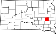
Shannon Colony is a census-designated place (CDP) and Hutterite colony[4] in Miner County, South Dakota, United States. It was first listed as a CDP prior to the 2020 census.[2] The population of the CDP was 1 at the 2020 census.[5]
It is in the eastern part of the county, 7 miles (11 km) by road southeast of Howard, the county seat, and 4 miles (6 km) southwest of Winfred.
Demographics
| Census | Pop. | Note | %± |
|---|---|---|---|
| 2020 | 1 | — | |
| U.S. Decennial Census[6] | |||
References
- ^ "ArcGIS REST Services Directory". United States Census Bureau. Retrieved October 15, 2022.
- ^ a b c U.S. Geological Survey Geographic Names Information System: Shannon Colony, South Dakota
- ^ "Census Population API". United States Census Bureau. Retrieved October 15, 2022.
- ^ Friesen, Bert (May 2021). "Shannon Hutterite Colony (Winfred, South Dakota, USA)". Global Anabaptist Mennonite Encyclopedia Online. Retrieved September 20, 2021.
- ^ "U.S. Census Bureau: Shannon Colony CDP, South Dakota". www.census.gov. United States Census Bureau. Retrieved January 16, 2022.
- ^ "Census of Population and Housing". Census.gov. Retrieved June 4, 2016.
- v
- t
- e
Municipalities and communities of Miner County, South Dakota, United States
County seat: Howard
- Cloverleaf Colony
- Fedora
- Roswell
- Shannon Colony
- Argonne (formerly St. Marys)
- South Dakota portal
- United States portal
 | This South Dakota state location article is a stub. You can help Wikipedia by expanding it. |
- v
- t
- e


