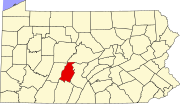
Shellytown, Pennsylvania
Census-designated place in Pennsylvania, United States
40°24′33″N 78°12′38″W / 40.40917°N 78.21056°W / 40.40917; -78.21056[1]
[2]
16693 (Williamsburg)
Shellytown is an unincorporated community and census-designated place (CDP) in Blair County, Pennsylvania, United States. It was first listed as a CDP prior to the 2020 census.[2]
The CDP is in eastern Blair County, in the southeastern part of Woodbury Township. It is bordered to the west by Clover Creek, a north-flowing tributary of the Frankstown Branch Juniata River. Clover Creek Road is the main street in the community, leading north 4 miles (6 km) to Williamsburg and southwest 8 miles (13 km) to Fredericksburg.
References
- ^ "2020 U.S. Gazetteer Files – Pennsylvania". United States Census Bureau. Retrieved August 30, 2021.
- ^ a b c U.S. Geological Survey Geographic Names Information System: Shellytown, Pennsylvania
- v
- t
- e
Municipalities and communities of Blair County, Pennsylvania, United States
County seat: Hollidaysburg

- Bald Eagle
- Beavertown
- Blue Knob
- Brooks Mill
- Canan Station
- Canoe Creek
- Carson Valley
- Charlottsville
- Clappertown
- Claysburg
- Cotton Town
- Cove Forge
- Cross Keys
- Culp
- Curryville
- Dumb Hundred
- East Altoona
- East Freedom
- East Sharpsburg
- Elberta
- Eldorado
- Fisherville
- Foot of Ten
- Fort Fetter
- Fostoria
- Franklin Forge
- Frankstown
- Fredericksburg
- Friesville
- Ganister
- Geeseytown
- Gray
- Grazierville
- Greenwood
- Henrietta
- Homewood at Martinsburg
- Ironville
- Jugtown
- Juniata Gap
- Klahr
- Lakemont
- Larke
- Leamersville
- Linds Crossing
- Loop
- Martinsburg Junction
- McKee
- Mill Run
- Millerstown
- Moores Mill
- Nealmont
- Newburg
- Northwood
- Olivia
- Ore Hill
- Oreminea
- Penn Farms
- Pinecroft
- Point View
- Puzzletown
- Red Hill
- Reese
- Reightown
- Reservoir
- Robeson Extension
- Roots
- Royer
- Shelltown
- Shellytown
- Sickles Corner
- Skelp
- Ski Gap
- Smith Corner
- Spring Drive Mobile Home Park
- Sproul
- St. Clair
- Sunbrook
- Sylvan Hills
- Tipton
- Tyrone Forge
- Vail
- Vicksburg
- Wopsononock
- Yellow Springs
‡This populated place also has portions in an adjacent county or counties
- Pennsylvania portal
- United States portal
 | This Blair County, Pennsylvania state location article is a stub. You can help Wikipedia by expanding it. |
- v
- t
- e


