Spodnja Bačkova
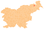
Place in Styria, Slovenia
46°38′14.83″N 15°52′56.38″E / 46.6374528°N 15.8823278°E / 46.6374528; 15.8823278 Slovenia
 (2020)
Spodnja Bačkova (pronounced [ˈspoːdnja ˈbaːtʃkɔʋa]) is a settlement in the Slovene Hills (Slovene: Slovenske gorice) in the Municipality of Benedikt in northeastern Slovenia. The area is part of the traditional region of Styria. It is now included in the Drava Statistical Region.[2]
A small hexagonal chapel-shrine in the settlement dates to 1871.[3]
References
External links
- Spodnja Bačkova on Geopedia
- v
- t
- e
Municipality of Benedikt
Administrative seat: Benedikt
| Current |
|
|---|---|
| Former |
|
 | This article about the Municipality of Benedikt in Slovenia is a stub. You can help Wikipedia by expanding it. |
- v
- t
- e


