Stoney 142, 143, 144
Indian reserve in Canada
Indian reserve in Stoney Nakoda *Bearspaw *Chiniki *Wesley
Stoney 142, 143, 144 | |
|---|---|
Indian reserve | |
| Stoney Indian Reserve Nos. 142, 143, and 144 | |
 Boundaries of Stoney 142, 143, 144 | |
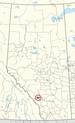 Location in Alberta | |
| First Nations | Stoney Nakoda
|
| Treaty | 7 |
| Country | Canada |
| Province | Alberta |
| Municipal districts | Bighorn No. 8 Rocky View County |
| Area [1] | |
| • Total | 39,264.5 ha (97,024.7 acres) |
| Population (2016)[2] | |
| • Total | 3,713 |
| • Density | 9.5/km2 (24/sq mi) |
Stoney 142, 143, 144 is an Indian reserve of the Stoney Nakoda First Nation, comprising Bearspaw, Chiniki, and Wesley First Nations in Alberta, located between the Municipal District of Bighorn No. 8 and Rocky View County.[3] The largest community of the Nakoda people, it is 56 kilometers west of Calgary.[1]
The community is spread along both sides of the Trans-Canada Highway, east of Banff National Park and north of Kananaskis Improvement District. In addition to Kananaskis, it is also bordered by Bighorn No. 8, Rocky View County, and the town of Cochrane. By land area, it is the third-largest Indian reserve in Canada (after Blood 148 and Siksika 146, both also in Alberta).
According to the Canada 2011 Census:
- Population: 3,494
- % Change (1996–2001): 0.7
- % Change (2001–2011): 38.16
- Dwellings: 795
- Area (km2): 444.94
- Density (persons per km2): 7.85
History
Most of the film Buffalo Bill and the Indians, or Sitting Bull's History Lesson was shot on location on the reserve.[4] Frank "Sitting Wind" Kaquitts, who played Sitting Bull in the film, had been elected the first ever chief of Alberta's Nakoda (Stoney) First Nation, after three bands had amalgamated the year before.[5][6] Kevin Costner's Open Range was also filmed on the reserve. The film Little Big Man starring Dustin Hoffman and Chief Dan George was shot here also, and the first screening was held in Calgary so the tribe could attend.
The Stoney Reserve was badly damaged by a massive flood in June 2013 and hundreds of residents were evacuated from their homes.[7]
See also
- Nakoda (Stoney)
References
- ^ a b "Reserve/Settlement/Village Detail". Crown–Indigenous Relations and Northern Affairs Canada. Government of Canada. Retrieved August 12, 2019.
- ^ "Census Profile, 2016 Census". Statistics Canada. February 8, 2017. Retrieved 2019-08-10.
- ^ Government of Alberta (May 25, 2019). Municipal Boundaries (Map). AltaLIS.
- ^ Kainai News, 23 May 1975
- ^ Warren Harbeck, One last mountain journey with Sitting Wind, Cochrane Eagle, November 27, 2002
- ^ Sitting Wind, Rocky Mountain Nakoda
- ^ Siksika and Stoney are the First Nations hit hardest by floods, says chief, Calgary Herald, June 25, 2013
External links
- Stoney Nation
- Map of Stoney 142, 143, 144 at Statcan
- v
- t
- e
Subdivisions of Alberta
service areas
- Alexander
- Alexis
- Allison Bay 219
- Amber River 211
- Assineau River 150F
- Beaver Lake 131
- Beaver Ranch
- Bistcho Lake 213
- Blood
- Blue Quills
- Boyer 164
- Buck Lake 133C
- Bushe River 207
- Charles Lake 225
- Child Lake 164A
- Chipewyan
- Clear Hills 152C
- Clearwater 175
- Cold Lake
- Collin Lake 223
- Cornwall Lake 224
- Cowper Lake 194A
- Devil's Gate 220
- Dog Head 218
- Driftpile River 150
- Duncan's 151A
- Enoch Cree Nation 135
- Ermineskin 138
- Fort McKay
- Fort Vermilion 173B
- Fox Lake 162
- Gregoire Lake 176
- Hay Lake 209
- Heart Lake
- Hokédhe Kué 196E
- Horse Lakes 152B
- Jackfish Point 214
- Janvier 194
- Jean Baptiste Gambler 183
- John D'Or Prairie 215
- Kapawe'no
- Kehewin 123
- K’ı Kué 196D
- Łı̨ Dezé 196C
- Loon Lake 235
- Loon Prairie 237
- Louis Bull 138B
- Makaoo 120
- Montana 139
- Namur Lake 174B
- Namur River 174A
- O'Chiese
- Old Fort 217
- Peace Point 222
- Peerless Trout 238
- Peigan Timber Limit B
- Pigeon Lake 138A
- Piikani 147
- Puskiakiwenin 122
- Saddle Lake 125
- Samson 137
- Sandy Point 221
- Sawridge
- Siksika 146
- Stoney Nakoda
- Stoney 142, 143, 144
- Stoney 142B
- Big Horn 144A
- Eden Valley 216
- Sturgeon Lake 154
- Sucker Creek 150A
- Sunchild 202
- Swampy Lake 236
- Swan River 150E
- Tallcree
- Tthebacha Náre 196A
- Tthebatthıe 196
- Ts’u K’adhe Kué 196F
- Ts’u Nedhé 196H
- Ts’u Kué 196G
- Tsuu Tina 145
- Tthejëre Ghaı̨lı̨ 196B
- Unipouheos 121
- Upper Hay River 212
- Utikoomak Lake
- Wabamun
- Wabasca
- Wadlin Lake 173C
- Whitefish Lake 128
- William McKenzie 151K
- Winefred Lake 194B
- Woodland Cree
- Zama Lake 210
- ʔejëre K’elnı Kuę́ 196I
- Carcajou
- Cadotte Lake
- Desmarais
- Fort McKay
- Garden Creek
- Little Buffalo
 Category
 Canada portal
 WikiProject


| |||||||||||||||||||||||||||||
|---|---|---|---|---|---|---|---|---|---|---|---|---|---|---|---|---|---|---|---|---|---|---|---|---|---|---|---|---|---|
| Ethnolinguistic groups (by language family) |
| ||||||||||||||||||||||||||||
| Historical polities | |||||||||||||||||||||||||||||
| Numbered Treaties | |||||||||||||||||||||||||||||
| Tribal councils and band governments |
| ||||||||||||||||||||||||||||

51°09′N 114°56′W / 51.150°N 114.933°W / 51.150; -114.933
 | This Calgary Metropolitan Region location article is a stub. You can help Wikipedia by expanding it. |
- v
- t
- e
 | This article about an Indian reserve in Alberta is a stub. You can help Wikipedia by expanding it. |
- v
- t
- e


