Tangasisi
Ward in Tanga City Council, Tanga Region
Ward of Tanga City Council in Tanga Region, Tanzania
Tangasisi Kata ya Tangasisi (Swahili) | |
|---|---|
Ward of Tanga City Council | |
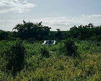 From top to bottom: Shaaban Robert;s Grave in Tangasisi ward | |
| Coordinates: 5°7′42.96″S 39°5′17.16″E / 5.1286000°S 39.0881000°E / -5.1286000; 39.0881000 | |
| Country |  Tanzania Tanzania |
| Region | Tanga Region |
| District | Tanga City Council |
| Area | |
| • Total | 38.9 km2 (15.0 sq mi) |
| Population (2012) | |
| • Total | 19,149 |
| Ethnic groups | |
| • Settler | Swahili |
| • Ancestral | Digo & Segeju |
| Tanzanian Postal Code | 21201 |
Tangasisi (Kata ya Tangasisi, in Swahili) is an administrative ward in Tanga City Council of Tanga Region in Tanzania. Mwanzange, Duga, Mabawa, and Mzingani form the ward's northern border. The Pemba Channel forms the eastern boundary of the ward. Tongoni is to the south. Maweni is to the west. The ward covers an area of 38.9 km2 (15.0 sq mi),[1] and has an average elevation of 27 m (89 ft).[2] According to the 2012 census, the ward has a total population of 19,149.[3] The ward was the birthplace, home of national poet Shaaban bin Robert in Vibamba village and is also his final resting place at Machui village.

Administration
The postal code for Tangasisi Ward is 21112.[4] The ward is divided into the following neighborhoods (Mitaa):
|
|
Government
The ward, like every other ward in the country, has local government offices based on the population served.The Tangasisi Ward administration building houses a court as per the Ward Tribunal Act of 1988, including other vital departments for the administration the ward.[5] The ward has the following administration offices:
- Tangasisi Police Station
- Tangasisi Government Office (Afisa Mtendaji)
- Tangasisi Tribunal (Baraza La Kata) is a Department inside Ward Government Office
In the local government system of Tanzania, the ward is the smallest democratic unit. Each ward is composed of a committee of eight elected council members which include a chairperson, one salaried officer (with no voting rights), and an executive officer. One-third of seats are reserved for women councillors.[6]
Demographics
Like much of the district, the ward is the ancestral home of the Digo people and Segeju.[7]
Education and health
Education
The ward is home to these educational institutions:[8]
- Machui Primary School
- Mwambani Primary School
- Mwakidila Primary School
- Mwapachu Secondary School
- Mwang'ombe Primary School
Healthcare
The ward is home to the following health institutions:[9]
- Machui Health Center
- Mwadikila Health Center
References
- ^ "Tanzania: Northern Zone Tanzania (Districts and Wards) – Population Statistics, Charts and Map". citypopulation.de. Retrieved 2022-06-01.
- ^ "Tangasisi Elevation". elevationmap.net. Retrieved 2022-06-01.
- ^ "2012 Population and Housing Census General Report" (PDF). Government of Tanzania. 2013-11-01. Retrieved 2022-06-01.
- ^ "Tangasisi Postal Code". Retrieved 2023-05-22.
- ^ "Ward Tribunal Act 1988". Retrieved 19 March 2023.
- ^ "Local Government System" (PDF). Retrieved 19 March 2023.
- ^ "Tanga City Council Strategic Plan 2021-2025" (PDF). The Tanga City Council. Retrieved 2023-07-25.
- ^ "Tanga City Council Strategic Plan 2021-2025" (PDF). The Tanga City Council. Retrieved 2023-07-25.
- ^ "Tanga City Council Strategic Plan 2021-2025" (PDF). The Tanga City Council. Retrieved 2023-07-25.
- v
- t
- e
Capital: Chumbageni
- Urithi Tanga Museum
- Shabaan Robert's House, Duga
- Shabaan Robert Museum, Machui
- Ulenge Island Front Range Lighthouse
- Ulenge Island Rear Range Lighthouse
 | This Tanga Region location article is a stub. You can help Wikipedia by expanding it. |
- v
- t
- e


