Toprakkale District
District of Osmaniye Province, Turkey
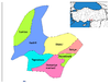
District in Osmaniye, Turkey
37°04′N 36°09′E / 37.067°N 36.150°E / 37.067; 36.150 (2022)
Toprakkale District is a district of the Osmaniye Province of Turkey. Its seat is the town of Toprakkale.[1] Its area is 112 km2,[2] and its population is 20,674 (2022).[3]
Composition
There are two municipalities in Toprakkale District:[1][4]
- Toprakkale
- Türkmen
There are three villages in Toprakkale District:[5]
- Aslanpınarı
- Lalegölü
- Sayhüyüğü
References
- ^ a b İlçe Belediyesi, Turkey Civil Administration Departments Inventory. Retrieved 22 May 2023.
- ^ "İl ve İlçe Yüz ölçümleri". General Directorate of Mapping. Retrieved 22 May 2023.
- ^ "Address-based population registration system (ADNKS) results dated 31 December 2022, Favorite Reports" (XLS). TÜİK. Retrieved 22 May 2023.
- ^ Belde Belediyesi, Turkey Civil Administration Departments Inventory. Retrieved 22 May 2023.
- ^ Köy, Turkey Civil Administration Departments Inventory. Retrieved 22 May 2023.
- v
- t
- e
Toprakkale District in Osmaniye Province of Turkey

| Istanbul | |
|---|---|
| West Marmara | |
| Aegean | |
| East Marmara | |
| West Anatolia | |
| Mediterranean | |
| Central Anatolia | |
| West Black Sea | |
| East Black Sea | |
| Northeast Anatolia | |
| Central East Anatolia | |
| Southeast Anatolia | |
Metropolitan municipalities are bolded.
 Toprakkale District Toprakkale District | |
|---|---|
| Municipalities | |
| Villages |
|
 | This article about a Mediterranean Region of Turkey location is a stub. You can help Wikipedia by expanding it. |
- v
- t
- e


