Ubuyama, Kumamoto
Village in Kyushu, Japan
Ubuyama  Flag  Chapter | |
|---|---|
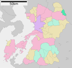
 Location of Ubuyama in Kumamoto Prefecture | |
 | |
| Symbols | |
| Flower | Echinops setifer |
| Tree | Sawtooth oak |

Ubuyama (産山村, Ubuyama-mura) is a village located in Aso District, Kumamoto Prefecture, Japan. As of 15 July 2024[update], the village had an estimated population of 1,378 in 654 households, and a population density of 23 persons per km2.[1] The total area of the village is 60.81 km2 (23.48 sq mi).
Geography
Ubuyama is located in the Kyushu Mountains in central Kyushu, between the outer rim of Aso caldera and the Kuju mountain range in Oita Prefecture. Most of the village is within the borders of the Aso-Kuju National Park.The Oso River, a part of the Oono River system, flows through the village, and the Oso Dam is located there.
Neighboring municipalities
Kumamoto Prefecture
- Aso
- Minamioguni
Ōita Prefecture
- Taketa
Climate
Oguni has a humid subtropical climate (Köppen Cfa) characterized by warm summers and cool winters with light to no snowfall. The average annual temperature in Oguni is 12.5 °C. The average annual rainfall is 1846 mm with September as the wettest month. The temperatures are highest on average in August, at around 22.8 °C, and lowest in January, at around 0.7 °C.[2]
Demographics
Per Japanese census data, the population of Ubuyama is as shown below
| Year | Pop. | ±% |
|---|---|---|
| 1940 | 2,478 | — |
| 1950 | 3,119 | +25.9% |
| 1960 | 3,168 | +1.6% |
| 1970 | 2,417 | −23.7% |
| 1980 | 1,981 | −18.0% |
| 1990 | 1,856 | −6.3% |
| 2000 | 1,824 | −1.7% |
| 2010 | 1,606 | −12.0% |
| 2020 | 1,382 | −13.9% |
History
The area of Ubuyama was part of ancient Higo Province, During the Edo Period it was part of the holdings of Kumamoto Domain. After the Meiji restoration, the village of Ubuyama was established on April 1, 1889 with the creation of the modern municipalities system.
Government
Ubuyama has a mayor-council form of government with a directly elected mayor and a unicameral village council of eightmembers. Ubayama, collectively with the other municipalities of Aso District contributes one member to the Kumamoto Prefectural Assembly. In terms of national politics, the village is part of the Kumamoto 3rd district of the lower house of the Diet of Japan.
Economy
Ubuyama's economy is mainly based on agriculture and tourism.
Education
Ubuyama has one public combined elementary/junior high school operated by the village government, The village does not have a high school.
Transportation
Railways
The village does not have any passenger railway service since the closure of the Miyahara Line in 1984. Miyaji Station on the JR Kyushu Hōhi Main Line is the nearest station.
Highways


References
External links
 Media related to Ubuyama, Kumamoto at Wikimedia Commons
- Ubuyama official website (in Japanese)
Authority control databases | |
|---|---|
| International |
|
| National |
|
- v
- t
- e


