Višnjik
Neighborhood in Sarajevo, FBiH, Bosnia and Herzegovina
Višnjik Вишњик | |
|---|---|
Neighborhood | |
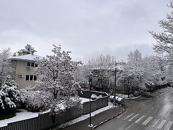 Part of the Višnjik street in the winter | |
 Višnjik border | |
| 43°52′00″N 18°25′04″E / 43.866774°N 18.417689°E / 43.866774; 18.417689 | |
| Country | Bosnia and Herzegovina |
| Entity | FBiH |
| Canton | Sarajevo |
| City | Sarajevo |
| Municipality | Centar Municipality, Sarajevo |
| Developed | since 1960 |
| Time zone | UTC+1 (CET) |
| • Summer (DST) | UTC+2 (CEST) |
| Area code | +387 |
Višnjik (Cyrillic: Вишњик, lit. "Cherry orchard") is a neighborhood in Sarajevo, Bosnia and Herzegovina.
Location
It is located just above central parts of the old city center, and is part of Centar municipality.
History

Neighborhood is conceived as residential, on a hillside above city center never developed before, where, beside many small private gardens, also existed large cherry orchard - hence the name Višnjik (in English: Cherry orchard). It was designed and developed after the World War II, mostly between early 1950s and late 1960s.
The historic building Višnjik 16, designed by unknown architect in vernacular style with secessionist elements, is inscribed into the List of National monuments of Bosnia and Herzegovina by KONS.[1]
Features

Neighborhood designers utilized the presence of abundant natural greenery on the location, and developed designated space while preserving most of it. This became a main attribute of the neighborhood, one which constitutes important quality and appeal. Višnjik neighborhood on its northern side borders with large Koševo hospital complex (KCUS, Klinički centar univerziteta Sarajevo).[2]
See also
References
- ^ "Stambeni objekat u ulici Višnjik 16, historijska građevina" (html, pdf). kons.gov.ba. Sarajevo: KONS. Retrieved 15 May 2024.
- ^ "Interactive Map - hospital complex and its neighborhoods" (.html). www.kcus.ba (in Bosnian and English). KCUS, Klinički centar univerziteta Sarajevo. Retrieved 29 July 2016.
- v
- t
- e

| City proper | |
|---|---|
| Urban area | |
| Metro area |
- Alipašino polje
- Babića bašća
- Baščaršija
- Čengić vila
- Dobrinja
- Grbavica
- Džidžikovac
- Hrasno
- Koševo
- Mejtaš
- Marijin dvor
- Otoka
- Višnjik
- Vratnik
landmarks
- Ambassadors' Alley
- ARIA Centar
- Avaz Twist Tower
- Bijela Tabija
- Bosmal City Center
- Clock Tower
- Despić House
- Eternal flame
- Goat's Bridge
- Greek-Bosnian Friendship Building
- Latin Bridge
- Morića Han
- Presidency Building
- Sarajevo Rose
- Sarajevo Tunnel
- Sarajevo Zoo
- Šeher-Ćehaja Bridge
- Skakavac Waterfall
- Svrzo's House
- UNITIC Towers
- Vidovdan Heroes Chapel
- Vraca Memorial Park
- Suada and Olga bridge
- Vrelo Bosne
| Muslim |
|
|---|---|
| Catholic | |
| Orthodox | |
| Jewish |
museums
| Public | |
|---|---|
| Private |
| Stadiums | |
|---|---|
| Indoor arenas |
- Ferhadija street
- Marshal Tito street
- Sarači street
- Trg Oslobođenja - Alija Izetbegović
- Vilsonovo Šetalište
- Baščaršija Nights
- Sarajevo Winter Festival
- Jazz Fest Sarajevo
- Sarajevo Film Festival
- Balkan Photo Festival
- Pop-Up! Sarajevo
- WARM Festival
- Ilidža Folk Music Festival
- Al Jazeera Balkans Documentary Film Festival
- Pravo Ljudski Film Festival
- Sarajevo Youth Film Festival
- Sarajevo StreeAt Food Festival
- OPEN Fest Sarajevo
- MESS International Theatre Festival
- Sarajevo Pride
- Sarajevo Chamber Music Festival
- Sarajevo Beer Festival
- Sarajevo International Guitar Festival
- Ballet Fest Sarajevo
- Sarajevo Ramadan Festival
- Spiritus Progenitum
 Category

 | This Sarajevo Canton geography article is a stub. You can help Wikipedia by expanding it. |
- v
- t
- e


