Vinje, Iowa
Unincorporated community in Iowa, United States
43°28′24″N 93°40′37″W / 43.47333°N 93.67694°W / 43.47333; -93.67694Vinje is an unincorporated community in Logan Township, Winnebago County, Iowa, United States.[1]
Vinje was founded by Norwegian settlers and is the site of an 1880 church. The community was the site of an 1894 post office and 20th century creamery. Lack of railroad access inhibited the growth of the community.
Geography
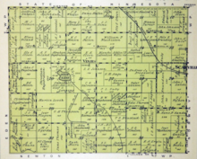
Vinje is located along county highways A16 and R50, 3 miles (4.8 km) west of Scarville.[2] Vinje is just north of the Harmon Lake Wildlife Management Area.[3]
History

Vinje was founded by Norwegian settlers, and the name Vinje is of Norwegian origin. Bethel Lutheran Church was founded in 1880; the original church was burned in 1949, and was replaced with a new church in summer 1955.[4] The church at Vinje still holds services.
The post office in Vinje was established in 1894.[5]
Circa 1900, Vinje was home to the Vinje Creamery Association.[6] The milk station was consolidated into the Thompson Cooperative Creamery in 1897.[7]
The Vinje post office was discontinued in 1907.[5]
Vinje's decline occurred because — like other communities such as Ratna, Tweten, and Delano — it did not have rail access, a fact noted by county historians in 1917.[8] In 1924, Vinje's population was 23 residents.[9]
In 1940, Vinje's population was 13.[10]
The Harmon Lake State Gaming Area is located near Vinje. It was established in 1950 to give area residents an established area for duck hunting.[11]
The community, which had a reported population of 2 in 2011, is home to Vinje's Pub and Grub.[12]
See also
 Iowa portal

- Amund, Iowa, also in Winnebago County
References
- ^ a b "Vinje". Geographic Names Information System. United States Geological Survey, United States Department of the Interior.
- ^ "Winnebago County, Iowa Highway and Transportation Map" (PDF). Iowa Department of Transportation. January 1, 2017. Archived (PDF) from the original on April 16, 2018. Retrieved April 15, 2018.
- ^ Iowa Atlas and Gazetteer. Yarmouth, ME: Garmin, Ltd. 2021. pp. 18–19.
- ^ "Winnebago co. IAGenWeb - church records". iagenweb.org. Archived from the original on June 3, 2021. Retrieved June 2, 2021.
- ^ a b "Post Offices". www.postalhistory.com. Archived from the original on November 13, 2022. Retrieved November 13, 2022.
- ^ 1904 Complete Creamery Directory of the United States. 1904. p. 93.
- ^ Centennial Book Committee (1992). A peek at the past ... Thompson, Iowa, 1892-1992. A good place to call home. pp. 17–18.
- ^ A History of Winnebago County and Hancock County, Iowa, Vol. 2. Chicago: Pioneer Publishing Company. 1917. p. 149.
- ^ General Rating Book. Boston, Massachusetts: Shoe and Leather Mercantile Agency. 1924. p. 296. Retrieved June 2, 2021.
- ^ The Attorneys List. United States Fidelity and Guaranty Company, Attorney List Department. 1940. p. 314. Archived from the original on November 3, 2022. Retrieved November 13, 2022.
- ^ Iowa Conservationist. Iowa Department of Natural Resources. 1950. p. 27.
- ^ Willette, Janet Kubat (December 21, 2011). "Burgers draw people to Vinje". Post-Bulletin.
- v
- t
- e
Municipalities and communities of Winnebago County, Iowa, United States
County seat: Forest City

communities
- Amund
- Vinje
‡This populated place also has portions in an adjacent county or counties
- Iowa portal
- United States portal


