Voerendaal

Cet article est une ébauche concernant une localité néerlandaise.
Vous pouvez partager vos connaissances en l’améliorant (comment ?) selon les recommandations des projets correspondants.
| Voerendaal | ||||
 Drapeau. | ||||
 De Sint Laurentiuskerk. | ||||
| Administration | ||||
|---|---|---|---|---|
| Pays |  Pays-Bas Pays-Bas | |||
| Province |  Limbourg Limbourg | |||
| Code postal | 6310-6312, 6343, 6367 | |||
| Indicatif téléphonique international | +(31) | |||
| Démographie | ||||
| Population | 12 419 hab. (31-01-2023) | |||
| Densité | 395 hab./km2 | |||
| Géographie | ||||
| Coordonnées | 50° 53′ 00″ nord, 5° 56′ 00″ est | |||
| Superficie | 3 142 ha = 31,42 km2 | |||
| Localisation | ||||
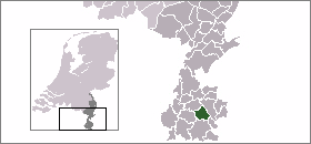 | ||||
| Géolocalisation sur la carte : Pays-Bas
Géolocalisation sur la carte : Pays-Bas
Géolocalisation sur la carte : Limbourg
| ||||
| Liens | ||||
| Site web | www.voerendaal.nl | |||
modifier  | ||||


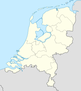
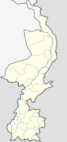
Voerendaal est une commune et un village néerlandais situé dans la province du Limbourg.
Lien externe
- Site officiel
v · m Commune de Voerendaal | ||
|---|---|---|
| Villes et villages |
|  |
| Hameaux et autres lieux |
| |
| ||
v · m Province de Limbourg | |
|---|---|
| |
Voir aussi : |
 Portail des Pays-Bas


