Itiquira (Mato Grosso)
Gemeente in Brazilië  | |||
|---|---|---|---|
  | |||
  | |||
| Situering | |||
| Regio | Centraal-West | ||
| Staat | Mato Grosso | ||
| Mesoregio | Sudeste Mato-Grossense | ||
| Microregio | Rondonópolis | ||
| Coördinaten | 17° 13′ ZB, 54° 9′ WL | ||
| Algemeen | |||
| Oppervlakte | 8.638,691 km² | ||
| Inwoners (2009) | 13.022 (1,2 inw./km²) | ||
| Hoogte | 522 m | ||
| Gemeentenummer | 5104609 | ||
| Burgemeester | Ernani José Sander | ||
| Overig | |||
| Tijdzone | UTC−4 | ||
| HDI | 0,767 | ||
| Website | itiquira.mt.gov.br | ||
| Detailkaart | |||
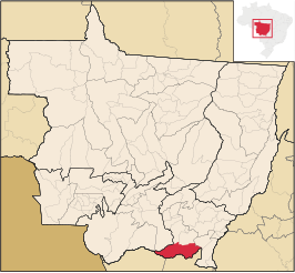 | |||
| Locatie van Itiquira in de staat Mato Grosso | |||
| |||

Itiquira is een gemeente in de Braziliaanse deelstaat Mato Grosso. De gemeente telt 13.022 inwoners (schatting 2009).
Geografie
De gemeente grenst aan Rondonópolis, Pedra Preta, Cuiabá, Sonora, Alto Garças, Alto Araguaia, Santo Antônio do Leverger, Barão de Melgaço en Coxim.
Bronnen, noten en/of referenties
- Instituto Brasileiro de Geografia e Estatística, Inwonertallen 2009


