Wyre Forest
Niet-metropolitaans district in Engeland  | |||
|---|---|---|---|
  | |||
| Situering | |||
| Land | Engeland | ||
| County | Worcestershire | ||
| Regio | West Midlands | ||
| Coördinaten | 52°23'20"NB, 2°15'18"WL | ||
| Algemeen | |||
| Oppervlakte | 195,4038[1] km² | ||
| Inwoners (2018[2]) | 101.062 (517 inw./km²) | ||
| ONS-code | E07000239 | ||
| Website | Officiële website | ||
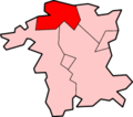
| Detailkaart | |||
 | |||
| |||

Wyre Forest is een Engels district in het shire-graafschap (non-metropolitan county OF county) Worcestershire en telt 101.000 inwoners. De oppervlakte bedraagt 195 km².
Van de bevolking is 16,6% ouder dan 65 jaar. De werkloosheid bedraagt 3,0% van de beroepsbevolking (cijfers volkstelling 2001).
Plaatsen in district Wyre Forest
- Kidderminster
Civil parishes in district Wyre Forest
Bewdley, Broome, Chaddesley Corbett, Churchill and Blakedown, Kidderminster Foreign, Ribbesford, Rock, Rushock, Stone, Stourport-on-Severn, Upper Arley, Wolverley and Cookley.
Bronnen, noten en/of referenties
- ↑ Office for National Statistics → Download → SAM_for_Administrative_Areas_(2018).zip → SAM_LAD_DEC_2018_UK.xlsx.
- ↑ https://www.ons.gov.uk/file?uri=/peoplepopulationandcommunity/populationandmigration/populationestimates/datasets/populationestimatesforukenglandandwalesscotlandandnorthernireland/mid20182019laboundaries/ukmidyearestimates20182019ladcodes.xls Schatting Office for National Statistics: knop MYE5 → kolom Estimated Population mid-2018]
- Volkstelling 2001, Office for National Statistics


