Hoyt (Kansas)
| Hoyt | |||
|---|---|---|---|
 | |||
| Land |  USA USA | ||
| Delstat |  Kansas Kansas | ||
| Fylke | Jackson County | ||
| Postnummer | 66440 | ||
| Retningsnummer | 785 | ||
| Areal | 1,28 km²[1] | ||
| Vannfylt arealandel | 0 % | ||
| Befolkning | 593[2] (2020) | ||
| Bef.tetthet | 465,07 innb./km² | ||
| Antall husholdninger | 265 | ||
| Høyde o.h. | 357 meter | ||
 Hoyt 39°14′55″N 95°42′19″V | |||
Hoyt på Commons | |||
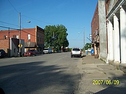
Hoyt er en amerikansk by som ligger i Jackson County i Kansas.
Byen hadde 593 innbyggere i 2020,[3] og dekker et areal på 1,28 km².
Historisk befolkningsdata
| Folketelling | Befolk. | %± | |
|---|---|---|---|
| 1920 | 282 | — | |
| 1930 | 228 | −19,1 % | |
| 1940 | 238 | 4,4 % | |
| 1950 | 246 | 3,4 % | |
| 1960 | 283 | 15,0 % | |
| 1970 | 420 | 48,4 % | |
| 1980 | 536 | 27,6 % | |
| 1990 | 489 | −8,8 % | |
| 2000 | 571 | 16,8 % | |
| 2010 | 669 | 17,2 % | |
| 2020 | 593 | −11,4 % | |
| U.S. Decennial Census[4] | |||
Referanser
- ^ United States. Bureau of the Census (2016) (på en), 2016 U.S. Gazetteer Files, Washington D.C.: Bureau of the Census, Wikidata Q32859555, https://www.census.gov/geographies/reference-files/time-series/geo/gazetteer-files.2016.html
- ^ https://data.census.gov/cedsci/table?t=Populations%20and%20People&g=0100000US,%241600000&y=2020; folketellingen i USA 2020; redaktør: Bureau of the Census; besøksdato: 1. januar 2022.
- ^ «Annual Estimates of the Resident Population for Incorporated Places in Kansas: April 1, 2020 to July 1, 2022».
- ^ «Census of Population and Housing». Census.gov. Besøkt 4. juni 2015.
Eksterne lenker
- (en) Hoyt, Kansas – kategori av bilder, video eller lyd på Commons


