Karnes City
| Karnes City | |
| city | |
 Stadshuset | |
| Land |  USA USA |
|---|---|
| Delstat | Texas |
| County | Karnes County |
| Höjdläge | 131 m ö.h. |
| Koordinater | 28°53′6″N 97°54′3″V / 28.88500°N 97.90083°V / 28.88500; -97.90083 |
| Yta | 5,5 km² (2010) |
| - land | 5,5 km² |
| - vatten | 0,0 km² |
| Folkmängd | 3 042 (2010) |
| Befolkningstäthet | 553 invånare/km² |
| Tidszon | CST (UTC-6) |
| - sommartid | CDT (UTC-5) |
| ZIP-kod | 78118 |
| FIPS | 4838452 |
| Geonames | 4702664 |
  Ortens läge i Texas | |
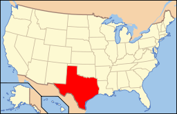 Texas läge i USA | |
Karnes City är administrativ huvudort i Karnes County i Texas[1][2] sedan 1894. Orten har fått sitt namn efter militären Henry Carnes.[3] Enligt 2010 års folkräkning hade Karnes City 3 042 invånare.[4]
Källor
- ^ Texas County Map with County Seat Cities. Geology.com Geoscience News and Information. Läst 18 augusti 2016.
- ^ Profile for Karnes City, Texas Arkiverad 3 juli 2017 hämtat från the Wayback Machine.. ePodunk. Läst 18 augusti 2016.
- ^ Karnes City, TX. Handbook of Texas Online. Läst 18 augusti 2016.
- ^ 2010 Census Population of Karnes City, Texas Arkiverad 29 augusti 2017 hämtat från the Wayback Machine.. Census Viewer. Läst 18 augusti 2016.
Bilder & media
|


