Barão de Melgaço, Mato Grosso
Municipality in Center-West, Brazil
Barão de Melgaço | |
|---|---|
Municipality | |
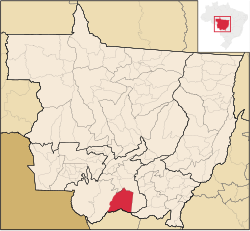 Location in Mato Grosso | |
| Country |  Brazil Brazil |
| Region | Center-West |
| State | Mato Grosso |
| Mesoregion | Centro-Sul Mato-Grossense |
| Population (2020 [1]) | |
| • Total | 8,164 |
| Time zone | UTC−3 (BRT) |
Barão de Melgaço is a municipality in the state of Mato Grosso in the Central-West Region of Brazil.[2][3][4][5]
The municipality contains 43% of the 108,960 hectares (269,200 acres) Encontro das Águas State Park, created in 2004.[6]
The city is named for Augusto Leverger, Baron of Melgaço, a Brazilian Navy admiral during the Paraguayan War.[7]
See also
External links
- Pantanal Escapes - Travel Guide and tourist information for Barão de Melgaço and region
References
- ^ IBGE 2020
- ^ "Divisão Territorial do Brasil" (in Portuguese). Divisão Territorial do Brasil e Limites Territoriais, Instituto Brasileiro de Geografia e Estatística (IBGE). July 1, 2008. Retrieved December 17, 2009.
- ^ "Estimativas da população para 1º de julho de 2009" (PDF) (in Portuguese). Estimativas de População, Instituto Brasileiro de Geografia e Estatística (IBGE). August 14, 2009. Retrieved December 17, 2009.
- ^ "Ranking decrescente do IDH-M dos municípios do Brasil" (in Portuguese). Atlas do Desenvolvimento Humano, Programa das Nações Unidas para o Desenvolvimento (PNUD). 2000. Archived from the original on October 3, 2009. Retrieved December 17, 2009.
- ^ "Produto Interno Bruto dos Municípios 2002-2005" (PDF) (in Portuguese). Instituto Brasileiro de Geografia e Estatística (IBGE). December 19, 2007. Archived from the original (PDF) on October 2, 2008. Retrieved December 17, 2009.
- ^ PES Encontro das Águas (in Portuguese), ISA: Instituto Socioambiental, retrieved 2016-08-02
- ^ "Dados Gerais" (in Portuguese). City Hall of Barão de Melgaço. Retrieved March 10, 2024.
- v
- t
- e
Capital: Cuiabá
| Alto Pantanal | |
|---|---|
| Alto Paraguai | |
| Cuiabá | |
| Rosario Oeste |

| Canarana | |
|---|---|
| Medio Araguaia | |
| Norte Araguaia |
| Alta Floresta | |
|---|---|
| Alto Teles Pires | |
| Arinos | |
| Aripuanã | |
| Colíder | |
| Paranatinga | |
| Parecis | |
| Sinop |
| Alto Araguaia | |
|---|---|
| Primavera do Leste | |
| Rondonópolis | |
| Tesouro |
| Alto Guaporé | |
|---|---|
| Jauru | |
| Tangará da Serra |
16°16′44″S 55°57′28″W / 16.2789°S 55.9578°W / -16.2789; -55.9578
 | This Mato Grosso, Brazil location article is a stub. You can help Wikipedia by expanding it. |
- v
- t
- e


