Kuriyama, Hokkaido
Town in Hokkaido, Japan
Kuriyama  Flag  Emblem | |
|---|---|
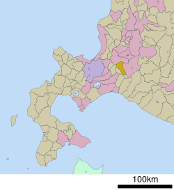 Location of Kuriyama in Sorachi Subprefecture | |
| 43°3′N 141°47′E / 43.050°N 141.783°E / 43.050; 141.783 | |
| Country | Japan |
| Region | Hokkaido |
| Prefecture | Sorachi Subprefecture |
| District | Yūbari |
| Area | |
| • Total | 203.84 km2 (78.70 sq mi) |
| Population (September 30, 2016) | |
| • Total | 12,365 |
| • Density | 61/km2 (160/sq mi) |
| Time zone | UTC+09:00 (JST) |
| Website | www |
Kuriyama (栗山町, Kuriyama-chō) is a town located in Sorachi Subprefecture, Hokkaido, Japan.[1]
As of September 2016, the town has an estimated population of 12,365, and a density of 61 persons per km2. The total area is 203.84 km2.
Notable people from Kuriyama
- Tadashi Watanabe, computer engineer
References
- ^ https://www.google.co.uk/maps/place/Kuriyama,+Yubari+District,+Hokkaido,+Japan/@43.0161985,141.6993262,11z/data=!3m1!4b1!4m6!3m5!1s0x5f74c8916f0cc08b:0xbd7b3b5d0862786a!8m2!3d43.0563748!4d141.7841372!16zL20vMDUxYjlo?entry=ttu
External links
 Media related to Kuriyama, Hokkaidō at Wikimedia Commons
- Official Website (in Japanese)
 Hokkaido Hokkaido | ||||||||||||
|---|---|---|---|---|---|---|---|---|---|---|---|---|
Sapporo (capital) | ||||||||||||
|  | |||||||||||
|
| ||||||||||||
| ||||||||||||
| ||||||||||||
| ||||||||||||
| ||||||||||||
| ||||||||||||
| ||||||||||||
| ||||||||||||
| ||||||||||||
| ||||||||||||
| ||||||||||||
| ||||||||||||
Authority control databases | |
|---|---|
| International |
|
| National |
|
| Geographic |
|
 | This Hokkaidō location article is a stub. You can help Wikipedia by expanding it. |
- v
- t
- e


