Luxwoude
Village in Friesland, Netherlands
Luxwoude Lúkswâld | |
|---|---|
Village | |
 Coat of arms | |
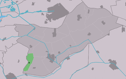 Location in Opsterland municipality | |
52°59′48″N 5°58′50″E / 52.99667°N 5.98056°E / 52.99667; 5.98056 | |
| Country |  Netherlands Netherlands |
| Province |  Friesland Friesland |
| Municipality |  Opsterland Opsterland |
| Area [1] | |
| • Total | 5.07 km2 (1.96 sq mi) |
| Elevation [2] | 0 m (0 ft) |
| Population (2021)[1] | |
| • Total | 430 |
| • Density | 85/km2 (220/sq mi) |
| Postal code | 8405[1] |
| Dialing code | 0513 |
Luxwoude (West Frisian: Lúkswâld) is a village in the municipality of Opsterland in the east of Friesland, the Netherlands. It had a population of around 275 in January 2017.[3]
The village was first mentioned in 1315 as Lukeswalde, and means the forest of Lucas (person). See also: Lucaswolde.[4] Luxwoude developed as a peat excavation village. It was home to 137 people in 1840.[5]
References
- ^ a b c "Kerncijfers wijken en buurten 2021". Central Bureau of Statistics. Retrieved 2 April 2022.
- ^ "Postcodetool for 8405BP". Actueel Hoogtebestand Nederland (in Dutch). Het Waterschapshuis. Retrieved 2 April 2022.
- ^ Kerncijfers wijken en buurten 2017 - CBS Statline
- ^ "Luxwoude - (geografische naam)". Etymologiebank (in Dutch). Retrieved 2 April 2022.
- ^ "Luxwoude". Plaatsengids (in Dutch). Retrieved 2 April 2022.
- v
- t
- e
Populated places in the municipality of Opsterland
- Gorredijk
- Bakkeveen
- Beetsterzwaag
- Frieschepalen
- Hemrik
- Jonkerslân
- Langezwaag
- Lippenhuizen
- Luxwoude
- Nij Beets
- Olterterp
- Siegerswoude
- Terwispel
- Tijnje
- Ureterp
- Wijnjewoude
- Industrial zone
- Drachten-Azeven [nl]
 | This Friesland location article is a stub. You can help Wikipedia by expanding it. |
- v
- t
- e


