Rural Municipality of North Battleford No. 437
Rural municipality in Saskatchewan, Canada
Rural municipality in Saskatchewan, Canada
52°45′36″N 108°13′41″W / 52.760°N 108.228°W / 52.760; -108.228[1][3]
(2016)[4]
(2016)[4]
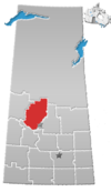
The Rural Municipality of North Battleford No. 437 (2016 population: 725) is a rural municipality (RM) in the Canadian province of Saskatchewan within Census Division No. 16 and SARM Division No. 6. Located in the west-central portion of the province, it comprises the rural area generally to the north and east of the City of North Battleford.
History
The RM of North Battleford No. 437 incorporated as a rural municipality on December 12, 1910.[2]
Geography
Communities and localities
The following unincorporated communities are within the RM.
- Localities
Demographics
In the 2021 Census of Population conducted by Statistics Canada, the RM of North Battleford No. 437 had a population of 687 living in 262 of its 288 total private dwellings, a change of -5.2% from its 2016 population of 725. With a land area of 792.18 km2 (305.86 sq mi), it had a population density of 0.9/km2 (2.2/sq mi) in 2021.[7]
In the 2016 Census of Population, the RM of North Battleford No. 437 recorded a population of 725 living in 276 of its 290 total private dwellings, a -1.1% change from its 2011 population of 733. With a land area of 797.2 km2 (307.8 sq mi), it had a population density of 0.9/km2 (2.4/sq mi) in 2016.[4]
Government
The RM of North Battleford No. 437 is governed by an elected municipal council and an appointed administrator that meets on the second Wednesday of every month.[3] The reeve of the RM is Dan Bartko while its administrator is Debbie Arsenault.[3] The RM's office is located in North Battleford.[3]
Infrastructure
The North Battleford Energy Centre, a 260 MW generating station, was built by Northland Power in the RM.
References
- ^ "Pre-packaged CSV files - CGN, Canada/Province/Territory (cgn_sk_csv_eng.zip)". Government of Canada. July 24, 2019. Retrieved May 23, 2020.
- ^ a b "Rural Municipality Incorporations (Alphabetical)". Saskatchewan Ministry of Municipal Affairs. Archived from the original on April 21, 2011. Retrieved May 9, 2020.
- ^ a b c d "Municipality Details: RM of North Battleford No. 437". Government of Saskatchewan. Retrieved May 21, 2020.
- ^ a b c "Population and dwelling counts, for Canada, provinces and territories, and census subdivisions (municipalities), 2016 and 2011 censuses – 100% data (Saskatchewan)". Statistics Canada. February 8, 2017. Retrieved May 1, 2020.
- ^ "Saskatchewan Census Population" (PDF). Saskatchewan Bureau of Statistics. Archived from the original (PDF) on September 24, 2015. Retrieved May 9, 2020.
- ^ "Saskatchewan Census Population". Saskatchewan Bureau of Statistics. Retrieved May 9, 2020.
- ^ "Population and dwelling counts: Canada, provinces and territories, census divisions and census subdivisions (municipalities), Saskatchewan". Statistics Canada. February 9, 2022. Retrieved April 13, 2022.
- v
- t
- e
Subdivisions of Saskatchewan
- Aberdeen
- Abernethy
- Antelope Park
- Antler
- Arborfield
- Argyle
- Arlington
- Arm River
- Auvergne
- Baildon
- Barrier Valley
- Battle River
- Bayne
- Beaver River
- Bengough
- Benson
- Big Arm
- Biggar
- Big Quill
- Big River
- Big Stick
- Birch Hills
- Bjorkdale
- Blaine Lake
- Blucher
- Bone Creek
- Bratt's Lake
- Britannia
- Brock
- Brokenshell
- Browning
- Buchanan
- Buckland
- Buffalo
- Calder
- Caledonia
- Cambria
- Cana
- Canaan
- Canwood
- Carmichael
- Caron
- Chaplin
- Chester
- Chesterfield
- Churchbridge
- Clayton
- Clinworth
- Coalfields
- Colonsay
- Connaught
- Corman Park
- Cote
- Coteau
- Coulee
- Craik
- Cupar
- Cut Knife
- Cymri
- Deer Forks
- Douglas
- Duck Lake
- Dufferin
- Dundurn
- Eagle Creek
- Edenwold
- Elcapo
- Eldon
- Elfros
- Elmsthorpe
- Emerald
- Enfield
- Enniskillen
- Enterprise
- Estevan
- Excel
- Excelsior
- Eyebrow
- Eye Hill
- Fertile Belt
- Fertile Valley
- Fillmore
- Fish Creek
- Flett's Springs
- Foam Lake
- Fox Valley
- Francis
- Frenchman Butte
- Frontier
- Garden River
- Garry
- Glen Bain
- Glen McPherson
- Glenside
- Golden West
- Good Lake
- Grandview
- Grant
- Grass Lake
- Grassy Creek
- Gravelbourg
- Grayson
- Great Bend
- Griffin
- Gull Lake
- Happyland
- Happy Valley
- Harris
- Hart Butte
- Hazel Dell
- Hazelwood
- Heart's Hill
- Hillsborough
- Hillsdale
- Hoodoo
- Hudson Bay
- Humboldt
- Huron
- Indian Head
- Insinger
- Invergordon
- Invermay
- Ituna Bon Accord
- Kellross
- Kelvington
- Keys
- Key West
- Kindersley
- King George
- Kingsley
- Kinistino
- Lacadena
- Lac Pelletier
- Laird
- Lajord
- Lake Alma
- Lake Johnston
- Lakeland
- Lake Lenore
- Lake of the Rivers
- Lakeside
- Lakeview
- Langenburg
- Last Mountain Valley
- Laurier
- Lawtonia
- Leask
- Leroy
- Lipton
- Livingston
- Lomond
- Lone Tree
- Longlaketon
- Loon Lake
- Loreburn
- Lost River
- Lumsden
- Manitou Lake
- Mankota
- Maple Bush
- Maple Creek
- Mariposa
- Marquis
- Marriott
- Martin
- Maryfield
- Mayfield
- McCraney
- McKillop
- McLeod
- Meadow Lake
- Medstead
- Meeting Lake
- Meota
- Mervin
- Milden
- Milton
- Miry Creek
- Monet
- Montmartre
- Montrose
- Moose Creek
- Moose Jaw
- Moose Mountain
- Moose Range
- Moosomin
- Morris
- Morse
- Mountain View
- Mount Hope
- Mount Pleasant
- Newcombe
- Nipawin
- North Battleford
- North Qu'Appelle
- Norton
- Oakdale
- Old Post
- Orkney
- Paddockwood
- Parkdale
- Paynton
- Pense
- Perdue
- Piapot
- Pinto Creek
- Pittville
- Pleasantdale
- Pleasant Valley
- Ponass Lake
- Poplar Valley
- Porcupine
- Prairiedale
- Prairie Rose
- Preeceville
- Prince Albert
- Progress
- Reciprocity
- Redberry
- Redburn
- Reford
- Reno
- Riverside
- Rocanville
- Rodgers
- Rosedale
- Rosemount
- Rosthern
- Round Hill
- Round Valley
- Rudy
- Saltcoats
- Sarnia
- Saskatchewan Landing
- Sasman
- Scott
- Senlac
- Shamrock
- Shellbrook
- Sherwood
- Silverwood
- Sliding Hills
- Snipe Lake
- Souris Valley
- South Qu'Appelle
- Spalding
- Spiritwood
- Spy Hill
- St. Andrews
- Stanley
- Star City
- St. Louis
- St. Peter
- St. Philips
- Stonehenge
- Storthoaks
- Surprise Valley
- Sutton
- Swift Current
- Tecumseh
- Terrell
- The Gap
- Three Lakes
- Tisdale
- Torch River
- Touchwood
- Tramping Lake
- Tullymet
- Turtle River
- Usborne
- Val Marie
- Vanscoy
- Victory
- Viscount
- Wallace
- Walpole
- Waverley
- Wawken
- Webb
- Wellington
- Weyburn
- Wheatlands
- Whiska Creek
- White Valley
- Willner
- Willow Bunch
- Willow Creek
- Willowdale
- Wilton
- Winslow
- Wise Creek
- Wolseley
- Wolverine
- Wood Creek
- Wood River
- Wreford
- Culture
- Economy
- First Nations
- Geography
- Government
- History
- Regions
- Tourist attractions
 Category
 Canada portal
 WikiProject