Grade I listed buildings in Cornwall

Map all coordinates using OpenStreetMap
Download coordinates as:
- KML
- GPX (all coordinates)
- GPX (primary coordinates)
- GPX (secondary coordinates)
There are approximately 372,905 listed historic buildings in England and 2.5% of these are Grade I.[1] This article comprises a list of these buildings in the county of Cornwall.[2][3]
List of buildings
| Name | Location | Type | Completed [note 1] | Date designated | Grid ref.[note 2] Geo-coordinates | Entry number [note 3] | Image |
|---|---|---|---|---|---|---|---|
| Church of St Adwen | Advent | Parish church | 13th century, with Norman origins | 17 December 1962 | SX1047281608 50°36′12″N 4°40′47″W / 50.603335°N 4.679699°W / 50.603335; -4.679699 (Church of St Adwen) | 1328128 |  More images |
| Church of St Nonna | Altarnun | Parish church | Norman | 22 November 1960 | SX2227681337 50°36′17″N 4°30′47″W / 50.604617°N 4.512936°W / 50.604617; -4.512936 (Church of St Nonna) | 1142805 | 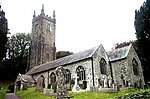 More images |
| Antony House | Antony Park, Antony | Country house | 1718–29 | 21 July 1951 | SX4176056303 50°23′07″N 4°13′38″W / 50.38527°N 4.227218°W / 50.38527; -4.227218 (Antony House) | 1311081 |  More images |
| Church of St James | Antony | Parish church | 13th century | 23 January 1968 | SX3983354586 50°22′10″N 4°15′13″W / 50.369318°N 4.25357°W / 50.369318; -4.25357 (Church of St James) | 1140708 |  More images |
| Forecourt buildings, walls and piers attached to south-east of Antony House | Antony Park, Antony | Kitchen | 1718–29 | 26 January 1987 | SX4178356280 50°23′06″N 4°13′37″W / 50.385069°N 4.226885°W / 50.385069; -4.226885 (Forecourt buildings, walls and piers attached to south-east of Antony House) | 1329109 |  More images |
| Church of St Protus and St Hyacinth | Blisland | Parish church | Norman origins | 6 June 1969 | SX1003873122 50°31′37″N 4°40′53″W / 50.526964°N 4.681492°W / 50.526964; -4.681492 (Church of St Protus and St Hyacinth) | 1142367 | 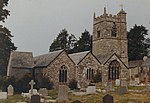 More images |
| Boconnoc Parish Church (dedication unknown) | Boconnoc Park, Boconnoc | Church | 1716 | 21 August 1964 | SX1469360593 50°24′57″N 4°36′35″W / 50.415901°N 4.609681°W / 50.415901; -4.609681 (Boconnoc Parish Church (dedication unknown)) | 1140355 |  More images |
| Church of St Petroc | Bodmin | Church | Norman | 24 March 1949 | SX0731367033 50°28′17″N 4°43′00″W / 50.471376°N 4.71675°W / 50.471376; -4.71675 (Church of St Petroc) | 1355166 | 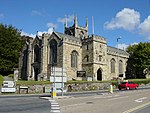 More images |
| Blowing House and attached walls at approximately 10 metres north-east of Blowing House Cottage | Godolphin, Breage | Tin works | 16th century | 14 September 1984 | SW6033632058 50°08′24″N 5°21′20″W / 50.140056°N 5.355471°W / 50.140056; -5.355471 (Blowing House and attached walls at approximately 10 metres north-east of Blowing House Cottage) | 1142264 |  Upload Photo |
| Church of Saint Breaca | Churchtown Breage, Breage | Church | 1795 | 10 July 1957 | SW6185728448 50°06′30″N 5°19′55″W / 50.108257°N 5.33197°W / 50.108257; -5.33197 (Church of Saint Breaca) | 1158264 |  More images |
| Forecourt walls, stiles and mounting block | Godolphin, Breage | Wall | 17th century | 26 August 1987 | SW6013631861 50°08′18″N 5°21′29″W / 50.138207°N 5.358141°W / 50.138207; -5.358141 (Forecourt walls, stiles and mounting block) | 1142259 |  |
| Godolphin House | Godolphin, Breage | Farmhouse | Circa late 15th century | 10 July 1957 | SW6012931840 50°08′17″N 5°21′30″W / 50.138015°N 5.358226°W / 50.138015; -5.358226 (Godolphin House) | 1158437 |  More images |
| Stabling and cobbled pavements adjoining Godolphin House | Godolphin, Breage | Stables | Possibly late 16th or early 17th century | 26 August 1987 | SW6007931842 50°08′17″N 5°21′32″W / 50.138013°N 5.358926°W / 50.138013; -5.358926 (Stabling and cobbled pavements adjoining Godolphin House) | 1158586 |  More images |
| Pengersick Castle | Breage | Keep | c.1510 | 10 July 1957 | SW5817828410 50°06′23″N 5°23′00″W / 50.106429°N 5.383305°W / 50.106429; -5.383305 (Pengersick Castle) | 1311147 | 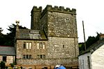 More images |
| Church of St Mary the Virgin | Bradoc, Broadoak | Church | 13th century | 21 August 1964 | SX1622862114 50°25′48″N 4°35′20″W / 50.430048°N 4.588844°W / 50.430048; -4.588844 (Church of St Mary the Virgin) | 1140324 |  More images |
| Church of St Andrew | Stratton | Church | Mid-14th century | 5 March 1952 | SS2315706483 50°49′51″N 4°30′45″W / 50.830798°N 4.512557°W / 50.830798; -4.512557 (Church of St Andrew) | 1279033 |  More images |
| Church of St Olaf | Poughill, Bude-Stratton | Parish church | 12th century | 5 March 1952 | SS2224707754 50°50′31″N 4°31′34″W / 50.841937°N 4.526083°W / 50.841937; -4.526083 (Church of St Olaf) | 1328522 |  More images |
| Church of St Mary | Callington | Parish church | 1438 | 23 January 1968 | SX3588069644 50°30′13″N 4°18′57″W / 50.503536°N 4.315704°W / 50.503536; -4.315704 (Church of St Mary) | 1140073 |  More images |
| Dupath Well | Callington | Holy well | Probably 1510 | 21 July 1951 | SX3750069219 50°30′01″N 4°17′34″W / 50.500169°N 4.292694°W / 50.500169; -4.292694 (Dupath Well) | 1140066 |  More images |
| Barn about 25 metres south-east of Cotehele House | Calstock | Curtain wall | Late 15th century | 19 October 1987 | SX4228768556 50°29′44″N 4°13′30″W / 50.495521°N 4.22497°W / 50.495521; -4.22497 (Barn about 25 metres south-east of Cotehele House) | 1140258 |  More images |
| Church of St Andrew | Calstock | Parish church | Late 14th century | 19 October 1987 | SX4364869255 50°30′08″N 4°12′22″W / 50.502167°N 4.206089°W / 50.502167; -4.206089 (Church of St Andrew) | 1140252 |  More images |
| Cotehele | Calstock | Country house | c.1300 | 21 July 1951 | SX4224068618 50°29′46″N 4°13′32″W / 50.496065°N 4.225658°W / 50.496065; -4.225658 (Cotehele) | 1140255 |  More images |
| New Bridge | Gunnislake, Calstock | Bridge | c.1520 | 23 January 1968 | SX4330972206 50°31′43″N 4°12′44″W / 50.528595°N 4.212105°W / 50.528595; -4.212105 (New Bridge) | 1140201 |  More images |
| Retainers Court and screen wall attached to north | Calstock | House | Probably c.1485 | 21 July 1951 | SX4220968593 50°29′45″N 4°13′34″W / 50.495832°N 4.226084°W / 50.495832; -4.226084 (Retainers Court and screen wall attached to north) | 1138043 | Upload Photo |
| Church of St Martin and St Meriadocus | Camborne | Parish church | Mostly late 15th century | 1 December 1951 | SW6452240042 50°12′48″N 5°18′07″W / 50.213418°N 5.301935°W / 50.213418; -5.301935 (Church of St Martin and St Meriadocus) | 1142659 |  More images |
| Church of St Julitta | Lanteglos, Camelford | Church | Norman and later | 17 December 1962 | SX0881582343 50°36′34″N 4°42′12″W / 50.609397°N 4.703466°W / 50.609397; -4.703466 (Church of St Julitta) | 1142729 |  More images |
| Church of St Meubred | Cardinham | Church | 15th century | 6 June 1969 | SX1230768697 50°29′17″N 4°38′50″W / 50.487945°N 4.64729°W / 50.487945; -4.64729 (Church of St Meubred) | 1143114 |  More images |
| Church of St Colanus | Colan | Church | 1724 | 10 February 1967 | SW8682461300 50°24′46″N 5°00′07″W / 50.412795°N 5.001823°W / 50.412795; -5.001823 (Church of St Colanus) | 1144182 |  More images |
| Church of St Constantine | Constantine | Parish church | c.1420–80 | 10 July 1957 | SW7310429073 50°07′06″N 5°10′31″W / 50.118274°N 5.175305°W / 50.118274; -5.175305 (Church of St Constantine) | 1142141 |  More images |
| Church of St Carantoc | Crantock | Collegiate church | 1236 | 24 October 1951 | SW7904660556 50°24′12″N 5°06′38″W / 50.40324°N 5.110693°W / 50.40324; -5.110693 (Church of St Carantoc) | 1327391 |  More images |
| Church of St Cubert | Cubert | Parish church | 13th century | 30 May 1967 | SW7860957756 50°22′41″N 5°06′55″W / 50.377932°N 5.115183°W / 50.377932; -5.115183 (Church of St Cubert) | 1141573 |  More images |
| Church of St Cuby | Tregony, Cuby | Parish church | 12th century | 30 May 1967 | SW9276245252 50°16′15″N 4°54′34″W / 50.270784°N 4.909535°W / 50.270784; -4.909535 (Church of St Cuby) | 1291868 |  More images |
| Church of Saint Corentin | Cury | Parish church | 12th century | 10 July 1957 | SW6776321280 50°02′46″N 5°14′43″W / 50.046234°N 5.24516°W / 50.046234; -5.24516 (Church of Saint Corentin) | 1157903 |  More images |
| Church of St Cuby | Duloe | Parish church | 13th century | 21 August 1964 | SX2346458095 50°23′46″N 4°29′07″W / 50.39616°N 4.485175°W / 50.39616; -4.485175 (Church of St Cuby) | 1312202 |  More images |
| Gate, gate-piers and garden wall to north-east of Penheale Manor | Penheale, Egloskerry | Gate | 18th century | 11 January 1989 | SX2684488040 50°39′58″N 4°27′06″W / 50.666215°N 4.451578°W / 50.666215; -4.451578 (Gate, gate-piers and garden wall to north-east of Penheale Manor) | 1160167 | Upload Photo |
| Gatehouse at Penheale | Penheale, Egloskerry | Gatehouse | c.1636 | 22 November 1960 | SX2684288052 50°39′59″N 4°27′06″W / 50.666322°N 4.451612°W / 50.666322; -4.451612 (Gatehouse at Penheale) | 1142958 | Upload Photo |
| Penheale Manor | Penheale, Egloskerry | Country house | After 1572 | 1 December 1951 | SX2683388018 50°39′58″N 4°27′06″W / 50.666014°N 4.451723°W / 50.666014; -4.451723 (Penheale Manor) | 1160121 |  More images |
| Stables at Penheale | Penheale, Egloskerry | Farmhouse | 1620 | 22 November 1960 | SX2676288099 50°40′00″N 4°27′10″W / 50.66672°N 4.452765°W / 50.66672; -4.452765 (Stables at Penheale) | 1142918 | Upload Photo |
| Little Dennis Blockhouse, Pendennis Castle | Pendennis Castle, Falmouth | Castle | 1540–45 | 23 January 1973 | SW8274031546 50°08′39″N 5°02′32″W / 50.14409°N 5.042126°W / 50.14409; -5.042126 (Little Dennis Blockhouse, Pendennis Castle) | 1270099 |  More images |
| Pendennis Castle | Falmouth | Castle | 1540–45 | 23 January 1973 | SW8243031783 50°08′46″N 5°02′48″W / 50.146105°N 5.046593°W / 50.146105; -5.046593 (Pendennis Castle) | 1270096 | 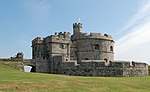 More images |
| Church of St Merteriana | Boscastle, Forrabury and Minster | Parish church | 13th century | 17 December 1962 | SX1107190472 50°40′59″N 4°40′33″W / 50.683155°N 4.675766°W / 50.683155; -4.675766 (Church of St Merteriana) | 1327702 |  More images |
| Church of St Fimbarrus or St Nicholas | Fowey | Parish church | 1336 | 13 March 1951 | SX1252851706 50°20′07″N 4°38′08″W / 50.335376°N 4.63569°W / 50.335376; -4.63569 (Church of St Fimbarrus or St Nicholas) | 1327314 |  More images |
| Place House | Fowey | House | Mid- to late 15th century | 13 March 1951 | SX1251751756 50°20′09″N 4°38′09″W / 50.335821°N 4.635869°W / 50.335821; -4.635869 (Place House) | 1218869 |  More images |
| Church of Saint Germoe | Germoe | Parish church | Possibly 12th century | 10 July 1957 | SW5853829422 50°06′56″N 5°22′44″W / 50.115661°N 5.37892°W / 50.115661; -5.37892 (Church of Saint Germoe) | 1142197 |  More images |
| St Germoe's Chair | Germoe | Sedilia building | Probably c.early 13th century | 26 August 1987 | SW5856629423 50°06′56″N 5°22′43″W / 50.115681°N 5.378529°W / 50.115681; -5.378529 (St Germoe's Chair) | 1310470 |  More images |
| Church of St Gerrans | Gerrans | Church | 13th century | 30 May 1967 | SW8727635176 50°10′42″N 4°58′51″W / 50.178337°N 4.98076°W / 50.178337; -4.98076 (Church of St Gerrans) | 1328952 |  More images |
| Church of St Grada | Grade-Ruan | Parish church | 13th century | 10 July 1957 | SW7122014297 49°59′06″N 5°11′34″W / 49.984867°N 5.192791°W / 49.984867; -5.192791 (Church of St Grada) | 1141938 |  More images |
| Church of St Rumon | Ruan Major, Grade-Ruan | Parish church | Possibly c.13th century | 10 July 1957 | SW7038316426 50°00′13″N 5°12′21″W / 50.003663°N 5.20572°W / 50.003663; -5.20572 (Church of St Rumon) | 1141915 | Upload Photo |
| Church of St Crida | Creed | Parish church | 12th century | 10 February 1967 | SW9349147224 50°17′20″N 4°54′01″W / 50.288752°N 4.900396°W / 50.288752; -4.900396 (Church of St Crida) | 1136281 |  More images |
| Church of Saint Winwaloe | Gunwalloe | Church | c.late 15th/early 16th century | 10 July 1957 | SW6602020548 50°02′20″N 5°16′08″W / 50.038978°N 5.269017°W / 50.038978; -5.269017 (Church of Saint Winwaloe) | 1157975 |  More images |
| Church of Saint Wenappa | Gwennap | Church | 15th century | 30 May 1967 | SW7388640105 50°13′03″N 5°10′15″W / 50.217638°N 5.170939°W / 50.217638; -5.170939 (Church of Saint Wenappa) | 1328991 | 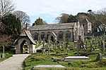 More images |
| Tower of Church of Saint Wenappa | Gwennap | Bell tower | c.16th century | 3 February 1986 | SW7389040076 50°13′03″N 5°10′15″W / 50.217379°N 5.170866°W / 50.217379; -5.170866 (Tower of Church of Saint Wenappa) | 1140940 |  More images |
| Pengreep House | Pengreep, Gwennap | Farmhouse | Early 18th century | 30 May 1967 | SW7475638794 50°12′22″N 5°09′29″W / 50.206197°N 5.157985°W / 50.206197; -5.157985 (Pengreep House) | 1136570 | Upload Photo |
| Church of Saint Winnear | Gwinear-Gwithian | Parish church | 13th century | 14 January 1988 | SW5949737370 50°11′15″N 5°22′14″W / 50.187407°N 5.370548°W / 50.187407; -5.370548 (Church of Saint Winnear) | 1159537 |  More images |
| Helland Bridge | Hellandbridge, Helland | Bridge | Early 15th century | 6 June 1969 | SX0652371488 50°30′40″N 4°43′49″W / 50.511134°N 4.730177°W / 50.511134; -4.730177 (Helland Bridge) | 1327910 |  More images |
| Church of St James | Jacobstow | Parish church | 15th century | 29 September 1961 | SX1981495840 50°44′03″N 4°33′17″W / 50.734154°N 4.554759°W / 50.734154; -4.554759 (Church of St James) | 1328255 |  More images |
| The Friends Meeting House | Come-to-Good, Kea | House | c.1710 | 30 May 1967 | SW8127940322 50°13′21″N 5°04′03″W / 50.222367°N 5.067592°W / 50.222367; -5.067592 (The Friends Meeting House) | 1140860 |  More images |
| Church of St James | Kilkhampton | Parish church | 12th century | 29 September 1961 | SS2525811339 50°52′30″N 4°29′06″W / 50.875063°N 4.485072°W / 50.875063; -4.485072 (Church of St James) | 1141826 |  More images |
| Church of St Ladoca | Ladock | Parish church | 15th century | 17 October 1984 | SW8945750986 50°19′16″N 4°57′33″W / 50.321113°N 4.959045°W / 50.321113; -4.959045 (Church of St Ladoca) | 1310553 |  More images |
| Church of St Winwalaus | Church Cove, Landewednack | Parish church | 11th century | 9 October 1984 | SW7114212672 49°58′13″N 5°11′34″W / 49.970245°N 5.19291°W / 49.970245; -5.19291 (Church of St Winwalaus) | 1141920 |  More images |
| Church of St Michael | Landrake, Landrake with St. Erney | Parish church | Some 13th-century masonry | 23 January 1968 | SX3740260506 50°25′19″N 4°17′25″W / 50.421848°N 4.290288°W / 50.421848; -4.290288 (Church of St Michael) | 1140553 |  More images |
| Church of St Leonard and St Dilp | Landulph | Church | Probably 14th century | 23 January 1968 | SX4311261512 50°25′57″N 4°12′37″W / 50.432443°N 4.210393°W / 50.432443; -4.210393 (Church of St Leonard and St Dilp) | 1140179 | 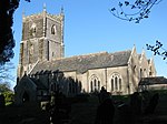 More images |
| Church of St Sidwell | Laneast | Parish church | 12th century | 22 November 1960 | SX2279283994 50°37′43″N 4°30′25″W / 50.628645°N 4.506921°W / 50.628645; -4.506921 (Church of St Sidwell) | 1159130 |  More images |
| Church of St Hydroc | Lanhydrock Park, Lanhydrock | Parish church | Probably early 15th century | 6 June 1969 | SX0851263625 50°26′28″N 4°41′53″W / 50.441154°N 4.69813°W / 50.441154; -4.69813 (Church of St Hydroc) | 1158013 | 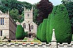 More images |
| Gatehouse about 40 metres east of Lanhydrock House | Lanhydrock Park, Lanhydrock | Gate | 1651 | 25 October 1951 | SX0863663602 50°26′28″N 4°41′47″W / 50.440988°N 4.696374°W / 50.440988; -4.696374 (Gatehouse about 40 metres east of Lanhydrock House) | 1157994 |  More images |
| Gateway and flanking walls at the east entrance to Lanhydrock Park | Lanhydrock Park, Lanhydrock | Gate | 1657 | 15 April 1988 | SX0957063567 50°26′28″N 4°41′00″W / 50.440978°N 4.683218°W / 50.440978; -4.683218 (Gateway and flanking walls at the east entrance to Lanhydrock Park) | 1143097 |  |
| Lanhydrock House | Lanhydrock Park, Lanhydrock | House | 17th century on earlier foundation | 25 October 1951 | SX0853963587 50°26′27″N 4°41′52″W / 50.440822°N 4.697731°W / 50.440822; -4.697731 (Lanhydrock House) | 1157870 |  More images |
| Church of St Nivet | Lanivet | Church | Early 15th century | 6 June 1969 | SX0394064208 50°26′42″N 4°45′46″W / 50.444881°N 4.762746°W / 50.444881; -4.762746 (Church of St Nivet) | 1158241 |  More images |
| Church of St Brevita | Lanlivery | Parish church | Late 14th century | 10 February 1967 | SX0799159046 50°23′59″N 4°42′11″W / 50.39985°N 4.703115°W / 50.39985; -4.703115 (Church of St Brevita) | 1137701 | 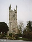 More images |
| Church of St Manarck and St Dunstan | Lanreath | Church | 15th century, Norman origins | 21 August 1964 | SX1811556911 50°23′02″N 4°33′35″W / 50.383891°N 4.559782°W / 50.383891; -4.559782 (Church of St Manarck and St Dunstan) | 1136993 |  More images |
| Church of St Ildierna | Lansallos | Parish church | 1331 | 21 August 1964 | SX1724251589 50°20′09″N 4°34′10″W / 50.335806°N 4.569464°W / 50.335806; -4.569464 (Church of St Ildierna) | 1365628 |  More images |
| Church of St Tallanus | Talland, Lansallos | Church | Circa 13th century | 21 August 1964 | SX2285951629 50°20′16″N 4°29′26″W / 50.337883°N 4.490633°W / 50.337883; -4.490633 (Church of St Tallanus) | 1140743 |  More images |
| Church of St Willow | Lanteglos-by-Fowey | Church | Late 14th century | 21 August 1964 | SX1446951523 50°20′04″N 4°36′30″W / 50.334346°N 4.608355°W / 50.334346; -4.608355 (Church of St Willow) | 1312492 |  More images |
| Church of St Swithin | Launcells | Parish church | 14th century | 9 September 1985 | SS2438905715 50°49′27″N 4°29′41″W / 50.824273°N 4.494713°W / 50.824273; -4.494713 (Church of St Swithin) | 1141834 |  More images |
| Church of St Mary Magdalene | Launceston | Church | 14th century | 27 February 1950 | SX3320884675 50°38′16″N 4°21′36″W / 50.637839°N 4.360092°W / 50.637839; -4.360092 (Church of St Mary Magdalene) | 1280301 |  More images |
| Church of St Stephen | Launceston | Parish church | 1259 | 27 February 1950 | SX3247685701 50°38′49″N 4°22′15″W / 50.646847°N 4.370899°W / 50.646847; -4.370899 (Church of St Stephen) | 1297830 |  More images |
| Launceston Castle Keep and attached buildings | Launceston | Castle | 1341 | 7 June 1993 | SX3311384647 50°38′15″N 4°21′41″W / 50.63756°N 4.361422°W / 50.63756; -4.361422 (Launceston Castle Keep and attached buildings) | 1297840 |  More images |
| The North Gatehouse of Launceston Castle and attached walls | Launceston | Tower | 12th century | 7 June 1993 | SX3304584655 50°38′15″N 4°21′45″W / 50.637612°N 4.362386°W / 50.637612; -4.362386 (The North Gatehouse of Launceston Castle and attached walls) | 1280359 | Upload Photo |
| The South Gate | Launceston | Town gate | Early 19th century | 27 February 1950 | SX3324184537 50°38′12″N 4°21′34″W / 50.636608°N 4.359564°W / 50.636608; -4.359564 (The South Gate) | 1298820 |  More images |
| The South Gatehouse of Launceston Castle and attached buildings | Launceston | Gatehouse | 13th century | 7 June 1993 | SX3304584525 50°38′11″N 4°21′44″W / 50.636444°N 4.362328°W / 50.636444; -4.362328 (The South Gatehouse of Launceston Castle and attached buildings) | 1196033 |  |
| The West Bridge (Prior's Bridge) | St Thomas, Launceston | Packhorse bridge | Late Medieval | 27 February 1950 | SX3278985095 50°38′29″N 4°21′58″W / 50.641492°N 4.366202°W / 50.641492; -4.366202 (The West Bridge (Prior's Bridge)) | 1196031 |  More images |
| Chapel of St Mary Magdalene | Trecarrell, Lezant | Domestic chapel | Early 16th century | 22 November 1960 | SX3178078259 50°34′47″N 4°22′38″W / 50.57978°N 4.377359°W / 50.57978; -4.377359 (Chapel of St Mary Magdalene) | 1291332 | More images |
| Greystone Bridge | Lezant | Bridge | 1439 | 1 December 1951 | SX3683480342 50°36′00″N 4°18′25″W / 50.599931°N 4.306952°W / 50.599931; -4.306952 (Greystone Bridge) | 1219394 |  More images |
| Trecarrell Manor | Trecarrell, Lezant | Farmhouse | Early 16th century | 1 December 1951 | SX3175278277 50°34′48″N 4°22′40″W / 50.579933°N 4.377763°W / 50.579933; -4.377763 (Trecarrell Manor) | 1219694 | Upload Photo |
| Church of St Melor | Linkinhorne | Parish church | 15th century | 21 August 1964 | SX3195273559 50°32′15″N 4°22′22″W / 50.537599°N 4.372809°W / 50.537599; -4.372809 (Church of St Melor) | 1311136 |  More images |
| Church of St Martin by Looe | St Martin, Looe | Parish church | Norman | 19 March 1951 | SX2599255032 50°22′10″N 4°26′54″W / 50.369393°N 4.448223°W / 50.369393; -4.448223 (Church of St Martin by Looe) | 1282854 |  More images |
| Church of St Bartholomew | Lostwithiel | Parish church | 13th century | 18 October 1949 | SX1044059797 50°24′27″N 4°40′09″W / 50.407392°N 4.669074°W / 50.407392; -4.669074 (Church of St Bartholomew) | 1327333 |  More images |
| Freemasons' Hall | Lostwithiel | Freemasons hall | c.1280 | 18 October 1949 | SX1048059724 50°24′24″N 4°40′07″W / 50.406749°N 4.668475°W / 50.406749; -4.668475 (Freemasons' Hall) | 1327326 |  More images |
| Lostwithiel Bridge | Lostwithiel | Bridge | Mid-15th century | 18 October 1949 | SX1061559809 50°24′27″N 4°40′00″W / 50.407557°N 4.66662°W / 50.407557; -4.66662 (Lostwithiel Bridge) | 1327324 |  More images |
| Church of St Ciricius and St Julitta | Luxulyan | Parish church | Mid–late 15th century | 10 February 1967 | SX0520458067 50°23′25″N 4°44′30″W / 50.390139°N 4.741776°W / 50.390139; -4.741776 (Church of St Ciricius and St Julitta) | 1158407 |  More images |
| Church of St Maddern | Madron | Parish church | 14th and 15th century | 10 June 1954 | SW4534331813 50°07′54″N 5°33′53″W / 50.13161°N 5.564719°W / 50.13161; -5.564719 (Church of St Maddern) | 1312533 |  More images |
| Church of St Germanus | Rame, Maker-with-Rame | Parish church | Consecrated 1259 | 23 January 1968 | SX4262649150 50°19′16″N 4°12′43″W / 50.321222°N 4.212055°W / 50.321222; -4.212055 (Church of St Germanus) | 1310051 |  More images |
| Church of St Mary and St Julian | Maker-with-Rame | Parish church | c.1500 | 23 January 1968 | SX4463351992 50°20′50″N 4°11′06″W / 50.347295°N 4.185056°W / 50.347295; -4.185056 (Church of St Mary and St Julian) | 1140716 |  More images |
| Church of Saint Manacca | Manaccan | Parish church | 12th century | 10 July 1957 | SW7639425030 50°05′00″N 5°07′37″W / 50.083216°N 5.126989°W / 50.083216; -5.126989 (Church of Saint Manacca) | 1328590 |  More images |
| Parish Church of St Marwenne | Marhamchurch | Parish church | 14th century | 29 September 1961 | SS2230903689 50°48′20″N 4°31′24″W / 50.805437°N 4.523233°W / 50.805437; -4.523233 (Parish Church of St Marwenne) | 1230750 |  More images |
| Church of Saint Maugan | Mawgan, Mawgan-in-Meneage | Parish church | 13th century | 10 July 1957 | SW7095525094 50°04′54″N 5°12′11″W / 50.081719°N 5.202931°W / 50.081719; -5.202931 (Church of Saint Maugan) | 1328596 | 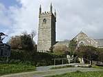 More images |
| Trelowarren House | Trelowarren, Mawgan-in-Meneage | Great house | Late medieval, remodelled 1609–65 | 10 July 1957 | SW7207823841 50°04′15″N 5°11′11″W / 50.070899°N 5.186513°W / 50.070899; -5.186513 (Trelowarren House) | 1159172 | 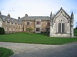 More images |
| Church of St Mawgan | St Mawgan, St Mawgan in Pydar | Parish church | 13th century | 12 May 1988 | SW8723065946 50°27′17″N 4°59′56″W / 50.454667°N 4.998754°W / 50.454667; -4.998754 (Church of St Mawgan) | 1144128 |  More images |
| Lanherne Carmelite Convent | St Mawgan, St Mawgan in Pydar | House | Early 16th century | 12 May 1988 | SW8718365913 50°27′16″N 4°59′58″W / 50.454354°N 4.999397°W / 50.454354; -4.999397 (Lanherne Carmelite Convent) | 1144134 | 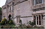 More images |
| Church of St Lalluwy | Menheniot | Church | Consecrated 1293 | 21 August 1964 | SX2878962820 50°26′25″N 4°24′45″W / 50.440191°N 4.412481°W / 50.440191; -4.412481 (Church of St Lalluwy) | 1329431 |  More images |
| Church of St Michael | Michaelstow | Church | Possibly 13th century | 17 December 1962 | SX0807478868 50°34′41″N 4°42′44″W / 50.577938°N 4.712131°W / 50.577938; -4.712131 (Church of St Michael) | 1158085 |  More images |
| Church of St Wenna | Morval | Parish church | 15th century | 18 December 1985 | SX2602856720 50°23′04″N 4°26′55″W / 50.38457°N 4.448498°W / 50.38457; -4.448498 (Church of St Wenna) | 1311998 | 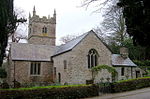 More images |
| Morval House | Morval | House | c.15th century | 18 December 1985 | SX2598756634 50°23′02″N 4°26′57″W / 50.383786°N 4.449034°W / 50.383786; -4.449034 (Morval House) | 1311992 |  More images |
| St Michael's Mount | Mount's Bay | Castle | c.1135 | 9 October 1987 | SW5146729843 50°06′59″N 5°28′40″W / 50.116522°N 5.477913°W / 50.116522; -5.477913 (St Michael's Mount) | 1143795 |  More images |
| Church of St Morwenna and St John the Baptist | Morwenstow | Parish church | 12th century | 29 September 1961 | SS2050515315 50°54′34″N 4°33′16″W / 50.909324°N 4.554513°W / 50.909324; -4.554513 (Church of St Morwenna and St John the Baptist) | 1141774 |  More images |
| Tonacombe Manor | Morwenstow | Courtyard house | Early 16th century | 26 September 1951 | SS2092514506 50°54′08″N 4°32′53″W / 50.902186°N 4.548148°W / 50.902186; -4.548148 (Tonacombe Manor) | 1231185 | Upload Photo |
| Church of St Melaines | Churchtown, Mullion | Parish church | 15th century | 10 July 1957 | SW6789119198 50°01′39″N 5°14′32″W / 50.027589°N 5.242114°W / 50.027589; -5.242114 (Church of St Melaines) | 1158147 |  More images |
| Church of Saint Mylor | Mylor Churchtown, Mylor | Parish church | Predominantly 15th century | 30 May 1967 | SW8202635242 50°10′37″N 5°03′15″W / 50.177021°N 5.05422°W / 50.177021; -5.05422 (Church of Saint Mylor) | 1141632 |  More images |
| Church of St Columba | St Columb Minor, Newquay | Church | 14th century | 24 October 1951 | SW8397762401 50°25′18″N 5°02′33″W / 50.421643°N 5.042469°W / 50.421643; -5.042469 (Church of St Columba) | 1144140 |  More images |
| Church of St Torney | North Hill | Church | Largely late 15th or early 16th century | 22 November 1960 | SX2719076646 50°33′50″N 4°26′29″W / 50.563946°N 4.441379°W / 50.563946; -4.441379 (Church of St Torney) | 1249982 |  More images |
| Church of St Paternus | North Petherwin | Parish church | Norman origins | 23 August 1957 | SX2819689626 50°40′51″N 4°26′00″W / 50.680865°N 4.433203°W / 50.680865; -4.433203 (Church of St Paternus) | 1142903 |  More images |
| Church of St Denis | North Tamerton | Parish church | Early 15th century | 29 September 1961 | SX3119597327 50°45′03″N 4°23′40″W / 50.750935°N 4.394317°W / 50.750935; -4.394317 (Church of St Denis) | 1142437 |  More images |
| Church of St Petroc | Padstow | Parish church | c.12th-century origins | 24 April 1953 | SW9157575409 50°32′28″N 4°56′34″W / 50.541216°N 4.942912°W / 50.541216; -4.942912 (Church of St Petroc) | 1289931 |  More images |
| Entrance gate and flanking walls forming mock fortifications to east of Prideaux Place | Prideaux Place, Padstow | Gate | Before 1758 | 24 April 1953 | SW9140875578 50°32′34″N 4°56′43″W / 50.542675°N 4.94536°W / 50.542675; -4.94536 (Entrance gate and flanking walls forming mock fortifications to east of Prideaux Place) | 1289743 |  More images |
| Prideaux Place | Padstow | Country house | Late 16th century | 24 April 1953 | SW9137575572 50°32′33″N 4°56′45″W / 50.542609°N 4.945822°W / 50.542609; -4.945822 (Prideaux Place) | 1212008 |  More images |
| Church of St Nonna | Churchtown Pelynt, Pelynt | Parish church | Possibly 14th century | 21 August 1964 | SX2031655055 50°22′04″N 4°31′41″W / 50.367893°N 4.527967°W / 50.367893; -4.527967 (Church of St Nonna) | 1161660 |  More images |
| Church of Pol de Leon | Paul, Penzance | Church | 15th century | 29 July 1950 | SW4645427082 50°05′23″N 5°32′46″W / 50.089618°N 5.546063°W / 50.089618; -5.546063 (Church of Pol de Leon) | 1327894 |  More images |
| Egyptian House | Penzance | House | Early 19th century | 29 July 1950 | SW4730730181 50°07′04″N 5°32′10″W / 50.1178°N 5.536212°W / 50.1178; -5.536212 (Egyptian House) | 1143147 | 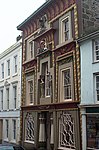 More images |
| Market Building, Penzance | Penzance | Market hall | 1837 | 29 July 1950 | SW4727430293 50°07′08″N 5°32′12″W / 50.118791°N 5.536746°W / 50.118791; -5.536746 (Market Building, Penzance) | 1221062 |  More images |
| Church of St Felix | Philleigh | Parish church | 14th century | 30 May 1967 | SW8711639461 50°13′00″N 4°59′07″W / 50.216765°N 4.985399°W / 50.216765; -4.985399 (Church of St Felix) | 1141029 |  More images |
| Church of St Odulphus | Pillaton | Parish church | Probably 14th century | 23 January 1968 | SX3669864313 50°27′21″N 4°18′07″W / 50.455862°N 4.30185°W / 50.455862; -4.30185 (Church of St Odulphus) | 1311439 |  More images |
| Church of St Winwaloe (listed as St Neot) | Poundstock | Parish church | 13th century or earlier | 29 September 1961 | SX2021999453 50°46′00″N 4°33′03″W / 50.766738°N 4.550791°W / 50.766738; -4.550791 (Church of St Winwaloe (listed as St Neot)) | 1231799 | 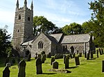 More images |
| The Gildhouse (listed as Guildhouse) | Poundstock | Church house | 16th century | 29 September 1961 | SX2020699411 50°45′59″N 4°33′03″W / 50.766356°N 4.550954°W / 50.766356; -4.550954 (The Gildhouse (listed as Guildhouse)) | 1141793 |  More images |
| Church of St Probus | Probus | Tower | c.1523 | 30 May 1967 | SW8990147728 50°17′31″N 4°57′04″W / 50.29201°N 4.951003°W / 50.29201; -4.951003 (Church of St Probus) | 1310352 | 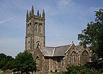 More images |
| Pavilion approx 15 metres north-west of Trewithen House | Probus | Pavilion | c.1740 | 17 October 1984 | SW9127947542 50°17′27″N 4°55′54″W / 50.290829°N 4.931581°W / 50.290829; -4.931581 (Pavilion approx 15 metres north-west of Trewithen House) | 1328913 | Upload Photo |
| Pavilion approx 15 metres north-east of Trewithen House | Probus | Pavilion | c.1740 | 17 October 1984 | SW9133547545 50°17′27″N 4°55′51″W / 50.290876°N 4.930798°W / 50.290876; -4.930798 (Pavilion approx 15 metres north-east of Trewithen House) | 1160827 | Upload Photo |
| Trewithen House | Probus | Country house | 1723 | 20 February 1956 | SW9130947516 50°17′26″N 4°55′52″W / 50.290606°N 4.931146°W / 50.290606; -4.931146 (Trewithen House) | 1141100 | 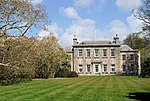 More images |
| Church of St Hugh of Lincoln | Quethiock | Parish church | c.early to mid-14th century | 23 January 1968 | SX3130164746 50°27′30″N 4°22′41″W / 50.458224°N 4.378006°W / 50.458224; -4.378006 (Church of St Hugh of Lincoln) | 1140035 |  More images |
| Chapel of St Michael at Roche Rock | Roche | Chapel | Licensed 1409 | 10 February 1967 | SW9911259618 50°24′07″N 4°49′42″W / 50.402019°N 4.828199°W / 50.402019; -4.828199 (Chapel of St Michael at Roche Rock) | 1327342 |  More images |
| Church of St Rumon | Ruan Lanihorne | Parish church | 13th century | 30 May 1967 | SW8944242026 50°14′26″N 4°57′15″W / 50.240635°N 4.954266°W / 50.240635; -4.954266 (Church of St Rumon) | 1141087 |  More images |
| Church of St Stephen | Saltash | Church | Probably 15th century | 17 January 1952 | SX4170058334 50°24′13″N 4°13′44″W / 50.403505°N 4.228917°W / 50.403505; -4.228917 (Church of St Stephen) | 1140379 |  More images |
| Granite archway and wall to Nos 15 and 17 (Kingsleigh House) fronting road | Saltash | Boundary wall | 17th century | 22 November 1982 | SX4293658782 50°24′28″N 4°12′42″W / 50.407863°N 4.211726°W / 50.407863; -4.211726 (Granite archway and wall to Nos 15 and 17 (Kingsleigh House) fronting road) | 1159090 | Upload Photo |
| Ince Castle | Saltash | Castle | 1653 | 17 January 1952 | SX4013556514 50°23′12″N 4°15′01″W / 50.386726°N 4.250147°W / 50.386726; -4.250147 (Ince Castle) | 1329260 |  More images |
| Parish Church of St Nicholas and St Faith | Saltash | Parish church | Norman origins | 17 January 1952 | SX4310858813 50°24′29″N 4°12′34″W / 50.408187°N 4.20932°W / 50.408187; -4.20932 (Parish Church of St Nicholas and St Faith) | 1140384 |  More images |
| Church of St Mary | Sheviock | Parish church | 13th century | 23 January 1968 | SX3701755092 50°22′23″N 4°17′36″W / 50.373091°N 4.293354°W / 50.373091; -4.293354 (Church of St Mary) | 1140579 |  More images |
| Church of Saint Sithney | Sithney | Parish church | 15th century | 10 July 1957 | SW6365128993 50°06′50″N 5°18′26″W / 50.113867°N 5.307261°W / 50.113867; -5.307261 (Church of Saint Sithney) | 1142179 |  More images |
| Church of St Sampson | South Hill | Parish church | Dedicated 1333 | 21 August 1964 | SX3295872626 50°31′46″N 4°21′30″W / 50.529504°N 4.358208°W / 50.529504; -4.358208 (Church of St Sampson) | 1140786 |  More images |
| Church of St Paternus | South Petherwin | Parish church | Norman origins, largely rebuilt 15th century | 22 November 1960 | SX3094481908 50°36′44″N 4°23′27″W / 50.612325°N 4.390818°W / 50.612325; -4.390818 (Church of St Paternus) | 1142745 |  More images |
| Church of Saint Anthony | St Anthony-in-Meneage | Parish church | 12th century | 10 July 1957 | SW7828925666 50°05′23″N 5°06′03″W / 50.089638°N 5.10091°W / 50.089638; -5.10091 (Church of Saint Anthony) | 1141687 |  More images |
| Holy Trinity Church | St Austell | Church | 15th century | 28 November 1950 | SX0141952452 50°20′18″N 4°47′31″W / 50.338435°N 4.791994°W / 50.338435; -4.791994 (Holy Trinity Church) | 1211925 |  More images |
| Church of St Brueredus | St Breward | Parish church | Dedicated 1278 | 17 December 1962 | SX0972877346 50°33′53″N 4°41′17″W / 50.564807°N 4.688018°W / 50.564807; -4.688018 (Church of St Brueredus) | 1158842 |  More images |
| Church of Saint Buryan | St Buryan | Parish church | 15th century | 15 December 1988 | SW4091425718 50°04′30″N 5°37′21″W / 50.074986°N 5.622429°W / 50.074986; -5.622429 (Church of Saint Buryan) | 1327526 |  More images |
| Church of St Clarus | St Cleer | Parish church | Early 15th century with Norman origins | 21 August 1964 | SX2478268154 50°29′13″N 4°28′17″W / 50.486932°N 4.471354°W / 50.486932; -4.471354 (Church of St Clarus) | 1140474 |  More images |
| St Cleer's Well and wall | St Cleer | Wall | Late 15th century | 21 August 1964 | SX2494868310 50°29′18″N 4°28′09″W / 50.488383°N 4.469089°W / 50.488383; -4.469089 (St Cleer's Well and wall) | 1140482 |  More images |
| Church of St Clement | St Clement | Parish church | 14th century | 30 May 1967 | SW8506043876 50°15′20″N 5°01′00″W / 50.255672°N 5.01668°W / 50.255672; -5.01668 (Church of St Clement) | 1328900 |  More images |
| Church of St Columba | St Columb Major | Church | 14th century | 10 February 1967 | SW9129763675 50°26′09″N 4°56′25″W / 50.435733°N 4.940276°W / 50.435733; -4.940276 (Church of St Columba) | 1144068 |  More images |
| Nine Maidens | St Columb Major | Standing stones | Early Bronze Age | 10 February 1967 | SW9365667589 50°28′18″N 4°54′33″W / 50.47172°N 4.90926°W / 50.47172; -4.90926 (Nine Maidens) | 1144121 |  More images |
| Church of St Dominica | St Dominic | Parish church | 14th century | 23 January 1968 | SX3989067827 50°29′18″N 4°15′30″W / 50.488319°N 4.258425°W / 50.488319; -4.258425 (Church of St Dominica) | 1158849 |  More images |
| Church of St Endelienta | St Endellion | Church | c.early 15th century | 6 June 1969 | SW9970378664 50°34′24″N 4°49′48″W / 50.573294°N 4.830103°W / 50.573294; -4.830103 (Church of St Endelienta) | 1320630 |  More images |
| Roscarrock | St Endellion | House | Late 15th or early 16th century | 25 October 1951 | SW9863480379 50°35′18″N 4°50′46″W / 50.58833°N 4.846109°W / 50.58833; -4.846109 (Roscarrock) | 1115088 |  More images |
| Church of St Enoder | St Enoder | Church | 14th-century origin | 10 February 1967 | SW8924756969 50°22′29″N 4°57′55″W / 50.374773°N 4.965338°W / 50.374773; -4.965338 (Church of St Enoder) | 1311865 |  More images |
| Church of Saint Erth | St Erth | Parish church | 15th century | 14 January 1988 | SW5498535027 50°09′52″N 5°25′56″W / 50.164524°N 5.432128°W / 50.164524; -5.432128 (Church of Saint Erth) | 1327632 |  More images |
| Church of St Uvelus | St Eval | Parish church | Late 11th or early 12th century | 6 June 1969 | SW8719369181 50°29′01″N 5°00′04″W / 50.483707°N 5.001115°W / 50.483707; -5.001115 (Church of St Uvelus) | 1289472 |  More images |
| Church of All Saints | St Ewe | Church | 13th century | 10 February 1967 | SW9779146044 50°16′47″N 4°50′22″W / 50.279642°N 4.839479°W / 50.279642; -4.839479 (Church of All Saints) | 1137082 |  More images |
| Church of St Genesius | Rosecare, St Gennys | Parish church | 12th century | 29 September 1961 | SX1489697173 50°44′40″N 4°37′30″W / 50.744581°N 4.625044°W / 50.744581; -4.625044 (Church of St Genesius) | 1142413 |  More images |
| Church of St Germanus | St Germans | Parish church | 12th century | 23 January 1968 | SX3594257751 50°23′48″N 4°18′35″W / 50.396686°N 4.309619°W / 50.396686; -4.309619 (Church of St Germanus) | 1140544 |  More images |
| Molenick Farmhouse | St Germans | Farmhouse | Early 16th century | 21 July 1951 | SX3348461183 50°25′37″N 4°20′45″W / 50.426833°N 4.345695°W / 50.426833; -4.345695 (Molenick Farmhouse) | 1329177 | Upload Photo |
| Port Eliot | St Germans | Country house | Early 18th century | 21 July 1951 | SX3596057793 50°23′49″N 4°18′34″W / 50.397068°N 4.309384°W / 50.397068; -4.309384 (Port Eliot) | 1140516 |  More images |
| Church of Saint Hilary | St Hilary | Parish church | 13th-century tower | 10 June 1954 | SW5504631298 50°07′52″N 5°25′44″W / 50.131072°N 5.428878°W / 50.131072; -5.428878 (Church of Saint Hilary) | 1310334 |  More images |
| Church of St Petroc Minor | Little Petherick, St Issey | Parish church | 14th century | 6 June 1969 | SW9182872147 50°30′43″N 4°56′15″W / 50.51201°N 4.937525°W / 50.51201; -4.937525 (Church of St Petroc Minor) | 1212675 |  More images |
| Church of St Ivo | St Ive | Parish church | Consecrated 1338 | 21 August 1964 | SX3093967158 50°28′47″N 4°23′03″W / 50.479793°N 4.384192°W / 50.479793; -4.384192 (Church of St Ivo) | 1140830 |  More images |
| Church of St Ia | St Ives | Chapel of ease | 1410 to 1434 | 4 June 1952 | SW5182240525 50°12′45″N 5°28′48″W / 50.212562°N 5.479921°W / 50.212562; -5.479921 (Church of St Ia) | 1143424 |  More images |
| Church of St Uny | Lelant, St Ives | Church | Norman | 4 June 1952 | SW5482737728 50°11′19″N 5°26′10″W / 50.188706°N 5.436077°W / 50.188706; -5.436077 (Church of St Uny) | 1143403 |  More images |
| Church of St John | St John | Parish church | 12th century | 23 January 1968 | SX4079153692 50°21′42″N 4°14′23″W / 50.361545°N 4.239732°W / 50.361545; -4.239732 (Church of St John) | 1161834 |  More images |
| Pendeen Manor House and adjoining wall to south-east | Pendeen, St Just | House | 16th century | 26 April 1950 | SW3839035473 50°09′41″N 5°39′52″W / 50.161434°N 5.664315°W / 50.161434; -5.664315 (Pendeen Manor House and adjoining wall to south-east) | 1143260 |  More images |
| Church of Saint Just | St Just in Roseland | Parish church | 13th century | 30 May 1967 | SW8484535690 50°10′55″N 5°00′54″W / 50.182075°N 5.01505°W / 50.182075; -5.01505 (Church of Saint Just) | 1141006 |  More images |
| St Mawes Castle, Gatehouse, Blockhouse, Magazine and Outer Defences | St Mawes, St Just-in-Roseland | Castle | 1540–43 | 25 June 1985 | SW8410432752 50°09′20″N 5°01′25″W / 50.155419°N 5.023747°W / 50.155419; -5.023747 (St Mawes Castle, Gatehouse, Blockhouse, Magazine and Outer Defences) | 1136705 |  More images |
| Church of St Keverne | St Keverne | Parish church | c.late 13th century | 10 July 1957 | SW7912421299 50°03′03″N 5°05′12″W / 50.05073°N 5.086734°W / 50.05073; -5.086734 (Church of St Keverne) | 1311542 |  More images |
| Church of St James | St Kew | Parish church | c.15th century | 6 June 1969 | SX0215976885 50°33′29″N 4°47′40″W / 50.558152°N 4.794516°W / 50.558152; -4.794516 (Church of St James) | 1116830 |  More images |
| Church of Saint Levan | St Levan | Parish church | 13th or 14th century | 15 December 1988 | SW3803222213 50°02′32″N 5°39′37″W / 50.042264°N 5.660225°W / 50.042264; -5.660225 (Church of Saint Levan) | 1143872 |  More images |
| Church of St Mabena | St Mabyn | Church | Largely late 15th century | 6 June 1969 | SX0417473201 50°31′33″N 4°45′51″W / 50.52574°N 4.764166°W / 50.52574; -4.764166 (Church of St Mabena) | 1161735 |  More images |
| Church of St Mellanus | St Mellion | Church | Dedicated 1259 | 26 November 1985 | SX3884565575 50°28′04″N 4°16′20″W / 50.467796°N 4.272173°W / 50.467796; -4.272173 (Church of St Mellanus) | 1140815 |  More images |
| Gatepiers to south-east of Newton Ferrers House and garden wall to east | Newton Ferrers, St Mellion | Gate pier | Late 17th century | 26 November 1985 | SX3470365859 50°28′09″N 4°19′50″W / 50.469195°N 4.330613°W / 50.469195; -4.330613 (Gatepiers to south-east of Newton Ferrers House and garden wall to east) | 1140812 | Upload Photo |
| Gatepiers to south-west of Newton Ferrers House and garden wall to west | Newton Ferrers, St Mellion | Gate pier | Late 17th century | 26 November 1985 | SX3464265875 50°28′10″N 4°19′53″W / 50.469321°N 4.331479°W / 50.469321; -4.331479 (Gatepiers to south-west of Newton Ferrers House and garden wall to west) | 1277594 | Upload Photo |
| Lower gatepiers to south of Newton Ferrers and adjoining garden walls | Newton Ferrers, St Mellion | Gate pier | Late 17th century | 26 November 1985 | SX3465565800 50°28′07″N 4°19′53″W / 50.468651°N 4.331262°W / 50.468651; -4.331262 (Lower gatepiers to south of Newton Ferrers and adjoining garden walls) | 1140813 | Upload Photo |
| Newton Ferrers House | Newton Ferrers, St Mellion | Country house | c.1685–95 | 21 July 1951 | SX3467865891 50°28′10″N 4°19′52″W / 50.469475°N 4.330979°W / 50.469475; -4.330979 (Newton Ferrers House) | 1140810 |  More images |
| Terrace to south of Newton Ferrers | Newton Ferrers, St Mellion | Balustrade | Late 17th century | 26 November 1985 | SX3466965858 50°28′09″N 4°19′52″W / 50.469176°N 4.331091°W / 50.469176; -4.331091 (Terrace to south of Newton Ferrers) | 1312304 | Upload Photo |
| Church of St Michael | St Michael Caerhays | Church | 1785–1808 | 10 February 1967 | SW9638242179 50°14′40″N 4°51′26″W / 50.244442°N 4.85715°W / 50.244442; -4.85715 (Church of St Michael) | 1327073 |  More images |
| Caerhays Castle | St Michael Caerhays | Country house | 1808 | 15 November 1988 | SW9710541613 50°14′23″N 4°50′48″W / 50.239606°N 4.84672°W / 50.239606; -4.84672 (Caerhays Castle) | 1327071 |  More images |
| Garden wall with gateways and Folly Tower attached to west and east of Caerhays Castle | St Michael Caerhays | Gate | 1808 | 15 November 1988 | SW9716741680 50°14′25″N 4°50′45″W / 50.240229°N 4.845888°W / 50.240229; -4.845888 (Garden wall with gateways and Folly Tower attached to west and east of Caerhays Castle) | 1144760 |  More images |
| Higher Lodge | St Michael Caerhays | Tower | c.1808 | 15 November 1988 | SW9630441731 50°14′25″N 4°51′29″W / 50.240391°N 4.858002°W / 50.240391; -4.858002 (Higher Lodge) | 1138159 |  More images |
| Lower Lodge with attached screen walls | St Michael Caerhays | Gate | c.1808 | 15 November 1988 | SW9744741430 50°14′17″N 4°50′31″W / 50.23808°N 4.841832°W / 50.23808; -4.841832 (Lower Lodge with attached screen walls) | 1311957 |  More images |
| Service buildings attached to south-west of Caerhays Castle | St Michael Caerhays | Service buildings | 1808 | 15 November 1988 | SW9707441590 50°14′22″N 4°50′50″W / 50.239389°N 4.847142°W / 50.239389; -4.847142 (Service buildings attached to south-west of Caerhays Castle) | 1144759 |  More images |
| Church of St Michael | St Michael Penkevil | Parish church | Mostly rebuilt 1859; dedicated 1261 | 30 May 1967 | SW8579242156 50°14′26″N 5°00′20″W / 50.24049°N 5.005453°W / 50.24049; -5.005453 (Church of St Michael) | 1141064 |  More images |
| Tregothnan | Tregothnan Park, St Michael Penkevil | Great house | 1650 | 28 February 1952 | SW8576741571 50°14′07″N 5°00′20″W / 50.235227°N 5.005473°W / 50.235227; -5.005473 (Tregothnan) | 1141069 |  More images |
| The Church of Saint Michael | St Michael's Mount | Chapel | Mostly rebuilt 14th century | 9 October 1987 | SW5145029841 50°06′59″N 5°28′41″W / 50.116497°N 5.478149°W / 50.116497; -5.478149 (The Church of Saint Michael) | 1310728 |  More images |
| Church of St Menefreda | St Minver, St. Minver Highlands | Church | 12th century and later | 6 June 1969 | SW9647777084 50°33′29″N 4°52′29″W / 50.557988°N 4.874738°W / 50.557988; -4.874738 (Church of St Menefreda) | 1332584 |  More images |
| Church of St Enodoc | Trebetherick, St Minver Lowlands | Church | c.12th century origins | 6 June 1969 | SW9316177232 50°33′29″N 4°55′18″W / 50.558153°N 4.921572°W / 50.558153; -4.921572 (Church of St Enodoc) | 1211902 |  More images |
| Church of St Anietus | St Neot | Parish church | 15th century | 5 November 1987 | SX1860567857 50°28′57″N 4°33′30″W / 50.482383°N 4.558195°W / 50.482383; -4.558195 (Church of St Anietus) | 1329212 |  More images |
| Cargoll Farm Barn | Cargoll, St Newlyn East | Barn | Late 14th century | 30 May 1967 | SW8194556388 50°22′01″N 5°04′03″W / 50.366893°N 5.067542°W / 50.366893; -5.067542 (Cargoll Farm Barn) | 1141453 | Upload Photo |
| Trerice | Trerice, St Newlyn East | Manor house | 15th century | 28 February 1952 | SW8411558478 50°23′11″N 5°02′18″W / 50.386463°N 5.038274°W / 50.386463; -5.038274 (Trerice) | 1328731 |  More images |
| Church of St Pynnochus | St Pinnock | Parish church | Late 14th century and onwards; Norman origins | 21 August 1964 | SX2005463233 50°26′29″N 4°32′08″W / 50.441287°N 4.535568°W / 50.441287; -4.535568 (Church of St Pynnochus) | 1140308 |  More images |
| Church of St Sampson | Golant, St Sampson | Parish church | c.1450–1500 | 10 February 1967 | SX1205655163 50°21′59″N 4°38′39″W / 50.366282°N 4.64404°W / 50.366282; -4.64404 (Church of St Sampson) | 1158982 | 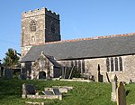 More images |
| Church of St Stephen | St Stephen-in-Brannel | Parish church | 12th century | 10 February 1967 | SW9449453317 50°20′38″N 4°53′23″W / 50.343828°N 4.889653°W / 50.343828; -4.889653 (Church of St Stephen) | 1137033 |  More images |
| Higher New Bridge | St Stephens by Launceston Rural | Road bridge | c.1504 | 22 November 1960 | SX3489186691 50°39′23″N 4°20′14″W / 50.656433°N 4.337212°W / 50.656433; -4.337212 (Higher New Bridge) | 1327996 |  More images |
| Church of St Tetha | St Teath | Parish church | Norman origins | 13 January 1988 | SX0643980594 50°35′34″N 4°44′10″W / 50.592902°N 4.736095°W / 50.592902; -4.736095 (Church of St Tetha) | 1327712 |  More images |
| Church of St Uda | St Tudy | Parish church | 15th cenbtury, Norman origins | 6 June 1969 | SX0661776302 50°33′16″N 4°43′53″W / 50.554408°N 4.731351°W / 50.554408; -4.731351 (Church of St Uda) | 1162144 |  More images |
| Church of St Ciricus and Julitta | St Veep | Parish church | Dedicated 1336 | 21 August 1964 | SX1400454993 50°21′55″N 4°37′00″W / 50.365374°N 4.616596°W / 50.365374; -4.616596 (Church of St Ciricus and Julitta) | 1140311 |  More images |
| Church of St Wenna | St Wenn | Church | 15th century | 10 February 1967 | SW9679064835 50°26′53″N 4°51′49″W / 50.448079°N 4.863658°W / 50.448079; -4.863658 (Church of St Wenna) | 1327422 |  More images |
| Church of St Winnow | St Winnow | Parish church | Norman traces | 21 August 1964 | SX1153756971 50°22′56″N 4°39′08″W / 50.382358°N 4.652236°W / 50.382358; -4.652236 (Church of St Winnow) | 1311942 | 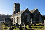 More images |
| Horse Bridge | Stoke Climsland | Bridge | 1437 | 1 December 1951 | SX4000474873 50°33′06″N 4°15′35″W / 50.551666°N 4.259843°W / 50.551666; -4.259843 (Horse Bridge) | 1290978 |  More images |
| Church of St Materiana | Tintagel | Church | c.1080 | 17 December 1962 | SX0506188452 50°39′47″N 4°45′35″W / 50.663027°N 4.759672°W / 50.663027; -4.759672 (Church of St Materiana) | 1327752 |  More images |
| The Old Post Office | Tintagel | House | Probably 15th century | 19 January 1952 | SX0562788467 50°39′48″N 4°45′06″W / 50.663351°N 4.751681°W / 50.663351; -4.751681 (The Old Post Office) | 1143438 |  More images |
| Church of St Cornelly | Tregoney | Parish church | 13th century | 30 May 1967 | SW9164945154 50°16′10″N 4°55′30″W / 50.269512°N 4.925078°W / 50.269512; -4.925078 (Church of St Cornelly) | 1328898 |  More images |
| Church of St Winwalo | Tremaine | Parish church | 12th century origins | 22 November 1960 | SX2347489057 50°40′28″N 4°29′59″W / 50.674339°N 4.499702°W / 50.674339; -4.499702 (Church of St Winwalo) | 1142888 |  More images |
| Truro Cathedral | Truro | Cathedral | 1880 | 29 December 1950 | SW8263444916 50°15′51″N 5°03′05″W / 50.264124°N 5.05126°W / 50.264124; -5.05126 (Truro Cathedral) | 1205377 |  More images |
| Church of St Symphorian | Veryan | Parish church | c.1300 | 30 May 1967 | SW9168239580 50°13′10″N 4°55′18″W / 50.219459°N 4.921551°W / 50.219459; -4.921551 (Church of St Symphorian) | 1141048 |  More images |
| Egloshayle Church | Egloshayle, Wadebridge | Parish church | Largely rebuilt 15th century | 6 June 1969 | SX0008371909 50°30′46″N 4°49′16″W / 50.512751°N 4.821118°W / 50.512751; -4.821118 (Egloshayle Church) | 1142961 |  More images |
| Church of the Nativity of the Blessed Virgin Mary | Week St Mary | Parish church | 14th century | 29 September 1961 | SX2371797716 50°45′08″N 4°30′01″W / 50.752206°N 4.500405°W / 50.752206; -4.500405 (Church of the Nativity of the Blessed Virgin Mary) | 1137655 | 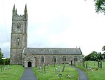 More images |
| Church of Saint Gwendron | Wendron | Parish church | Probably 13th century | 10 July 1957 | SW6788631055 50°08′03″N 5°14′58″W / 50.134053°N 5.249381°W / 50.134053; -5.249381 (Church of Saint Gwendron) | 1328447 |  More images |
| Gatehouse and adjoining courtyard walls immediately in front of Trenethick Barton Farmhouse | Trenethick, Wendron | Wall | 16th century | 17 June 1988 | SW6683629089 50°06′58″N 5°15′46″W / 50.115989°N 5.262847°W / 50.115989; -5.262847 (Gatehouse and adjoining courtyard walls immediately in front of Trenethick Barton Farmhouse) | 1142019 | Upload Photo |
| Trenethick Barton Farmhouse including rear courtyard and walls and gateway | Trenethick Barton, Wendron | Farmhouse | Probably 16th century | 10 July 1957 | SW6683229107 50°06′58″N 5°15′46″W / 50.116149°N 5.262914°W / 50.116149; -5.262914 (Trenethick Barton Farmhouse including rear courtyard and walls and gateway) | 1328458 |  More images |
| Church of St Martin and St Giles | Werrington | Parish church | 1742 | 23 August 1957 | SX3278987612 50°39′51″N 4°22′02″W / 50.664108°N 4.367339°W / 50.664108; -4.367339 (Church of St Martin and St Giles) | 1142855 |  More images |
| Cullacott and attached open-fronted cartshed | Werrington | Farmhouse | Early 16th century | 23 August 1957 | SX3030488058 50°40′03″N 4°24′10″W / 50.667396°N 4.402673°W / 50.667396; -4.402673 (Cullacott and attached open-fronted cartshed) | 1142836 | Upload Photo |
| Werrington Park House | Werrington | Country house | 16th century | 23 August 1957 | SX3320287118 50°39′35″N 4°21′41″W / 50.659788°N 4.361278°W / 50.659788; -4.361278 (Werrington Park House) | 1309836 |  More images |
| Yeolm Bridge | Yeolmbridge, Werrington | Road bridge | Mid-14th century | 23 August 1957 | SX3181187388 50°39′43″N 4°22′52″W / 50.661813°N 4.381063°W / 50.661813; -4.381063 (Yeolm Bridge) | 1161009 |  More images |
| Parish Church of St Anne | Whitstone | Parish church | 13th century | 29 September 1961 | SX2629498610 50°45′40″N 4°27′52″W / 50.761016°N 4.464331°W / 50.761016; -4.464331 (Parish Church of St Anne) | 1142426 | 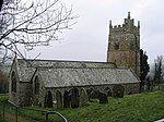 More images |
| Church of St Clement | Withiel | Church | 18th century | 6 June 1969 | SW9942665384 50°27′14″N 4°49′37″W / 50.453918°N 4.826871°W / 50.453918; -4.826871 (Church of St Clement) | 1143078 |  More images |
| Church of Saint Sennar | Zennor | Church | 12th century and later | 10 June 1954 | SW4547438513 50°11′31″N 5°34′03″W / 50.191806°N 5.567368°W / 50.191806; -5.567368 (Church of Saint Sennar) | 1312091 | 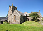 More images |
Isles of Scilly
| Name | Location | Type | Completed [note 1] | Date designated | Grid ref.[note 2] Geo-coordinates | Entry number [note 3] | Image |
|---|---|---|---|---|---|---|---|
| Bastions and walls of Star Castle | Hugh Town, St. Mary's | Wall | 1593 | 12 February 1975 | SV8991310622 49°54′55″N 6°19′16″W / 49.915203°N 6.321089°W / 49.915203; -6.321089 (Bastions and walls of Star Castle) | 1141188 |  |
| Outer walls and gateway (to The Garrison) | Hugh Town, St. Mary's | Gate | After 1601 | 14 December 1992 | SV9007510650 49°54′56″N 6°19′08″W / 49.915538°N 6.318861°W / 49.915538; -6.318861 (Outer walls and gateway (to The Garrison)) | 1291751 |  |
| Powder Magazine and Blast Walls | Hugh Town, St. Mary's | Powder magazine | Early 17th century | 14 December 1992 | SV9003610636 49°54′55″N 6°19′10″W / 49.915392°N 6.319391°W / 49.915392; -6.319391 (Powder Magazine and Blast Walls) | 1141187 | Upload Photo |
| Star Castle Hotel | Hugh Town, St. Mary's | House | 1593 | 12 February 1975 | SV8991810641 49°54′55″N 6°19′16″W / 49.915376°N 6.321034°W / 49.915376; -6.321034 (Star Castle Hotel) | 1291756 |  More images |
Notes
- ^ a b The date given is the date used by Historic England as significant for the initial building or that of an important part in the structure's description.
- ^ a b Sometimes known as OSGB36, the grid reference is based on the British national grid reference system used by the Ordnance Survey.
- ^ a b The "List Entry Number" is a unique number assigned to each listed building and scheduled monument by Historic England.
See also
 Cornwall portal

- Grade II* listed buildings in Cornwall
- Category:Grade I listed buildings in Cornwall
References
- ^ "Listed Buildings". English Heritage. 2010. Archived from the original on 26 January 2013. Retrieved 19 August 2011.
- ^ Images of England[dead link]
- ^ English Heritage Gateway
External links
 Media related to Grade I listed buildings in Cornwall at Wikimedia Commons
- v
- t
- e
- Bedfordshire
- Berkshire
- Bristol
- Buckinghamshire
- Cambridgeshire
- Cheshire
- Cornwall
- Cumbria
- Derbyshire
- Devon
- Dorset
- Durham
- East Sussex
- East Riding of Yorkshire
- Essex
- Gloucestershire
- Greater London
- Greater Manchester
- Hampshire
- Herefordshire
- Hertfordshire
- Isle of Wight
- Kent
- Lancashire
- Leicestershire
- Lincolnshire
- Merseyside
- Norfolk
- North Yorkshire
- Northamptonshire
- Northumberland
- Nottinghamshire
- Oxfordshire
- Rutland
- Shropshire
- Somerset
- South Yorkshire
- Staffordshire
- Suffolk
- Surrey
- Tyne and Wear
- Warwickshire
- West Midlands
- West Sussex
- West Yorkshire
- Wiltshire
- Worcestershire
- Babergh
- Bath and North East Somerset
- Bradford
- Brighton and Hove
- Broadland
- Cheltenham
- Cheshire East
- Cheshire West and Chester
- Cotswold
- Craven
- Dartford
- Dover
- Forest Heath
- Forest of Dean
- Ipswich
- Maidstone
- Mendip
- Mid Suffolk
- North Somerset
- Sedgemoor
- South Gloucestershire
- South Somerset
- St Edmundsbury
- Stroud
- Suffolk Coastal
- Taunton Deane
- Tewkesbury
- Waveney
- West Somerset
- Churches
- War memorials
- 20th century


